Tren Urbano
 Underground station in Rio Piedras | |
| Overview | |
|---|---|
| Owner | Puerto Rico Department of Transportation and Public Works |
| Locale |
San Juan Guaynabo Bayamón |
| Transit type | Rapid transit |
| Number of lines | 1 |
| Number of stations | 16 |
| Daily ridership | 36,280 (Daily Passengers)[1] |
| Headquarters | Guaynabo, Puerto Rico |
| Website | Autoridad de Transporte Integrado (ATI) |
| Operation | |
| Began operation | December 17, 2004 |
| Operator(s) | Alternate Concepts, Inc (ACI)[1] |
| Number of vehicles | 74 |
| Train length | 4 Vehicles (two permanently coupled pairs) during peak hours; 2 Vehicles (one permanently coupled pair) during off-peak hours, weekends and holidays. |
| Headway | 12 minutes (8 minutes during peak hours) |
| Technical | |
| System length | 10.7 miles (17.2 km) |
| Track gauge | 4 ft 8½ in (1,435 mm) (standard gauge) |
| Electrification | Third rail, 750 V DC |
| Average speed | 20.6 mph (33.2 km/h) (including stops) |
| Top speed | 62 mph (100 km/h) |
The Tren Urbano (English: Urban Train) is a 10.7-mile (17.2 km) fully automated rapid transit system that serves the municipalities of San Juan, Guaynabo and Bayamón. The Tren Urbano consists of 16 stations operating on 10.7 miles (17.2 km) of track along a single line.
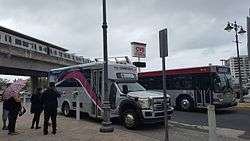
The Tren Urbano complements other forms of public transportation services in the San Juan metropolitan area such as the Metropolitan Bus Authority, Cataño Ferry, taxis and shuttles. The entire mass transportation system is operated by the Integrated Transit Authority (ATI), The Tren Urbano system is operated by Alternate Concepts, Inc (ACI).[1] Tren Urbano is also the Caribbean's first rapid transit system.[2]
History

In the late 19th century while the island was under Spanish rule, regional rail systems were begun in Puerto Rico. The railroad continued to be in use under US rule for most of the first half of the 20th century and played a key role in the transportation of people and goods throughout the island. The railroad systems of the period also played a vital role in the sugarcane industry.
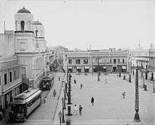
From 1901 to 1946 San Juan had a street tramway network known as “Trolley” de San Juan operated by the Porto Rico Railway, Light and Power Company[3] with more than 20 miles (32 km) of tracks and ran between San Juan and Santurce. During its heyday, it was the most modern electric streetcar system in Puerto Rico, rivaling New York and Toronto and transported nearly 10 million passengers a year. Today there are plans to bring back the tram to the heart of San Juan to complement the Tren Urbano.
During the 1950s, an industrial boom, due in part to development programs such as Operation Bootstrap, led to the downfall of agriculture as the principal industry on the island. During this decade automobiles became more widely available. Newer, and more efficient roads and highways along with the closure of sugarcane mills displaced the need for rail transportation. It was not long that it was realized that an alternative means of mass transportation was needed in addition to the public bus system to alleviate the severe traffic situation that was being created, especially in the San Juan metropolitan area.
Return of rail transit
Proposals

In 1967, proposals were made for the construction of a rapid rail transit system to serve the city of San Juan. In 1971, the major T.U.S.C.A. study—funded jointly by the Puerto Rico Planning Board and the U.S. federal government— recommended an island wide, elevated transit system and new community development program. That proposal would have traversed and also served the San Juan Metro Area, connecting it with the rest of the island without the necessity of highway construction. However, it was not until 1989 that Puerto Rico’s Department of Transportation and Public Works (Departamento de Transportación y Obras Públicas or DTOP in Spanish) officially adopted a proposal to begin design and construction of a rail system for the San Juan metropolitan area. The ridership demand for such a system had to be forecast using a mathematical model prepared by a team of transportation planners and engineers. By 1992, various alignments of the proposed system were considered, but the final design chosen served only certain parts of the metro area, and not Old San Juan. The name "Tren Urbano" (Urban Train) was chosen for the system. In 1993, the Federal Transit Administration (FTA) selected it as a Turnkey Demonstration Projects under the Intermodal Surface Transportation Efficiency Act of 1991. During 1996 and 1997, seven design-build contracts were awarded for different segments of the Tren Urbano Phase 1 system.
A number of companies shared the tasks for building the Tren Urbano including Siemens AG which was granted a concession to design and build the line and its rolling stock,[4] and to operate it for the first five years. The company won a contract which was a “first” for North America in the scope of the work which it involved, and which was awarded in July 1996.
Construction
.jpg)
The construction project was plagued by delays, contractual disputes between the government and companies involved in the undertaking, as well as investigations into possible mismanagement of funds. The project cost was US $2.28 billion.[5]
Free service
The rail system was officially inaugurated on December 19, 2004. After this date, free service was offered on weekends until April, 2005 when weekdays were added to the free service. Popularity grew quickly and by the end of the free period 40,000 people were using the train on a daily basis. By late 2005, however, ridership had fallen to 24,000, less than one-third of the 80,000 projection (and well below the projection of 110,000 for 2010).[6]
Paid service
Paid fare service started on June 6, 2005.[5] In 2006, average weekday boardings stood at 28,179 and in 2007, ridership decreased to 27,567.[5] Nonetheless, by the third quarter of 2008 average weekday ridership had increased to 36,500.[7]
Issues and concerns
The Tren Urbano has no service to Old San Juan, Santurce, the Luis Muñoz Marín International Airport (nor to many other parts of Guaynabo, Bayamón, and San Juan), and doesn't serve important suburbs like Cataño, Toa Baja, Toa Alta, Carolina, Trujillo Alto, Canóvanas and others, which helps to explain low ridership. Some question the viability of this system for additional reasons, such as the lack of an island-wide public-transportation system, such as the T.U.S.C.A. system proposed in 1971. The inner-city, public bus transportation system—the Metropolitan Bus Authority (AMA)—that operates in the Greater San Juan Metro Area is considered unreliable by most people, and it does not have a regular schedule. Integration with public mass transit systems, such as the AMA and the Acuaexpreso (an urban ferry), was initially poor and remains a challenge for the DTOP.
Route
| Tren Urbano | ||||||||||||||||||||||||||||||||||||||||||||||||||||||||||||||||||||||||||||||||||||||||||||||||||||||||||||||||||||
|---|---|---|---|---|---|---|---|---|---|---|---|---|---|---|---|---|---|---|---|---|---|---|---|---|---|---|---|---|---|---|---|---|---|---|---|---|---|---|---|---|---|---|---|---|---|---|---|---|---|---|---|---|---|---|---|---|---|---|---|---|---|---|---|---|---|---|---|---|---|---|---|---|---|---|---|---|---|---|---|---|---|---|---|---|---|---|---|---|---|---|---|---|---|---|---|---|---|---|---|---|---|---|---|---|---|---|---|---|---|---|---|---|---|---|---|---|
| ||||||||||||||||||||||||||||||||||||||||||||||||||||||||||||||||||||||||||||||||||||||||||||||||||||||||||||||||||||
Tren Urbano is currently made up of a single rapid transit route. It consists of 16 stations, ten of which are elevated, four at grade or in open cuttings, and two underground. Ironically, the Tren Urbano goes mostly through suburban areas. All stations are designed to handle three permanently coupled pairs (6 vehicles). The stations in the system are:
- Minillas (Phase 1A) Planned ←
- Sagrado Corazón (Sagrado Corazón) (360 parking spaces)
- Hato Rey (Golden Mile / José Miguel Agrelot Coliseum)
- Roosevelt (Roosevelt Ave. and Ponce de León Ave.)
- Domenech (Hato Rey)
- Piñero (Hato Rey)
- Universidad (University of Puerto Rico at Río Piedras)
- Río Piedras (Río Piedras)
- → Carolina (Phase 2) Planned
- Cupey
- Centro Médico (Puerto Rico Medical Services Administration and University of Puerto Rico, Medical Sciences Campus)
- San Francisco (535 parking spaces)
- Las Lomas
- Martínez Nadal (1,200 parking spaces)
- Torrimar (Guaynabo) (45 parking spaces)
- Jardines (128 parking spaces)
- Deportivo (Juan Ramón Loubriel Stadium and Coliseo Rubén Rodríguez)
- Bayamón (Bayamón) (400 parking spaces)
Each of the 16 stations boasts unique artwork and architectural style.
A maintenance depot and operations control center is located halfway along the route, between Martínez Nadal station and Torrimar station.
Fares

A single trip costs $1.50 ($1.50 if customers transfer from an AMA bus) including a 1-hour bus transfer period. If a customer exits the station and wants to get back on the train the full fare must be re-paid; there is no train to train transfer period. Students and Seniors (60–74 years old) pay 75 cents per trip. Senior citizens older than 75 and children under 6 ride for free. Several unlimited passes are also available.
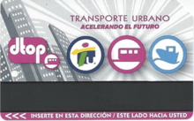
A stored-value multi-use farecard may be used for travel on buses as well as on trains. The value on the card is automatically deducted each time it is used. It is a system similar to the MetroCard system used in New York City.
Rolling stock
.jpg)
Tren Urbano's fleet consists of 74 Siemens, stainless steel-bodied cars, each 75 feet (23 m) long. Each vehicle carries 72 seated and 108 standing passengers. Trains have a maximum speed of 62 miles per hour (100 km/h), and average 20.6 miles per hour (33.2 km/h) including stops. All cars operate as married pairs and up to three pairs will run together at any time. Tren Urbano currently operates 15 trains during rush hours, while the remaining cars stand at the yards or serve as backup should a train experience problems.
Power is provided by AC traction motors, chosen over DC as they contain fewer moving parts and require less maintenance. The trains share many characteristics with the stock built by Siemens for Boston MBTA's Blue Line route. It is electrified by third rail at 750 V DC.
Air-conditioning systems have been specially designed to cope with the hot and muggy conditions commonly experienced in the metropolitan area.
Bus terminals
There are five bus terminals located at certain train stations that connect most of the San Juan metropolitan area. These are:

Bus terminal is located at the south entrance of the station:
- E10 express route: Sagrado Corazón – Old San Juan Covadonga Terminal
- T3: Sagrado Corazón – Santurce – Miramar – Old San Juan Covadonga Terminal
- T21: Sagrado Corazón – Santurce – Museum of Art of Puerto Rico – Condado – Old San Juan Covadonga Terminal
- C22: Sagrado Corazón – Hato Rey – Plaza Las Américas – Hiram Bithorn Stadium – Roberto Clemente Coliseum
- C1: Sagrado Corazón – Hato Rey (through Ponce de León Ave. & PR-1) – Río Piedras
- T2: Sagrado Corazón – Hato Rey – Plaza Las Américas – Hiram Bithorn Stadium – Roberto Clemente Coliseum – San Patricio – Caparra – Bayamón Station
- C35: Sagrado Corazón – Central Park – Puerto Rico Convention Center
- C36: Sagrado Corazón – Residencial Luis Lloréns Torres – Punta Las Marías
- D15: Sagrado Corazón – Hato Rey – Residencial Manuel A. Pérez – Río Piedras – Cupey Station
- D45: Sagrado Corazón – Isla Verde – Piñones – Loíza
- T9: Old San Juan Covadonga Terminal – Miramar – Santurce – Sagrado Corazón – Barrio Obrero – Hato Rey (through Barbosa Ave.) – Río Piedras – Cupey Station
- E40 express route: Piñero – The Mall of San Juan – Luis Muñoz Marín International Airport (SJU)
- T8: Piñero – Jesús T. Piñero Ave. – Martínez Nadal Station
- T41: Piñero – Barbosa Ave. – De Diego St. – The Mall of San Juan – Iturregui Terminal
- D26: Piñero – Río Piedras – Venus Gardens
Cupey station
- T7: Cupey – 65 de Infantería Ave. – Carolina Terminal
- T9: Cupey – Río Piedras – Hato Rey (through Barbosa Ave.) – Barrio Obrero – Sagrado Corazón Station – Santurce – Miramar – Old San Juan Covadonga Terminal
- D13: Cupey – El Señorial – Interamerican University
- D15: Cupey – Río Piedras – Residencial Manuel A. Pérez – Hato Rey – Sagrado Corazón Station
- D18: Cupey – Paraná St. – El Señorial – Winston Churchill Ave. – Riveras de Cupey
Martínez Nadal station
- T4: Martínez Nadal – San Patricio – Cataño Ferry Terminal
- T8: Martínez Nadal – Jesús T. Piñero Ave. – Piñero Station
- D27: Martínez Nadal – Lomas Verdes Ave. – Mario Quijote Morales Coliseum – Guaynabo
Bayamón station
- E20 express route: Bayamón – Campanilla park-and-ride terminal
- T2: Bayamón – Caparra – San Patricio – Roberto Clemente Coliseum – Hiram Bithorn Stadium – Plaza Las Américas – Hato Rey – Sagrado Corazón Station
- D91: Bayamón – Santa Rosa – University of Puerto Rico at Bayamón – Santa Juanita
- D92: Bayamón – Juan Ramón Loubriel Stadium – Rubén Rodríguez Coliseum – Lomas Verdes – Magnolia
Expansion plans
_at_the_R%C3%ADo_Piedras_subway_station.jpg)
The infrastructure of the Tren Urbano, with stations built for six–car train sets and a minimum headway of 90 seconds, has a maximum capacity of 40,000 passengers per hour per direction, compared to 3,000 passengers per hour per direction for the current peak hour 8 minute headway and 4-car trains, and to an actual daily ridership of roughly 40,000 commuters. The train system is thus working at 13.33 per cent capacity, and also well under the 110,000 rail passengers planned by 2010.
In addition, with a fleet of 74 rail vehicles in the local yard to cover at least double the 10.7 miles (17.2 km) system length, and with all the basic facilities and capital equipment needed for the functioning in place, it is indispensable that the train be extended as it was originally intended to include higher-density areas of the central district for it to be operationally successful and sustainable.
The Puerto Rico's Department of Transportation and Public Works (DTPW) plans include:
Phase 1A
- Phase 1A[8] of the project includes the extension of the original line westward from the current terminal at Sagrado Corazón (Sacred Heart) through a medium to high density corridor in two stations: San Mateo to a new terminal at Minillas at the heart of Santurce, a distance of 1,500 meters, with a possible transfer from Minillas to a future tram line from the historic district of Old San Juan to the Luis Muñoz Marín International Airport. Phase 1A was approved by the United States Environmental Protection Agency.[9]
- By the end of fiscal 2008, the legislature identified federal funds for the expansion of the train in its second phase. It was expected that during fiscal year 2009 the legislature would begin to issue bonds for this purpose.
Phase 2
- Upon opening of the Tren Urbano, there were further proposals to extend the rail system to other municipalities such as Carolina. A two-way tunnel, 136 ft (42 meters) in length, south of the Río Piedras Station is already built for a future expansion along heavily transited 65th Infantry Avenue.[10]
- In 2012, the government informed they had no plans to expand the Tren Urbano in the future, and that they were moving to other alternatives to help alleviate traffic.[11]
Other projects
There are several projects to improve public transport connectivity:
- Also being considered (2008) is a tramway from Sagrado Corazón station to colonial Old San Juan in Puerta de Tierra where many of Puerto Rico's state government buildings are located. It will run partially on an existing right-of-way on Fernández Juncos Ave.[12] Construction was originally projected to start in 2009, but the Fortuño administration is exploring other financing options, such as the American Recovery and Reinvestment Act of 2009. The first line of the tramway will be built by the Municipality of San Juan (MSJ) and will be known as the Sistema de Asistencia, Transportación y Organización Urbana (System of Assistance, Transportation and Urban Organization) (SATOUR).
- The proposal to build a second tram line to Carolina, possibly with a station at the Luis Muñoz Marín International Airport.
- The extension of a line to Caguas by the existing Urban Train from the Centro Médico or Cupey stations,
- or a second plan for the development of a line to Caguas with a new "Light regional railcar" network system with future extensions throughout the island.[13]
See also
- List of Latin American rail transit systems by ridership
- List of metro systems
- List of Puerto Rico railroads
- List of United States rapid transit systems by ridership
- Metro systems by annual passenger rides
- Rail transport in Puerto Rico
- Transportation in Puerto Rico
References
- 1 2 3 Alternate Concepts, Inc (ACI) website
- ↑ Railway-Technology Tren Urbano Rapid Transit System, Puerto Rico, 2002
- ↑ Canadian Transit Interests Outside Canada
- ↑ www.kiewit.com Projects Tren Urbano – Rio Piedras Section / Accessed June 13, 2009
- 1 2 3 http://www.fta.dot.gov/documents/NSPA2007_Final(1).pdf FTA – The Predicted and Actual Impacts of New Starts Projects – 2007
- ↑ Tren Urbano PR another way low transit ridership forecast, TOLLROADSNews, November 20, 2005, accessed April 13, 2007.
- ↑ Transit Ridership Report Third Quarter 2008, Heavy rail / Accessed December 5, 2008
- ↑ www.fta.dot.gov – Projects Tren Urbano – San Juan, Puerto Rico/Minillas Extension / Accessed April 21, 2010
- ↑ www.epa.gov Environmental Impact Statement on the Phase 1A Extension of Tren Urbano – Accessed April 12, 2010
- ↑ American Underground-Construction Association
- ↑ Ortíz, Joel (February 5, 2012). "Abandona el gobierno la era del Tren Urbano". El Nuevo Día.
- ↑ www.enrieles.com San Juan Tramway Proposal – (in Spanish) – Accessed April 15, 2010
- ↑ www.oficinascomerciales.es Proyecto de tren ligero entre Caguas y San Juan (in Spanish) – Accessed April 12, 2010
- Railway-Technology: San Juan Details of the Tren Urbano project.
External links
| Wikimedia Commons has media related to San Juan Tren Urbano. |
|
|
- Tren Urbano App (unofficial app)
- Urge darle vida al Tren Urbano – Editorial de El Nuevo Día (Spanish)
- Urban Transport Technology – San Juan Tren Urbano Heavy Rail System, Puerto Rico
- Puerto Rico Public Art Project – Tren Urbano – Photos and information related to the artwork located on each of the train route's stations.
- En Rieles – Campaign to promote San Juan Tram (Spanish)
Coordinates: 18°23′26″N 66°06′22″W / 18.39055°N 66.10618°W
