Tses
| Tses | |
|---|---|
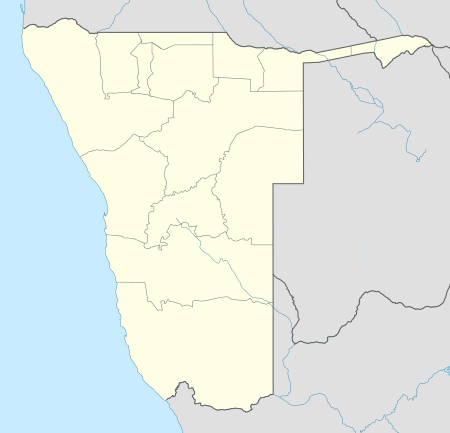 Tses Location in Namibia | |
| Coordinates: 25°53′S 18°0′E / 25.883°S 18.000°E | |
| Country |
|
| Region | ǁKaras Region |
| Population [1] | |
| • Total | 2,000 |
| Time zone | South African Standard Time (UTC+1) |
| Climate | BWh |
Tses is a village in the ǁKaras Region of southern Namibia with a population of approximately 1000; probably 1000 more live in the surrounding semi-desert farming hinterland. It is situated one kilometre off the main B1 highway from Windhoek to Cape Town and Johannesburg, opposite the turning to Berseba and Brukkaros Mountain. From 1980 until independence in 1990, Tses was part of Namaland, a reserve set aside for the Nama people.[2]
The main economic activity in this area is subsistence livestock farming. Tses houses a general dealer and a petrol station. The passenger trains from Windhoek to Keetmanshoop stop at Tses.
Politics
Uses is governed by a village council that currently has five seats.[3]
Local authority results, 2010
In the 2010 local authority election, a total of 984 votes were cast in the village. SWAPO won with approximately 55% of the vote. Of the four other parties seeking seats, DTA received approximately 21% of the vote, followed by RDP (19%), SWANU (2%) and COD (2%).[4]
References
- ↑ "Karas Region Namibia, Kara's People". Karas Regional Council. Retrieved 14 July 2010.
- ↑ William Hawkins reflects on his teaching experience in Namibia Australian Mathematics Trust
- ↑ "Know Your Local Authority". Election Watch (3). Institute for Public Policy Research. 2015. p. 4.
- ↑ Local Authority Election Results for Tses
Coordinates: 25°53′S 18°0′E / 25.883°S 18.000°E