Turtle Creek (Monongahela River)
| Turtle Creek | |
|---|---|
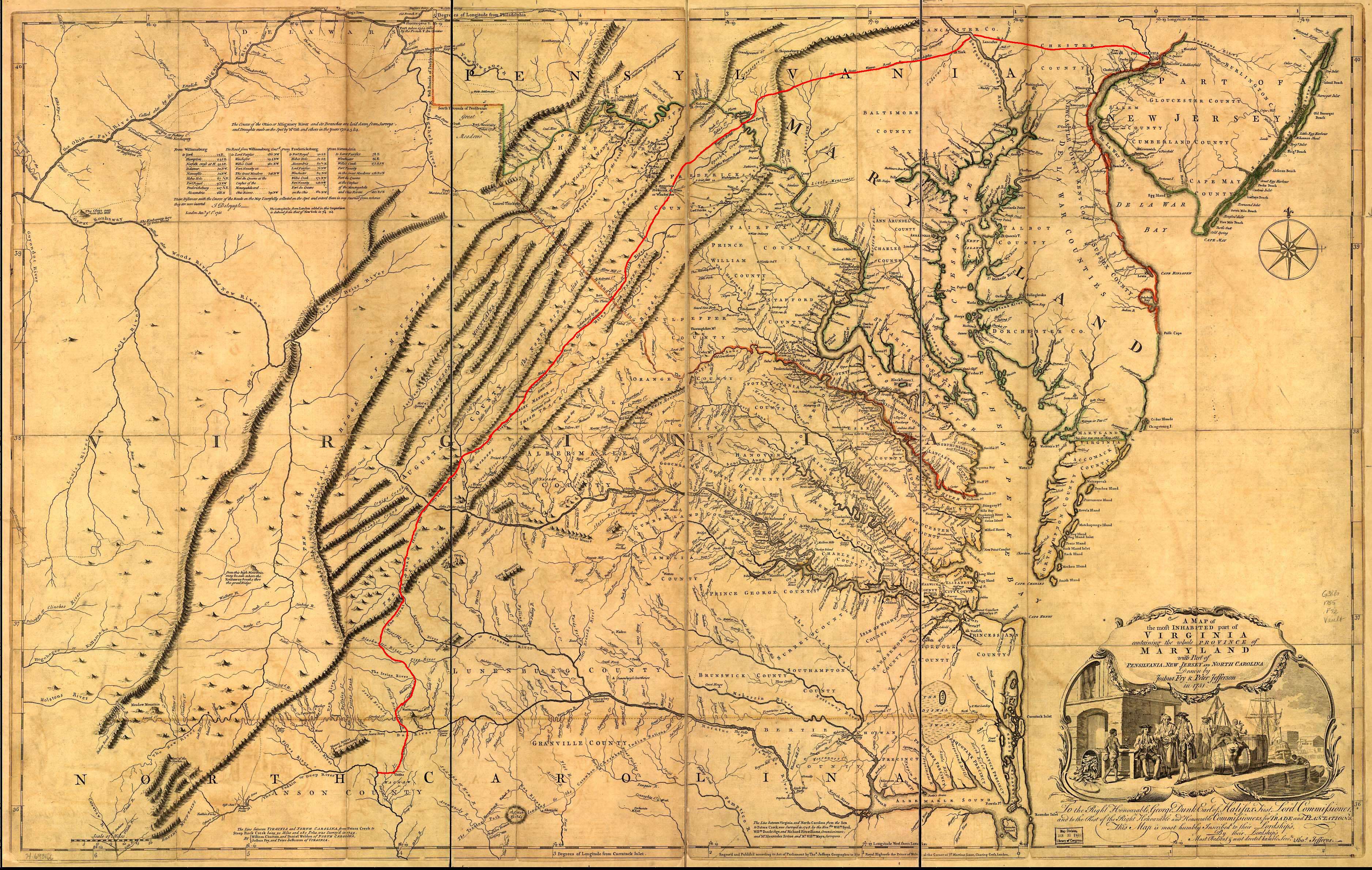 1751 map depicting "Turtle C" near top, just left of center | |
| Country | United States |
| Basin | |
| Main source | 40°25′39″N 79°34′37″W / 40.4275675°N 79.5769871°W |
| River mouth |
722 ft (220 m) 40°23′23″N 79°51′07″W / 40.3897913°N 79.8519929°WCoordinates: 40°23′23″N 79°51′07″W / 40.3897913°N 79.8519929°W |
| River system | Monongahela River |
Turtle Creek is a 21.1-mile-long (34.0 km)[1] tributary of the Monongahela River in Allegheny and Westmoreland counties in the U.S. state of Pennsylvania.[2] At its juncture with the Monongahela is Braddock, Pennsylvania, where the Battle of the Monongahela ("Braddock's Defeat") was fought in 1755. In the mid-19th century, the Pennsylvania Railroad laid tracks along the stream as part of its Main Line from Philadelphia to Pittsburgh.
Course
The headwaters of Turtle Creek are in Delmont. The stream flows west and enters the Monongahela River at North Versailles Township.
History
Turtle Creek is the English translation of the Native American name,[3] naming the area for its abundance of turtles.[4] In 1742, John Fraser and his family established Braddock at the mouth of Turtle Creek as the first permanent English settlement west of the Allegheny Mountains.[5] George Washington visited the area in 1753-1754. It was the site of Braddock's Defeat on July 9, 1755.
Wall is located at the site of a farm purchased by James Walls in 1829. The property, on the south bank of Turtle Creek, was passed to James' sons Henry and John Walls, who lived in a log cabin near the heart of present-day Wall. A station on the Pennsylvania Railroad opened in the early 1840s, which was named "Walls' Station" in honor of the Walls family. Eventually, the name of the station and the town that grew up around it was shortened to "Wall Station". Henry and John Walls sold their property to their cousin Frank Wall, an engineer on riverboats who developed the property around the station. Wall got its name after this Frank Wall, whose said property development led to him being the owner of the first two houses erected in the region.[6][7]
Watershed
The Turtle Creek watershed is the region drained by Turtle Creek. Sixty-six percent of its area is in Westmoreland County, with the balance in Allegheny County. Turtle Creek's source is in Delmont, Westmoreland County and its mouth on the Monongahela River is in North Versailles Township, Allegheny County. The watershed's area is 147.41 square miles (381.79 km2). It drains forests, farmlands, abandoned mines, and urban and suburban communities. 33 municipalities span the watershed. The lower watershed drains a heavily industrial area between the cities of Pittsburgh and McKeesport.[8]
Subwatersheds include the following:
- Abers Creek 10.64 square miles (27.56 km2)
- Ardmore Run 3.16 square miles (8.18 km2)
- Lower Brush Creek 17.43 square miles (45.14 km2)
- Upper Brush Creek 26.13 square miles (67.68 km2)
- Bushy Run 13.94 square miles (36.10 km2)
- Dirty Camp Run 3.23 square miles (8.37 km2)
- Haymaker Run 10.97 square miles (28.41 km2)
- Lyons Run 8.78 square miles (22.74 km2)
- Sawmill Run 2.02 square miles (5.23 km2)
- Steel's Run 4.81 square miles (12.46 km2)
- Thompson Run 15.87 square miles (41.10 km2)
- Lower Turtle Creek 10.02 square miles (25.95 km2)
- Middle Turtle Creek 7.43 square miles (19.24 km2)
- Upper Turtle Creek 12.98 square miles (33.62 km2).
See also
References
- ↑ U.S. Geological Survey. National Hydrography Dataset high-resolution flowline data. The National Map, accessed August 15, 2011
- ↑ "Turtle Creek". Geographic Names Information System. United States Geological Survey. Retrieved 2010-11-24.
- ↑ "What's in a name? - history". Pittsburgh Post-Gazette. May 10, 1984. p. 3. Retrieved 15 October 2015.
- ↑ http://www.wallborough.com/history.htm
- ↑ "Braddock, Pennsylvania". Retrieved 2007-08-18.
- ↑ Cushing, Thomas. A Genealogical and Biographical History of Allegheny County, Pennsylvania. Baltimore: Genealogical Pub., 1975; p. 505
- ↑ "Frank Wall Has A Few Words To Say About The Value Of Poor Farm Land." Pittsburg Dispatch 8 Dec. 1891 p. 2
- ↑ Turtle Tracks, Fall 2000