Umm an Namil Island
 Kuwait | |
| Location |
Umm an Namil Island Kuwait |
|---|---|
| Coordinates | 29°23′14.3″N 47°52′16.3″E / 29.387306°N 47.871194°E |
| Foundation | concrete basement |
| Construction | metal skeletal tower |
| Tower shape | square pyramidal tower with balcony and lantern |
| Markings / pattern | red and white horizontal bands tower |
| Height | 16 metres (52 ft) |
| Focal height | 17 metres (56 ft) |
| Light source | solar power |
| Characteristic | Fl W 10s. |
| NGA number | 29211 |
| Managing agent | Kuwait Port Authority [1] [2] |
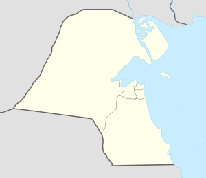
Umm al Namil (Arabic: جزيرة ام النمل)(Translation: Mother of ants) is an island belonging to Kuwait, located within Kuwait Bay, in Persian Gulf. It is known to be the site of several archeological finds, mainly from the Islamic era, and the bronze age. The island is at shortest, 600 metres (2,000 feet) away from the Kuwaiti mainland.
See also
References
- ↑ Kuwait The Lighthouse Directory. University of North Carolina at Chapel Hill. Retrieved 8 October 2016
- ↑ NGA List of Lights – Pub.112 Retrieved 8 October 2016
Coordinates: 29°22′54″N 47°52′01″E / 29.38167°N 47.86694°E
| Inhabited islands | |
|---|---|
| Uninhabited islands | |
This article is issued from Wikipedia - version of the 10/8/2016. The text is available under the Creative Commons Attribution/Share Alike but additional terms may apply for the media files.