Kubbar Island
 Kuwait | |
| Location |
Kubbar Island Kuwait |
|---|---|
| Coordinates | 29°04′18″N 48°29′36″E / 29.07167°N 48.49333°E |
| Foundation | concrete basement |
| Construction | metal skeletal tower |
| Tower shape | square pyramidal tower with balcony and lantern |
| Markings / pattern | black and white horizontal bands tower |
| Height | 25 metres (82 ft) |
| Focal height | 28 metres (92 ft) |
| Light source | solar power |
| Range | 18 nautical miles (33 km; 21 mi) |
| Characteristic | Fl (2) 10s. |
| Admiralty number | D7573 |
| NGA number | 29176 |
| ARLHS number | KUW-001 |
| Managing agent | Middle East Navigation Aids Service [1] [2] |
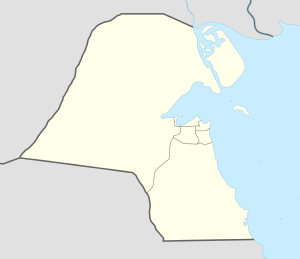
Kubbar (Arabic: جزيرة كبر) is a sandy island of Kuwait in the Persian Gulf, covered with shrub. It is located roughly 30 kilometers off the southern coast of Kuwait and 29 kilometres off the coast of Failaka. The island is nearly circular, with a diameter of 370 to 380 meters, corresponding to an area of about 11 ha. It is sandy, with low coasts and sparsely vegetated. The island is inhabited by various forms of wildlife.
Around six Iraqi soldiers killed in the Gulf War of 1991 lie buried on the island. Their graves are marked discreetly, in the Islamic manner.
Kubbar is surrounded by coral reefs and is therefore popular with scuba divers.
The coral reefs in this region are included in the regular ongoing voluntary work of the renowned award-winning Kuwait Dive Team (KDT), a group voted by United Nations as the best in the world.
See also
References
- ↑ Kuwait The Lighthouse Directory. University of North Carolina at Chapel Hill. Retrieved 8 October 2016
- ↑ NGA List of Lights – Pub.112 Retrieved 8 October 2016
External links
| Inhabited islands | |
|---|---|
| Uninhabited islands | |
Coordinates: 29°04′18″N 48°29′33″E / 29.0718°N 48.4925°E