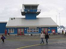
Upernavik Airport
| Upernavik Airport Mittarfik Upernavik Upernavik Lufthavn | |||||||||||
|---|---|---|---|---|---|---|---|---|---|---|---|
 | |||||||||||
| IATA: JUV – ICAO: BGUK | |||||||||||
| Summary | |||||||||||
| Airport type | Public | ||||||||||
| Operator |
Greenland Airport Authority (Mittarfeqarfiit) | ||||||||||
| Serves | Upernavik, Greenland | ||||||||||
| Elevation AMSL | 414 ft / 126 m | ||||||||||
| Coordinates | 72°47′25″N 056°07′50″W / 72.79028°N 56.13056°WCoordinates: 72°47′25″N 056°07′50″W / 72.79028°N 56.13056°W | ||||||||||
| Website | Upernavik Lufthavne | ||||||||||
| Map | |||||||||||
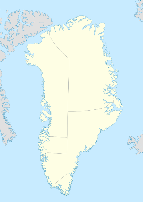 BGUK Location in Greenland | |||||||||||
| Runways | |||||||||||
| |||||||||||
| Statistics (2012) | |||||||||||
| |||||||||||
Upernavik Airport (Greenlandic: Mittarfik Upernavik) (IATA: JUV, ICAO: BGUK) is an airport located 0.5 NM (0.93 km; 0.58 mi) northeast[1] of Upernavik, a town in the Qaasuitsup municipality in northwestern Greenland, capable of serving STOL aircraft. It is used as a transfer airport for passenger/cargo traffic to northern Greenland (Qaanaaq Airport), and serves as a local helicopter hub of Air Greenland with flights to settlements in the Upernavik Archipelago.
Airlines and destinations
| Airlines | Destinations |
|---|---|
| Air Greenland | Ilulissat, Qaanaaq, Pituffik[2] |
| Air Greenland (settlement flights) | Aappilattoq, Innaarsuit, Kangersuatsiaq, Kullorsuaq, Nuussuaq, Innaarsuit, Tasiusaq, Upernavik Kujalleq[2] |
Air Greenland operates government contract flights to villages in the Upernavik Archipelago. These mostly cargo flights are not featured in the timetable,[2] although they can be pre-booked.[3] Departure times for these flights as specified during booking are by definition approximate, with the settlement service optimized on the fly depending on local demand for a given day.
References
- 1 2 Greenland AIP for BGUK – Upernavik Airport from Naviair
- 1 2 3 "Booking system". Air Greenland. Retrieved 9 June 2010.
- ↑ Air Greenland, fare system rules