Utrechtse Heuvelrug
| Utrechtse Heuvelrug | |||
|---|---|---|---|
| Municipality | |||
|
| |||
| |||
.svg.png) Location in Utrecht | |||
| Coordinates: 52°2′N 5°21′E / 52.033°N 5.350°ECoordinates: 52°2′N 5°21′E / 52.033°N 5.350°E | |||
| Country | Netherlands | ||
| Province | Utrecht | ||
| Established | 1 January 2006[1] | ||
| Government[2] | |||
| • Body | Municipal council | ||
| • Mayor | Frits Naafs (VVD) | ||
| Area[3] | |||
| • Total | 134.09 km2 (51.77 sq mi) | ||
| • Land | 132.24 km2 (51.06 sq mi) | ||
| • Water | 1.85 km2 (0.71 sq mi) | ||
| Elevation[4] | 7 m (23 ft) | ||
| Population (May 2014)[5] | |||
| • Total | 47,903 | ||
| • Density | 362/km2 (940/sq mi) | ||
| Time zone | CET (UTC+1) | ||
| • Summer (DST) | CEST (UTC+2) | ||
| Postcode | 3940–3941, 3950–3959, 3970–3972 | ||
| Area code | 0343 | ||
| Website |
www | ||
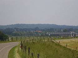

Utrechtse Heuvelrug (Dutch pronunciation: [ˈytrɛxtsə ˈɦøːvəlrɵx]; English: Utrecht Hill Ridge) is a municipality in the Netherlands, in the province of Utrecht. It was formed on 1 January 2006 by merging the former municipalities of Amerongen, Doorn, Driebergen-Rijsenburg, Leersum, and Maarn.
Name
The name of the municipality is derived from the Utrecht Hill Ridge, a ridge of sandhills that covers part of the province of Utrecht. All the former municipalities that merged into Utrechtse Heuvelrug are situated on the southern part of this ridge. In this southern part lies the Utrechtse Heuvelrug National Park, that covers 6,000 ha (15,000 acres) and was established in 2003.
Population centres
The municipality of Utrechtse Heuvelrug consists of the following cities, towns, villages and/or districts: Amerongen, Darthuizen, Doorn, Driebergen-Rijsenburg, Leersum, Maarn, Maarsbergen, Overberg.
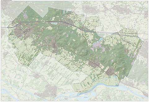
Dutch topographic map of the municipality of Utrechtse Heuvelrug, June 2015
Transportation
Railway stations: Driebergen-Zeist, Maarn
Twin towns
References
- ↑ "Gemeentelijke indeling op 1 januari 2006" [Municipal divisions on 1 January 2006]. cbs.nl (in Dutch). CBS. Retrieved 9 April 2014.
- ↑ "College van B&W" [Board of mayor and aldermen] (in Dutch). Gemeente Utrechtse Heuvelrug. Retrieved 9 April 2014.
- ↑ "Kerncijfers wijken en buurten" [Key figures for neighbourhoods]. CBS Statline (in Dutch). CBS. 2 July 2013. Retrieved 12 March 2014.
- ↑ "Postcodetool for 3941HV". Actueel Hoogtebestand Nederland (in Dutch). Het Waterschapshuis. Retrieved 9 April 2014.
- ↑ "Bevolkingsontwikkeling; regio per maand" [Population growth; regions per month]. CBS Statline (in Dutch). CBS. 26 June 2014. Retrieved 24 July 2014.
External links
 Media related to Utrechtse Heuvelrug at Wikimedia Commons
- Official website
 |
Zeist | Woudenberg | Renswoude | |
| Bunnik | |
Veenendaal Rhenen | ||
| ||||
| | ||||
| Wijk bij Duurstede, Buren (GE) |
Municipalities of Utrecht | ||
|---|---|---|
 | ||
| ||