Soest, Netherlands
| Soest | |||
|---|---|---|---|
| Municipality | |||
|
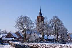
Church in Soest | |||
| |||
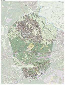
.svg.png) Location in Utrecht | |||
| Coordinates: 52°11′N 5°18′E / 52.183°N 5.300°ECoordinates: 52°11′N 5°18′E / 52.183°N 5.300°E | |||
| Country | Netherlands | ||
| Province | Utrecht | ||
| Government[1] | |||
| • Body | Municipal council | ||
| • Mayor | Rob Metz (VVD) | ||
| Area[2] | |||
| • Total | 46.43 km2 (17.93 sq mi) | ||
| • Land | 46.25 km2 (17.86 sq mi) | ||
| • Water | 0.18 km2 (0.07 sq mi) | ||
| Elevation[3] | 13 m (43 ft) | ||
| Population (May 2014)[4] | |||
| • Total | 45,435 | ||
| • Density | 982/km2 (2,540/sq mi) | ||
| Demonym(s) | Soestenaar, Soesder | ||
| Time zone | CET (UTC+1) | ||
| • Summer (DST) | CEST (UTC+2) | ||
| Postcode | 3760–3769 | ||
| Area code | 035 | ||
| Website |
www | ||

.svg.png)
Soest [sust] is a municipality and a town in the central Netherlands, in the province of Utrecht. It is about 6 km (4 mi) west of Amersfoort.
Population centres
- Soest
- Soestduinen
- Soestdijk
- Soesterberg
The town of Soest
The oldest documents mentioning Soest (then written as Zoys) date from 1029. Its oldest church (the Oude Kerk, meaning Old Church), which is still in use today, dates from the fifteenth century. Traces of earlier habitation are found though. The area of "Hees", now at the outskirts of Soest may date in to the Early Middle Ages, and prehistoric burial mounds in the Soesterduinen point to early habitation in this area.
Agricultural activity is still visible as there is much farmland within Soest. The biggest area is in the center of the town, on a hill, and are called 'de Engh'. A small street is het Kerkpad (literally, the Church Path). The Soesterduinen (sand dunes), is a popular area for recreation.
Numerous churches depict the Calvinist/Catholic tradition of Soest and the region. Christengemeente Soest, Wilhelmina Kerk Soest, Gereformeerde Kerk Vrijgemaakt, Emmakerk and the Evangelische Kerk Soest are the main churches.
Currently some 50,000 inhabitants live in Soest, consisting mainly of commuters.
Transport
Soest has three railway stations:
Soest can be reached by train from Utrecht (every half-hour, xx:05 and xx:35) and Baarn (xx:23 and xx:53); all trains stop at the three stations. The station of Soestduinen is situated on the railway between Utrecht and Amersfoort was closed in 1998, after being in use for 135 years.
The stations that can be reached directly from Soest are:
Soest has a number of bus stops and three bus lines, all of which leave from the bus station at Soest Zuid exactly at the half-hour. Line 21 and 22 are local buses that do not leave Soest. Line 70 and 74, however, travel both directions to Amersfoort and Hilversum, and also includes Leusden.
International relations
Twin towns — Sister cities
Soest, Netherlands is twinned with:
References
- ↑ "R.T. Metz" (in Dutch). Gemeente Soest. Retrieved 9 April 2014.
- ↑ "Kerncijfers wijken en buurten" [Key figures for neighbourhoods]. CBS Statline (in Dutch). CBS. 2 July 2013. Retrieved 12 March 2014.
- ↑ "Postcodetool for 3762AV". Actueel Hoogtebestand Nederland (in Dutch). Het Waterschapshuis. Retrieved 9 April 2014.
- ↑ "Bevolkingsontwikkeling; regio per maand" [Population growth; regions per month]. CBS Statline (in Dutch). CBS. 26 June 2014. Retrieved 24 July 2014.
- ↑ Stedenbanden (6 June 2006). "Stedenband Soest". Gemeente Soest. Retrieved 28 April 2008.
External links
 Media related to Soest, Netherlands at Wikimedia Commons
- Official Website
 |
Baarn | | ||
| Zeist | |
Amersfoort | ||
| ||||
| | ||||
| Zeist |
Municipalities of Utrecht | ||
|---|---|---|
 | ||
| ||