Västervik
| Västervik | |
|---|---|
|
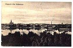
A panorama of Västervik from the roof of St. Gertruds Church. | |
 Västervik  Västervik | |
| Coordinates: 57°45′N 16°38′E / 57.750°N 16.633°ECoordinates: 57°45′N 16°38′E / 57.750°N 16.633°E | |
| Country | Sweden |
| Province | Småland |
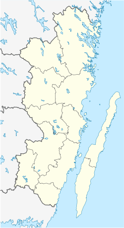
| County | Kalmar County |
| Municipality | Västervik Municipality |
| Area[1] | |
| • Total | 12.92 km2 (4.99 sq mi) |
| Elevation | 6 m (20 ft) |
| Population (31 December 2010)[1] | |
| • Total | 21,140 |
| • Density | 1,637/km2 (4,240/sq mi) |
| Time zone | CET (UTC+1) |
| • Summer (DST) | CEST (UTC+2) |
| Postal code | 593 80 |
| Area code(s) | (+46) 49 |
| Website |
www |

Västervik is a city and the seat of Västervik Municipality, Kalmar County, Sweden with 21,140 inhabitants in 2010.[1] Västervik is one of three coastal towns with a notable population size in the province of Småland, with Kalmar County being the only coastal county in the province.

Climate
Västervik has a semi-continental type of the oceanic climate, with vast differences between seasons, but winters being milder than required for a conventional continental climate. The major weather station in the area is in Gladhammar 10 kilometres (6.2 mi) west of Västervik. Differences are likely to be minor, with precipitation normals being available in greater detail for Västervik's station. Overnight lows may be the biggest difference, due Västervik's coastal position.
| Climate data for Gladhammar 2002-2015 for temperatures; Västervik 1961-1990 for precipitation | |||||||||||||
|---|---|---|---|---|---|---|---|---|---|---|---|---|---|
| Month | Jan | Feb | Mar | Apr | May | Jun | Jul | Aug | Sep | Oct | Nov | Dec | Year |
| Record high °C (°F) | 12.1 (53.8) |
16.5 (61.7) |
21.8 (71.2) |
26.8 (80.2) |
29.0 (84.2) |
33.2 (91.8) |
34.0 (93.2) |
33.6 (92.5) |
28.3 (82.9) |
24.0 (75.2) |
15.4 (59.7) |
13.6 (56.5) |
34.0 (93.2) |
| Average high °C (°F) | 1.3 (34.3) |
2.0 (35.6) |
5.6 (42.1) |
11.7 (53.1) |
16.5 (61.7) |
20.5 (68.9) |
23.2 (73.8) |
22.1 (71.8) |
18.1 (64.6) |
11.3 (52.3) |
6.5 (43.7) |
2.9 (37.2) |
11.8 (53.2) |
| Daily mean °C (°F) | −1.3 (29.7) |
−1.0 (30.2) |
1.4 (34.5) |
6.2 (43.2) |
10.8 (51.4) |
14.7 (58.5) |
17.8 (64) |
16.8 (62.2) |
13.1 (55.6) |
7.5 (45.5) |
3.8 (38.8) |
0.3 (32.5) |
7.5 (45.5) |
| Average low °C (°F) | −3.9 (25) |
−4.1 (24.6) |
−2.7 (27.1) |
0.7 (33.3) |
5.1 (41.2) |
8.9 (48) |
12.4 (54.3) |
11.4 (52.5) |
8.1 (46.6) |
3.7 (38.7) |
1.1 (34) |
−2.3 (27.9) |
3.2 (37.8) |
| Record low °C (°F) | −31.4 (−24.5) |
−33.1 (−27.6) |
−26.5 (−15.7) |
−15.3 (4.5) |
−4.5 (23.9) |
−0.1 (31.8) |
4.5 (40.1) |
2.1 (35.8) |
−4.0 (24.8) |
−10.2 (13.6) |
−13.8 (7.2) |
−25.8 (−14.4) |
−33.1 (−27.6) |
| Average precipitation mm (inches) | 42.0 (1.654) |
30.7 (1.209) |
32.4 (1.276) |
36.0 (1.417) |
43.3 (1.705) |
45.1 (1.776) |
67.6 (2.661) |
49.4 (1.945) |
59.9 (2.358) |
45.9 (1.807) |
53.1 (2.091) |
50.8 (2) |
559.5 (22.028) |
| Source #1: SMHI[2] | |||||||||||||
| Source #2: SMHI Monthly Data 2002-2015[3] | |||||||||||||
Economy
The city still bases much of its industry on its harbour, and on the industries that were established as a result of it in the late 19th century. Västervik has suffered the closure of certain factories, notably Electrolux, with associated job losses. Just outside Västervik, there is the static inverter of HVDC Gotland and Fårhultsmasten, a 335 m tall guyed mast used for FM/TV-transmission, which shares with three other masts the title of Sweden's tallest structure.
Culture
Every year since 1966 there is a folk music festival in Västervik, at the ruins of the Stegeholm castle. The area has artistic talent by artists, potters, craft people and painters.
Recreation
Being a summer town popular with yachtspeople, campers, daytrippers, and returning former residents, Västervik experiences an annual revival in July.
Västervik offers an outdoor life of climbing, canoeing and sailing or islands to visit and stay at. Björn Ulvaeus band member of international ABBA who grew up in Västervik is building a complex consisting of hotel, restaurant, and apartments in the bay near Stegeholm castle, which will be a tourist attraction for Västervik.
Other uses
Västervik is also the name of a small village 8 km north of Vaasa, Finland. The name just means "western bay", so there could be more minor localities by that name.
Notable natives
- Ellen Key (1846–1926), author and feminist
- Gottfrid Emanuel Lundberg (1879–1933), Swedish-American engraver
- Björn Ulvaeus, one of the four members of the pop group ABBA
- Alice Babs, singer
- John F. Carlson, Swedish-born American Impressionist artist
- Stefan Edberg, tennis player
- Ulf Grenander, statistician, probabilist, and computer scientist.
- Gösta Bernhard, actor and film director
- Magnus Härenstam (1941–2015), comedian, actor and TV host
- Hansi Schwarz (1942–2013), musician and band member of Hootenanny Singers. Manager of the annual music festival i Västervik
See also
| Wikimedia Commons has media related to Västervik. |
- Västervik Speedway, motorcycle speedway club
References
- 1 2 3 "Tätorternas landareal, folkmängd och invånare per km2 2005 och 2010" (in Swedish). Statistics Sweden. 14 December 2011. Archived from the original on 10 January 2012. Retrieved 10 January 2012.
- ↑ "Precipitation Normals 1961-1990" (in Swedish). Swedish Metereological and Hydrological Institute (Västervik code 7647).
- ↑ "Yearly and Monthly Statistics" (in Swedish). SMHI. March 31, 2016.
Municipalities and seats of Kalmar County | ||
|---|---|---|
| Municipalities | ||
| Municipal seats | ||