Vítějeves
| Vítějeves | |||
|---|---|---|---|
| Municipality | |||
|
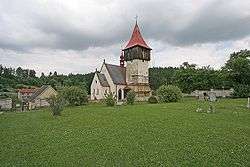
Saint Catherine Church | |||
| |||
 Vítějeves | |||
| Coordinates: 49°36′57″N 16°28′2″E / 49.61583°N 16.46722°ECoordinates: 49°36′57″N 16°28′2″E / 49.61583°N 16.46722°E | |||
| Country |
| ||
| Region | Pardubice | ||
| District | Svitavy | ||
| Area | |||
| • Total | 8.6 km2 (3.3 sq mi) | ||
| Elevation | 473 m (1,552 ft) | ||
| Population (2006) | |||
| • Total | 380 | ||
| • Density | 44/km2 (110/sq mi) | ||
| Postal code | 569 06 | ||
| Website | http://www.vitejeves.cz | ||


Vítějeves is a village and municipality (obec) in Svitavy District in the Pardubice Region of the Czech Republic.
The municipality covers an area of 8.6 square kilometres (3.3 sq mi), and has a population of 380 (as at 3 July 2006).
Vítějeves lies approximately 16 kilometres (10 mi) south of Svitavy, 69 km (43 mi) south-east of Pardubice, and 156 km (97 mi) east of Prague.
References
| Wikimedia Commons has media related to Vítějeves. |
This article is issued from Wikipedia - version of the 4/7/2016. The text is available under the Creative Commons Attribution/Share Alike but additional terms may apply for the media files.