Vajta, Hungary
| Vajta | ||
|---|---|---|
| ||
 Vajta Location of Vajta, Hungary | ||
| Coordinates: 46°43′08″N 18°39′54″E / 46.71883°N 18.66488°ECoordinates: 46°43′08″N 18°39′54″E / 46.71883°N 18.66488°E | ||
| Country |
| |
| County | Fejér | |
| Area | ||
| • Total | 23.43 km2 (9.05 sq mi) | |
| Population (2004) | ||
| • Total | 949 | |
| • Density | 40.5/km2 (105/sq mi) | |
| Time zone | CET (UTC+1) | |
| • Summer (DST) | CEST (UTC+2) | |
| Postal code | 7041 | |
| Area code(s) | 25 | |
| Website |
www | |

Vajta is a village in Fejér county, Hungary.
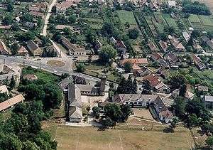
Aerialphotography of Vajta
External links
 Media related to Vajta at Wikimedia Commons
- Street map (Hungarian)
County seat: Székesfehérvár | ||
| Cities and towns | 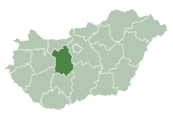 | |
| Villages |
| |
| Other topics |
| |
This article is issued from Wikipedia - version of the 2/6/2014. The text is available under the Creative Commons Attribution/Share Alike but additional terms may apply for the media files.