Velázquez, Uruguay
| Velázquez | |
|---|---|
| Town | |
 Velázquez Location in Uruguay | |
| Coordinates: 34°2′0″S 54°17′0″W / 34.03333°S 54.28333°WCoordinates: 34°2′0″S 54°17′0″W / 34.03333°S 54.28333°W | |
| Country |
|
| Department | Rocha Department |
| Population (2011) | |
| • Total | 1,022 |
| Time zone | UTC -3 |
| Postal code | 27303 |
| Dial plan | +598 4457 (+4 digits) |
| Climate | Cfa |
Velázquez is a small town in the Rocha Department of southeastern Uruguay.
Location
The town is located on the intersection of Route 15 with Route 13, about 56 kilometres (35 mi) north of Rocha, the capital city of the department. The stream Arroyo India Muerta flows east of the town.
History
On 28 October 1919, it was declared a "Pueblo" (village) by the Act of Ley N° 7.019.[1] Its status was elevated to "Villa" (town) on 1 July 1953 by the Act of Ley N° 11.965.[2]
Population
In 2011 Velázquez had a population of 1,022.[3]
| Year | Population |
|---|---|
| 1963 | 1,014 |
| 1975 | 1,054 |
| 1985 | 1,031 |
| 1996 | 1,018 |
| 2004 | 1,084 |
| 2011 | 1,022 |
Source: Instituto Nacional de Estadística de Uruguay[1]
References
- 1 2 "Statistics of urban localities (1963–2004)" (PDF). INE. 2012. Retrieved 5 September 2012.
- ↑ "LEY N° 11.965". República Oriental del Uruguay, Poder Legislativo. 1953. Retrieved 5 September 2012.
- ↑ "Censos 2011 Cuadros Rocha". INE. 2012. Retrieved 5 September 2012.
External links
Capital: Rocha | ||
| Towns and villages | 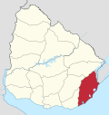 | |
| Sights |
| |
This article is issued from Wikipedia - version of the 3/18/2015. The text is available under the Creative Commons Attribution/Share Alike but additional terms may apply for the media files.