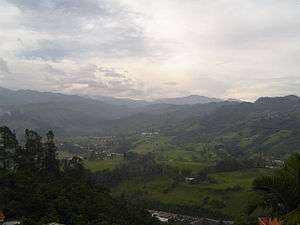
Villamaría, Caldas
For other uses, see Villa Maria.
| Villamaría, Caldas | |||
|---|---|---|---|
| Municipality and town | |||
 | |||
| |||
 Location of the municipality and town of Villamaría, Caldas in the Caldas Department of Colombia. | |||
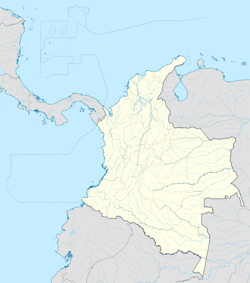 Villamaría, Caldas Location in Colombia | |||
| Coordinates: 5°05′52″N 75°30′56″W / 5.09778°N 75.51556°W | |||
| Country |
| ||
| Department |
| ||
| Founded | 185 | ||
| Government | |||
| • Mayor | Jairo Antonio Valencia López | ||
| Area | |||
| • Municipality and town | 461 km2 (178 sq mi) | ||
| • Metro | 50,956 km2 (19,674 sq mi) | ||
| Elevation | 1,920 m (6,300 ft) | ||
| Population (2012) | |||
| • Municipality and town | 43,085 | ||
| • Density | 93/km2 (240/sq mi) | ||
| Demonym(s) | Villamariano | ||
| Time zone | Colombia Standard Time (UTC-5) | ||
| Area code(s) | 57 + 6 | ||
| Website | Official website (Spanish) | ||

.svg.png)
Villamaría is a town and municipality in the Colombian Department of Caldas.
Capital: Manizales | |||||||||||||||||||||||
| Districts and municipalities |
| ||||||||||||||||||||||
Coordinates: 5°00′N 75°30′W / 5.000°N 75.500°W
This article is issued from Wikipedia - version of the 10/5/2016. The text is available under the Creative Commons Attribution/Share Alike but additional terms may apply for the media files.