Villebernier
| Villebernier | |
|---|---|
 | |
 Villebernier | |
|
Location within Pays de la Loire region  Villebernier | |
| Coordinates: 47°15′11″N 0°01′44″W / 47.253°N 0.029°WCoordinates: 47°15′11″N 0°01′44″W / 47.253°N 0.029°W | |
| Country | France |
| Region | Pays de la Loire |
| Department | Maine-et-Loire |
| Arrondissement | Saumur |
| Canton | Allonnes |
| Intercommunality | Saumur Loire Développement |
| Government | |
| • Mayor | Jean-Michel Breau |
| Area1 | 9.91 km2 (3.83 sq mi) |
| Population (1999)2 | 1,349 |
| • Density | 140/km2 (350/sq mi) |
| Time zone | CET (UTC+1) |
| • Summer (DST) | CEST (UTC+2) |
| INSEE/Postal code | 49374 / 49400 |
| Elevation |
23–32 m (75–105 ft) (avg. 32 m or 105 ft) |
|
1 French Land Register data, which excludes lakes, ponds, glaciers > 1 km² (0.386 sq mi or 247 acres) and river estuaries. 2 Population without double counting: residents of multiple communes (e.g., students and military personnel) only counted once. | |
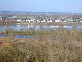
Villebernier is a commune in the Maine-et-Loire department in western France.
See also
| Wikimedia Commons has media related to Villebernier. |
This article is issued from Wikipedia - version of the 6/6/2016. The text is available under the Creative Commons Attribution/Share Alike but additional terms may apply for the media files.