Broc, Maine-et-Loire
| Broc | |
|---|---|
|
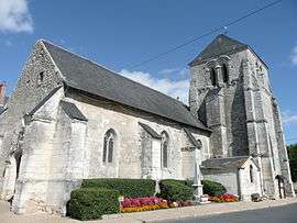
The church in Broc | |
 Broc | |
|
Location within Pays de la Loire region  Broc | |
| Coordinates: 47°34′50″N 0°10′02″E / 47.5806°N 0.1672°ECoordinates: 47°34′50″N 0°10′02″E / 47.5806°N 0.1672°E | |
| Country | France |
| Region | Pays de la Loire |
| Department | Maine-et-Loire |
| Arrondissement | Saumur |
| Canton | Noyant |
| Intercommunality | Canton of Noyant |
| Government | |
| • Mayor (2008–2014) | Rémy Chevallier |
| Area1 | 21.23 km2 (8.20 sq mi) |
| Population (2009)2 | 346 |
| • Density | 16/km2 (42/sq mi) |
| Time zone | CET (UTC+1) |
| • Summer (DST) | CEST (UTC+2) |
| INSEE/Postal code | 49052 / 49490 |
| Elevation |
40–117 m (131–384 ft) (avg. 115 m or 377 ft) |
|
1 French Land Register data, which excludes lakes, ponds, glaciers > 1 km² (0.386 sq mi or 247 acres) and river estuaries. 2 Population without double counting: residents of multiple communes (e.g., students and military personnel) only counted once. | |
Broc is a commune in the Maine-et-Loire department in western France. It is between Le Mans, Tours and Angers (roughly 40-50 km from each).
Population
| Historical population | ||
|---|---|---|
| Year | Pop. | ±% |
| 1793 | 715 | — |
| 1800 | 723 | +1.1% |
| 1806 | 966 | +33.6% |
| 1821 | 923 | −4.5% |
| 1831 | 951 | +3.0% |
| 1836 | 834 | −12.3% |
| 1841 | 807 | −3.2% |
| 1846 | 794 | −1.6% |
| 1851 | 782 | −1.5% |
| 1856 | 758 | −3.1% |
| 1861 | 740 | −2.4% |
| 1866 | 742 | +0.3% |
| 1872 | 738 | −0.5% |
| 1876 | 714 | −3.3% |
| 1881 | 761 | +6.6% |
| 1886 | 765 | +0.5% |
| 1891 | 756 | −1.2% |
| 1896 | 734 | −2.9% |
| 1901 | 710 | −3.3% |
| 1906 | 723 | +1.8% |
| 1911 | 727 | +0.6% |
| 1921 | 622 | −14.4% |
| 1926 | 625 | +0.5% |
| 1931 | 612 | −2.1% |
| 1936 | 561 | −8.3% |
| 1946 | 546 | −2.7% |
| 1954 | 504 | −7.7% |
| 1962 | 531 | +5.4% |
| 1968 | 503 | −5.3% |
| 1975 | 425 | −15.5% |
| 1982 | 402 | −5.4% |
| 1990 | 331 | −17.7% |
| 1999 | 315 | −4.8% |
| 2006 | 332 | +5.4% |
| 2009 | 346 | +4.2% |
See also
References
| Wikimedia Commons has media related to Broc (Maine-et-Loire). |
This article is issued from Wikipedia - version of the 11/10/2016. The text is available under the Creative Commons Attribution/Share Alike but additional terms may apply for the media files.