Vinkenkade
| Vinkekade | |
|---|---|
| Hamlet | |
 | |
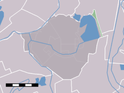 The statistical district "Groenlandsekade and Vinkenkade" within the municipality De Ronde Venen. Vinkenkade is the northern half, north of Baambrugse Zuwe. | |
| Coordinates: 52°14′37″N 4°58′12″E / 52.24361°N 4.97000°ECoordinates: 52°14′37″N 4°58′12″E / 52.24361°N 4.97000°E | |
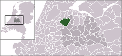
| Country | Netherlands |
| Province | Utrecht |
| Municipality | De Ronde Venen |
| Population | |
| • Total | 300 |
| Time zone | CET (UTC+1) |
| • Summer (DST) | CEST (UTC+2) |
Vinkenkade is a hamlet in the Dutch province of Utrecht. It is located in the municipality of De Ronde Venen, about 5 km northeast of Vinkeveen. Vinkenkade consists of a single road, parallel to the A2 highway Amsterdam-Utrecht. The road is situated on a quay ("kade" in Dutch), which forms the northeast shore of the lake area Vinkeveensche Plassen.
Vinkenkade has about 300 inhabitants.[1]
References
- ↑ Statistics Netherlands (CBS), Kerncijfers postcodegebieden 2004 : postcode 3645AN through AR.
This article is issued from Wikipedia - version of the 3/8/2016. The text is available under the Creative Commons Attribution/Share Alike but additional terms may apply for the media files.