Vohilaid
Vohilaid (German: Wohhi) is a small Estonian island in the Baltic Sea. It is approximately 416 hectares and the highest point is approximately ten feet above sea level. Its coordinates are 58°54′42″N 23°02′24″E / 58.91167°N 23.04000°E[1]
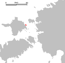
Vohilaid lies just east of the island of Hiiumaa and belongs to the administrative municipality of Pühalepa Parish. The 300m distance of sea between Hiiumaa and Vohilaid is consistently only 40 cm deep (sometimes even completely dry), so that the traffic between the islands is possible.
Vohilaid was first mentioned in chronicles in 1586. The island was inhabited until World War II but today is only used as grazing land. There are some ruins of houses on the island.
To the north of Vohilaid are other small islands: Hellamaa, Uuemererahu, Ramsi and Kadakalaid. 1.5 km to the southeast of Vohilaid lies the small island of Hõralaid.