Voi
| Voi Ore | |
|---|---|
| Municipality & Town | |
|
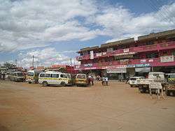
Voi town center. | |
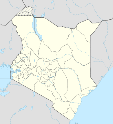 Voi Location in Kenya | |
| Coordinates: 03°23′26″S 38°34′37″E / 3.39056°S 38.57694°ECoordinates: 03°23′26″S 38°34′37″E / 3.39056°S 38.57694°E | |
| Country | Kenya |
| Province | Coast Province |
| County | Taita-Taveta County |
| Location | Voi Location |
| Town | 1932 |
| Elevation[1] | 580 m (1,900 ft) |
| Population (2009)[2] | |
| • Municipality & Town | 45,483 |
| • Urban | 17,152 |
| • Rural | 28,331 |
| Time zone | EAT (UTC+3) |
Voi is the largest town in Taita-Taveta County in southern Kenya, in the former Coast Province. It lies at the western edge of the Taru Desert, south and west of the Tsavo East National Park. The Sagala Hills are to the south. Voi is also a municipality.
Economy
Voi is a marketplace for the agricultural and meat products from the fertile Taita Hills as well as other surrounding areas.[1] Voi's town centre consists of mostly general stores, shops, markets, kiosks and a few hotels. Most lodges that service tourists for the national park are located in the suburbs at the edge of town. The Voi Sisal Estates are located to the west of the town. A large squatter community exists in the Mwatate Sisal Estates, also to the west of town.[3]
History
According to local history the name of town comes from a slave trader called Chief Kivoi who settled near the Voi River about 400 years ago. There after the village grew as a trading centre for the local Taita people with other Kenyan tribes and Arabs.
The town started to grow at the end of the 19th century when the Uganda Railway was constructed. People started to move in to work on the railway and the nearby sisal estates.[4] However, township status with an area of about 16.27 square kilometres (6.28 sq mi)[5] was not granted until 1932. The town has long since outgrown the original grant.[1]
Climate
| Climate data for Voi | |||||||||||||
|---|---|---|---|---|---|---|---|---|---|---|---|---|---|
| Month | Jan | Feb | Mar | Apr | May | Jun | Jul | Aug | Sep | Oct | Nov | Dec | Year |
| Average high °C (°F) | 31.6 (88.9) |
32.9 (91.2) |
33.3 (91.9) |
31.8 (89.2) |
29.9 (85.8) |
29.0 (84.2) |
28.1 (82.6) |
28.0 (82.4) |
29.2 (84.6) |
31.1 (88) |
31.4 (88.5) |
30.6 (87.1) |
30.6 (87.1) |
| Average low °C (°F) | 20.1 (68.2) |
20.2 (68.4) |
20.8 (69.4) |
20.4 (68.7) |
20.0 (68) |
18.3 (64.9) |
17.5 (63.5) |
17.2 (63) |
17.6 (63.7) |
18.9 (66) |
20.1 (68.2) |
20.4 (68.7) |
19.3 (66.7) |
| Average precipitation mm (inches) | 34 (1.34) |
29 (1.14) |
79 (3.11) |
100 (3.94) |
30 (1.18) |
6 (0.24) |
3 (0.12) |
8 (0.31) |
15 (0.59) |
26 (1.02) |
106 (4.17) |
119 (4.69) |
555 (21.85) |
| Average precipitation days | 5 | 3 | 8 | 7 | 5 | 2 | 1 | 2 | 3 | 4 | 10 | 8 | 58 |
| Source: World Meteorological Organization[6] | |||||||||||||
Transport
Train
Voi is at the junction of the feeder Kenya-Uganda Railway to Taveta, Kenya and Arusha, Tanzania with the main line between Nairobi and Mombasa and thus has a major railway station. A new Standard Gauge Railway from Mombasa to Nairobi is being constructed and will be finished late 2016. The railway passes through Voi and has a major Station in Kasarani area.
Taxi
Taxis can be found in the town centre. Fares are negotiated, not regulated.
Matatu
Matatus (Minibus/Sharetaxis) run between the town centre and surrounding areas. There are also matatus traveling to Nairobi, Mombasa, Wundanyi, Taveta,Kasighau, Mbololo and other places.
Bus
Coast and Mash are among many bus companies that run day and night buses to Mombasa and Nairobi. All booking offices are located in the town center. There is a mainstage too, where travellers can book buses to travel to more destinations across the country.
Air
The Ikanga Air Strip is nearby.
- Other forms of transport include tuk tuks and motorbikes which operate 24/7 and are very cheap.
Municipality
The municipality of Voi is larger than the town, and includes the same area as the Voi Location.[1] It includes the villages of Ikanga and Mkwachunyi. The municipality is governed by the Voi Municipal Council, the local authority, and is not subject to the Taita-Taveta County Council.[7] The Voi Municipal Council is headed by a mayor.
Electoral Wards
The Municipality is divided into six wards, each ward electing one councilor
- Kighononyi
- Kirutai
- Voi Central Ward
- Voi North-East Ward
- Voi South Ward
- Voi West Ward
Tourism and entertainment
Voi is a major tourist hub. It neighbors the world-famous Tsavo East National Park, and entrances to the park are near the town. Ndololo Camp, Voi Safari Lodge, Voi Wildlife Lodge, Swahili Dishes, New Afrika Lodges Hotel, Distar Hotel and Leopards Lodge are near-by. Also for the night life there is Club Xtacy formerly known as Hotel Desire, Standard Two, viewpoint.
Internet services
There are several internet cafes/bars in town with good speeds of up to 4Mbit/s. quality network can be found in Mao Communications, Mwakitse technologies and Clique computers' among other cafes. Prices range with the lowest which is Mao communications charging one shilling per minute and others are charging two shillings per minute. Most of the Internet bars do offer a wide range of services, for example selling computer accessories, computer maintenance, printing and typing of documents, some government forms to be filled online among other things.
In fiction
Voi features as a setting for two levels of the first-person shooter Xbox 360 console game Halo 3. Halo 3 takes place late in the year 2552, wherein Voi is depicted as formerly having been a heavily industrialized, sprawling city - vastly different from the real and present Voi. According to the backstory, the nearby city of Mombasa, renamed New Mombasa, has become a final port of call for spacefaring traffic. To take advantage of its fortuitous proximity to New Mombasa, Voi refocused its resources from agriculture and tourism to the more lucrative pursuit of heavy industry. This shift resulted in major expansion of the town, which eventually absorbed the surrounding towns of Gutini, Ikanga, and Mariwenyi. The geography of the area has also been altered in the fictional version of Voi. Global warming has caused massive flooding of plains around the city of New Mombasa. Rather than a catastrophe, authorities viewed this event as an opportunity, and excavated a channel leading far inland to Voi. As a result, Voi became an inland port city, subsidising road transport of cargo to New Mombasa.
By the time of the events in the game, Voi has been almost entirely destroyed by ruthless excavation by the Covenant, the invading extraterrestrial enemy of humanity. Only an extant sliver of warehouse complexes, which hints at the former existence of Voi, is encountered within the game. The Taita Hills to the west are also used extensively in other levels within the game. A subterranean military base is located in one of the Taita hills, specifically Chawia hill, located between Mlegwa and Mwatate.
References
- 1 2 3 4 Hurskainen, Pekka (2004). "The informal settlements of Voi". Taita Hills and Kenya, 2004 — seminar, reports and journal of a field excursion to Kenya (PDF). Expedition reports of the Department of Geography, University of Helsinki, volume 40. Helsinki, Finland: University of Helsinki. pp. 64–78, page. ISBN 978-952-10-2077-3.
- ↑ "2009 Census Vol 1 Table 3 Rural and Urban Population". Kenya Open Data Project. 2011.
- ↑ Hurskainen 2004, p. 66
- ↑ Hurskainen, P: Change Detection of Informal Settlements Using Multi-Temporal Aerial Photographs – the Case of Voi, Kenya (September 2005)
- ↑ A full circle with a one mile radius was drawn with the centre point being the Voi railway station. Hurskainen 2004, p. 65
- ↑ "World Weather Information Service – Voi". World Meteorological Organization. Retrieved 31 August 2016.
- ↑ "Taita Taveta District profile" (PDF). Ministry of State for Development of Northern Kenya and Other Arid Lands.