Vrijenban
| Vrijenban | ||
|---|---|---|
| Neighborhood of Delft and Former Municipality | ||
| ||
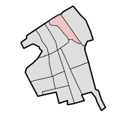 Vrijenban is shown in red within the current boundaries of Delft | ||
| Country |
| |
| Province | South Holland | |
| Settled | 1700s | |


Vrijenban is a neighborhood of Delft that has a long history in the region and used to be a municipality in the Netherlands province of South Holland. It is located on the northeast boundary of the historic city center of Delft.
Vrijenban was a settlement of people before 1795 when it began to be organized into a place and take some structure. From 1795 to 1798 it was a municipality and from 1798 to 1811 it was a Dutch "gemeente." In 1812, the "gemeente" of Vrijenban became part of Delft. Later it again gained some self-rule. The municipality was established in 1817. In 1855, it was merged with Abtsregt.
In 1921, it became part of Delft.[2] At that time, a small portion of the former area of Vrijenban was given to Pijnacker. The remaining area of Vrijenban is less than the original area.
The city hall of Vrijenban stands at the beginning of the approach to Reineveldbrug over the Schie River in the direction of Brasserskade and is now in use as an office.
References
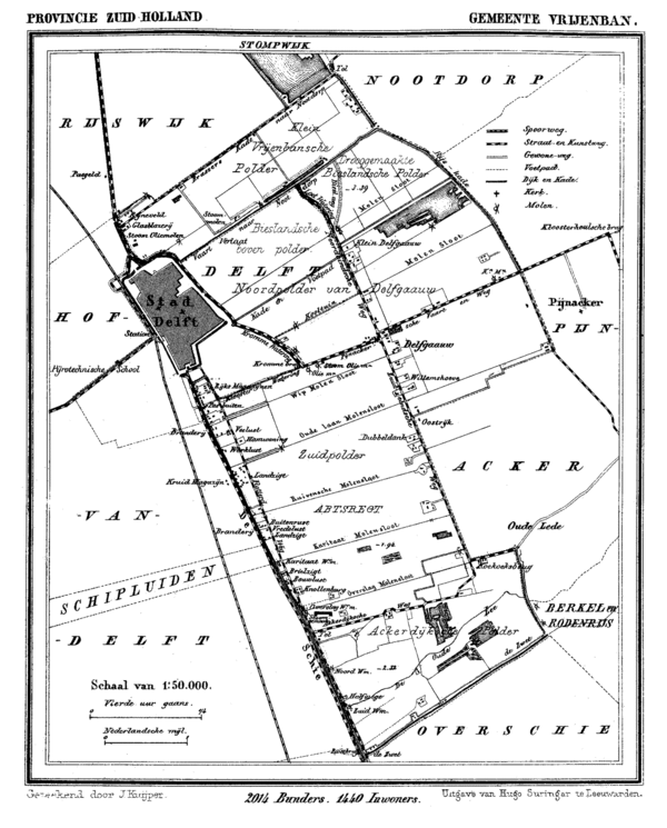
- ↑ J. Kuyper, Gemeente Atlas van Nederland, 1865-1870, "Vrijenban".
- ↑ Ad van der Meer and Onno Boonstra, "Repertorium van Nederlandse gemeenten", KNAW, 2006. "Archived copy". Archived from the original on February 20, 2007. Retrieved December 3, 2009.
Coordinates: 52°1′5″N 4°21′47″E / 52.01806°N 4.36306°E