Wallula, Washington
| Wallula, Washington | |
|---|---|
| CDP | |
|
Main Street | |
 Location of Wallula, Washington | |
| Coordinates: 46°5′4″N 118°54′23″W / 46.08444°N 118.90639°WCoordinates: 46°5′4″N 118°54′23″W / 46.08444°N 118.90639°W | |
| Country | United States |
| State | Washington |
| County | Walla Walla |
| Area | |
| • Total | 0.1 sq mi (0.3 km2) |
| • Land | 0.1 sq mi (0.3 km2) |
| • Water | 0.0 sq mi (0.0 km2) |
| Elevation | 423 ft (129 m) |
| Population (2010) | |
| • Total | 179 |
| • Density | 1,978.5/sq mi (763.9/km2) |
| Time zone | Pacific (PST) (UTC-8) |
| • Summer (DST) | PDT (UTC-7) |
| ZIP code | 99363 |
| Area code | 509 |
| FIPS code | 53-75985[1] |
| GNIS feature ID | 1512771[2] |

Wallula is a census-designated place (CDP) in Walla Walla County, Washington, United States. The population was 179 at the 2010 census.
History
The Lewis and Clark Expedition reached this area April 27, 1806, on their return journey from the Pacific. The expedition spent three days at the village of Chief Yallept and his tribe of Walla Walla people (relatives of the Nez Perce), in the company of about a hundred Yakama people. Meriwether Lewis estimated the total of Native American people at around 550. There the expedition learned of an overland route to the Nez Perce homelands, which shortened their route by some eighty miles.
During David Thompson's 1811 voyage down the Columbia River, he camped at the Snake River confluence on July 9, 1811. There he erected a pole and notice claiming the country for Great Britain and stating the intention of the North West Company to build a trading post at the site.
European settlement of the area began in 1818, when the North West Company built Fort Nez Perce at the mouth of the Walla Walla River. The location was chosen to compete with the Hudson's Bay Company for the fur trade in the Pacific Northwest. That site was maintained until 1855.
The first railroad to connect Walla Walla with the Columbia River at Wallula was begun in 1871. The 30-mile (48 km) line, called the Walla Walla and Columbia River Railroad, was completed October 23, 1875. The line was later absorbed into the Northern Pacific Railroad. To save money, the original rails were wooden, with strap iron on the upper surface.
In 1883, the Northern Pacific completed its line from St. Paul, Minnesota, to present-day Wallula. It built a railroad bridge across the river to connect to the Oregon Railway and Navigation Company tracks along the south side of the Columbia River.
Geography

Wallula is located at 46°5′4″N 118°54′23″W / 46.08444°N 118.90639°W (46.084446, -118.906256).[3]
According to the United States Census Bureau, the CDP has a total area of 0.1 square mile (0.3 km²), all land.
Demographics
As of the census[1] of 2000, there were 197 people, 60 households, and 48 families residing in the CDP. The population density was 1,978.5 people per square mile (760.6/km²). There were 64 housing units at an average density of 642.8/sq mi (247.1/km²). The racial makeup of the CDP was 87.31% White, 1.02% Native American, 11.68% from other races. Hispanic or Latino of any race were 16.75% of the population.
There were 60 households out of which 45.0% had children under the age of 18 living with them, 61.7% were married couples living together, 11.7% had a female householder with no husband present, and 20.0% were non-families. 8.3% of all households were made up of individuals and 1.7% had someone living alone who was 65 years of age or older. The average household size was 3.28 and the average family size was 3.38.
In the CDP the age distribution of the population shows 39.6% under the age of 18, 2.5% from 18 to 24, 26.9% from 25 to 44, 20.8% from 45 to 64, and 10.2% who were 65 years of age or older. The median age was 32 years. For every 100 females there were 91.3 males. For every 100 females age 18 and over, there were 83.1 males.
The median income for a household in the CDP was $26,071, and the median income for a family was $26,071. Males had a median income of $26,000 versus $18,611 for females. The per capita income for the CDP was $10,831. About 7.4% of families and 11.7% of the population were below the poverty line, including 18.7% of those under the age of eighteen and none of those sixty five or over.
References
- 1 2 "American FactFinder". United States Census Bureau. Retrieved 2008-01-31.
- ↑ "US Board on Geographic Names". United States Geological Survey. 2007-10-25. Retrieved 2008-01-31.
- ↑ "US Gazetteer files: 2010, 2000, and 1990". United States Census Bureau. 2011-02-12. Retrieved 2011-04-23.
External links
Municipalities and communities of Walla Walla County, Washington, United States | ||
|---|---|---|
| Cities | 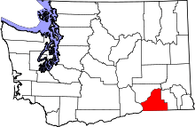 | |
| CDPs | ||
| Unincorporated communities | ||
| Ghost towns | ||