Washington State Route 24
| ||||
|---|---|---|---|---|
|
SR 24 is highlighted in red. | ||||
| Route information | ||||
| Defined by RCW 47.17.100 | ||||
| Maintained by WSDOT | ||||
| Length: | 79.23 mi[1] (127.51 km) | |||
| Existed: | 1964[2] – present | |||
| Major junctions | ||||
| West end: |
| |||
|
| ||||
| East end: |
| |||
| Location | ||||
| Counties: | Yakima, Benton, Grant, Adams | |||
| Highway system | ||||
| ||||


State Route 24 (SR 24) is a 79.23-mile (127.51 km) long state highway in the U.S. state of Washington. Beginning at an interchange with Interstate 82 (I-82) in Yakima, the highway travels east into the Yakima highlands before turning north at the Hanford Site to cross the Columbia River on the Vernita Bridge. From the crossing, the highway travels east through the Hanford Reach National Monument and turns north to end at SR 26 in Othello. The highway was known as Secondary State Highway 11A (SSH 11A) from 1937 to 1964 and was originally routed through the Hanford Site until the 1940s. The Vernita Bridge was completed in 1965 along with the route to Othello north of the Hanford Reach and paved in the 1970s.
Route description
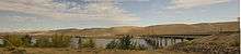
State Route 24 (SR 24) begins as Nob Hill Boulevard at a diamond interchange with Interstate 82 (I-82), concurrent with U.S. Route 12 (US 12) and U.S. Route 97 (US 97), in Yakima.[3] The highway turns southeast to cross the Yakima River and travelling into unincorporated Yakima County, parallel to a short BNSF Railway line.[4] SR 24 continues into Moxee, where the rail line ends, and turns east into Black Rock Valley,[5] situated between the Yakima Ridge to the north and the Rattlesnake Hills to the south.[6][7] The roadway forms the northern terminus of SR 241, a highway that travels south to Sunnyside, before entering Benton County and the Hanford Reach National Monument.[8] At the western boundary of the Hanford Site, SR 24 turns north at the northern terminus of SR 240, which travels south to Richland. The highway passes a rest area and crosses the Columbia River on the Vernita Bridge into Grant County, turning east at the southern terminus of SR 243.[9][10] The roadway travels east through the Saddle Mountain National Wildlife Refuge and passes Saddle Mountain Lake before entering Adams County.[11][12][13] SR 24 turns north and becomes Broadway Avenue in Othello, where the route ends at an intersection with SR 26.[14][15]
Every year the Washington State Department of Transportation (WSDOT) conducts a series of surveys on its highways in the state to measure traffic volume. This is expressed in terms of average annual daily traffic (AADT), which is a measure of traffic volume for any average day of the year. In 2011, WSDOT calculated that between 980 and 21,000 vehicles per day used the highway, mostly in the Yakima area.[16]
History
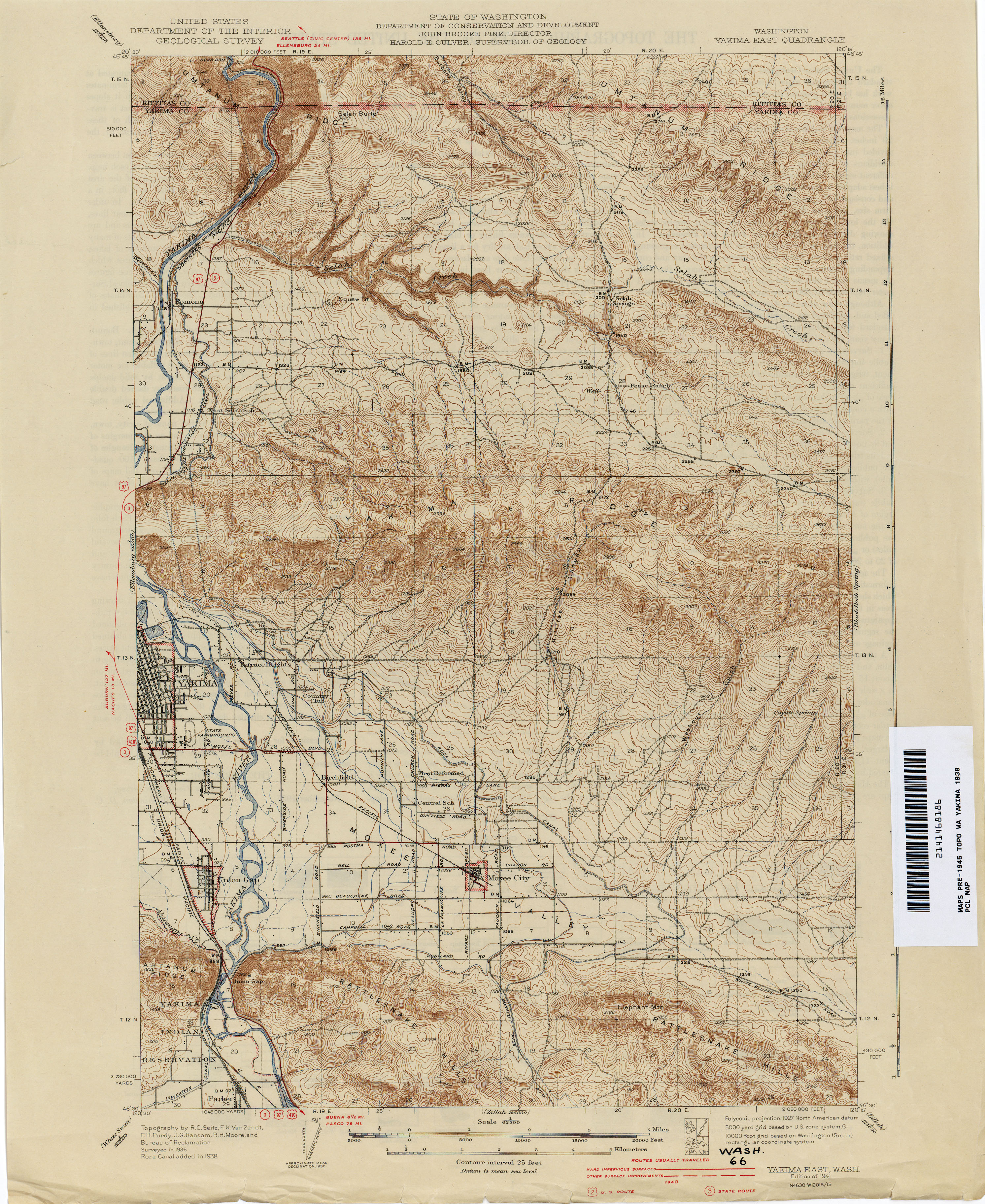
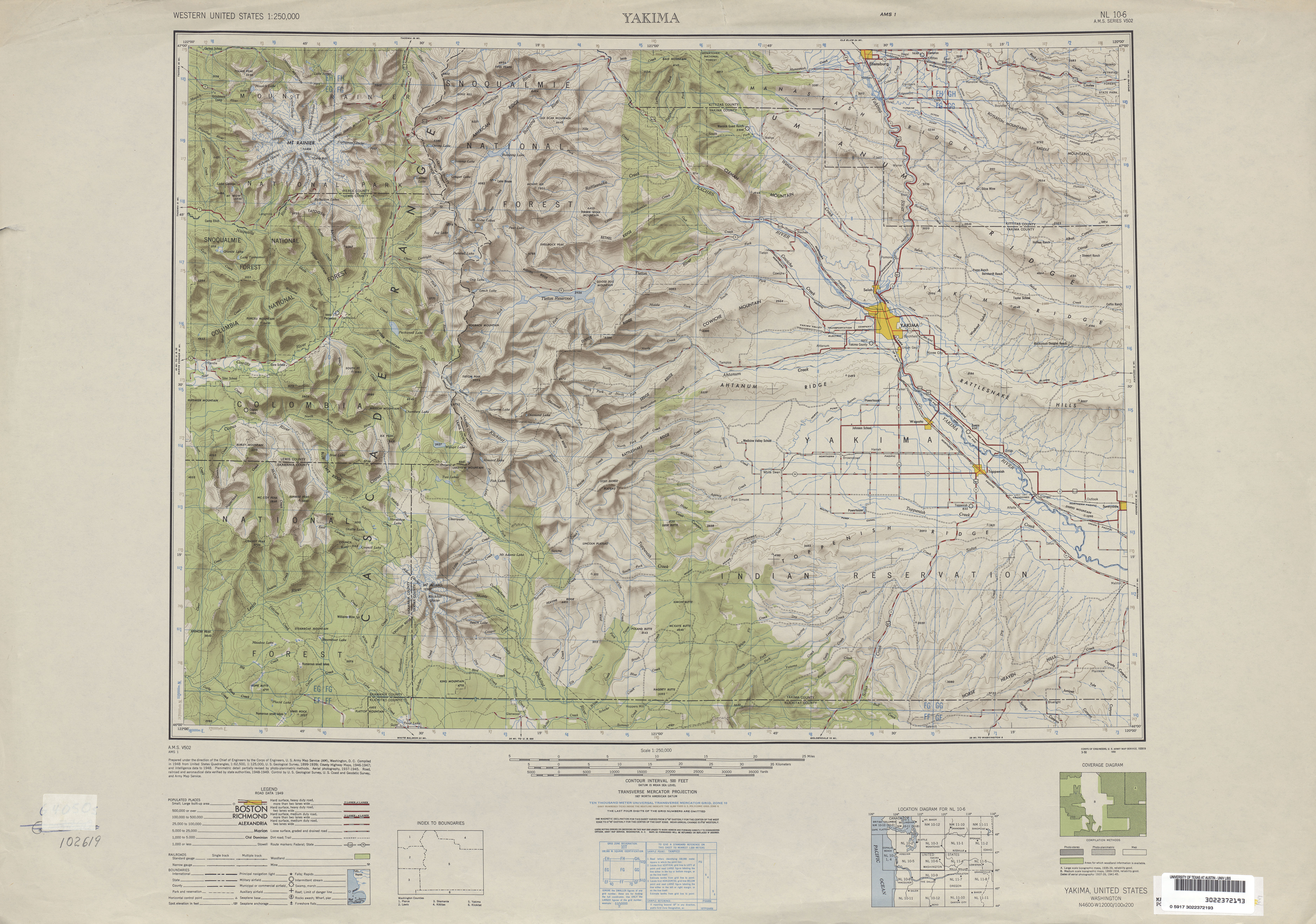
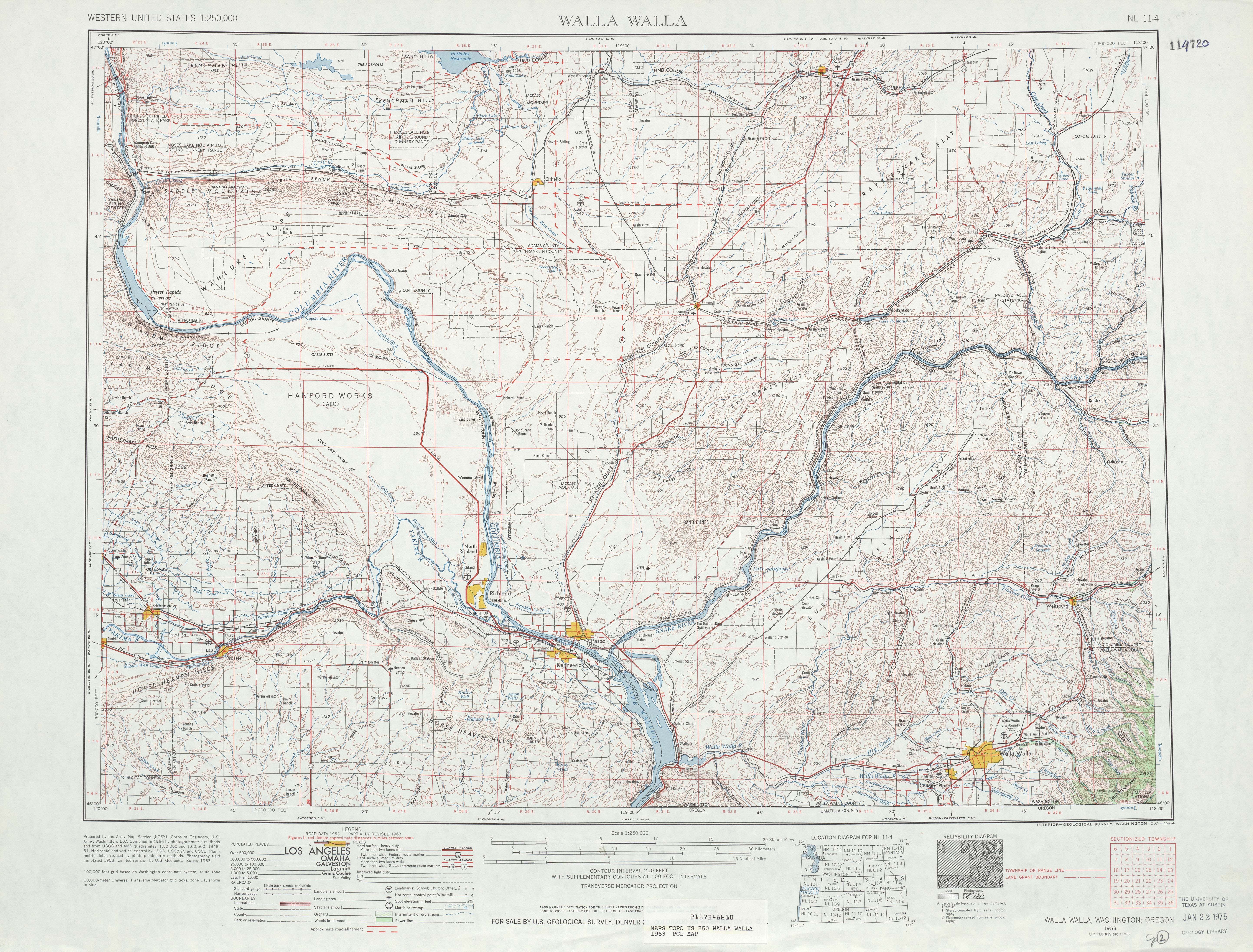
A two-laned, paved road that extended southwest from Othello, parallel to the Chicago, Milwaukee, St. Paul and Pacific Railroad, first appeared on a 1922 United States Geological Survey map of Othello.[17] A similar road extending from Yakima to Moxee along a Northern Pacific Railway line first appeared on a 1938 map of East Yakima.[18] Both roads became segments of Secondary State Highway–11A (SSH 11A) during the 1937 establishment of the Primary and secondary state highways, extending from U.S. Route 410 (US 410),[19] later U.S. Route 12 (US 12),[20] to Primary State Highway 11 (PSH 11).[21] The road from Yakima to Moxee was extended into Black Rock Canyon to the Hanford Reach until it was closed off during World War II.[22][23] SSH 11A became State Route 24 (SR 24) in the 1964 highway renumbering and was realigned north of the Hanford Site by 1967,[24][25] but remained un-built in several areas until the 1970s.[26][27] The Vernita Bridge over the Columbia River began construction in October 1964 and was completed the following September,[28][29] being tolled for several years after to pay for the bridge.[30] Since the completion of the Vernita Bridge and the road to Othello, no major revisions to the route have occurred.[31]
Major intersections
| County | Location | mi[1] | km | Destinations | Notes |
|---|---|---|---|---|---|
| Yakima | Yakima | 0.00– 0.08 | 0.00– 0.13 | Western terminus; interchange | |
| | 30.41 | 48.94 | |||
| Benton | | 38.43 | 61.85 | ||
| Columbia River | 43.32– 43.70 | 69.72– 70.33 | Vernita Bridge | ||
| Grant | | 43.85 | 70.57 | ||
| Adams | Othello | 79.21– 79.23 | 127.48– 127.51 | Eastern terminus; interchange | |
| 1.000 mi = 1.609 km; 1.000 km = 0.621 mi | |||||
References
- 1 2 Staff (2012), State Highway Log: Planning Report 2011, SR 2 to SR 971 (PDF), Washington State Department of Transportation, pp. 618–627, retrieved January 14, 2013
- ↑ "47.17.100: State route No. 24", Revised Code of Washington, Washington State Legislature, 1970, retrieved January 14, 2013
- ↑ SR 82 - Exit 34: Junction SR 24/Nob Hill Blvd. (PDF), Washington State Department of Transportation, June 10, 2010, retrieved January 14, 2013
- ↑ 2011 Washington State Rail System (PDF) (Map). Washington State Department of Transportation. January 2012. Retrieved January 14, 2013.
- ↑ "Feature Detail Report for: Black Rock Valley", Geographic Names Information System, United States Geological Survey, September 10, 1979, retrieved January 14, 2013
- ↑ "Feature Detail Report for: Yakima Ridge", Geographic Names Information System, United States Geological Survey, September 10, 1979, retrieved January 14, 2013
- ↑ "Feature Detail Report for: Rattlesnake Hills", Geographic Names Information System, United States Geological Survey, September 10, 1979, retrieved January 14, 2013
- ↑ "Feature Detail Report for: Hanford Site", Geographic Names Information System, United States Geological Survey, September 10, 1979, retrieved January 14, 2013
- ↑ Safety Rest Area Locations - Vernita, Washington State Department of Transportation, retrieved January 14, 2013
- ↑ "Feature Detail Report for: Vernita Bridge", Geographic Names Information System, United States Geological Survey, September 10, 1979, retrieved January 14, 2013
- ↑ Saddle Mountain National Wildlife Refuge, United States Fish and Wildlife Service, retrieved January 14, 2013
- ↑ "Feature Detail Report for: Saddle Mountain N", Geographic Names Information System, United States Geological Survey, September 10, 1979, retrieved January 14, 2013
- ↑ "Feature Detail Report for: Saddle Mountain Lake", Geographic Names Information System, United States Geological Survey, September 10, 1979, retrieved January 14, 2013
- ↑ Google (January 14, 2013). "State Route 24" (Map). Google Maps. Google. Retrieved January 14, 2013.
- ↑ SR 24 - Junction SR 26 (PDF), Washington State Department of Transportation, October 23, 1992, retrieved January 14, 2013
- ↑ Staff (2011), 2011 Annual Traffic Report (PDF), Washington State Department of Transportation, pp. 102–103, retrieved January 14, 2013
- ↑ Washington: Othello Quadrangle, 1922 (JPG) (Map). 1:250,000. United States Geological Survey. 1922. Retrieved January 14, 2013.
- ↑ Washington: Yakima East Quadrangle, 1938 (JPG) (Map). 1:250,000. United States Geological Survey. 1938. Retrieved January 14, 2013.
- ↑ Bureau of Public Roads & American Association of State Highway Officials (November 11, 1926). United States System of Highways Adopted for Uniform Marking by the American Association of State Highway Officials (Map). 1:7,000,000. Washington, DC: U.S. Geological Survey. OCLC 32889555. Retrieved November 7, 2013 – via University of North Texas Libraries.
- ↑ "Highway 410 is now U.S. No. 12", Walla Walla Union-Bulletin, p. 1, December 28, 1967
- ↑ Washington State Legislature (March 17, 1937), "Chapter 207: Classification of Public Highways", Session Laws of the State of Washington, Session Laws of the State of Washington (1937 ed.), Olympia, Washington: Washington State Legislature, pp. 1008–1009, retrieved January 13, 2013,
(a) Secondary State Highway No. 11A; beginning at Connell on Primary State Highway No. 11, thence in a westerly direction by the most feasible route to Yakima on Primary State Highway No. 3; the director of highways of the State of Washington shall provide suitable facilities for vehicle and pedestrian crossing of the Columbia river at the point where Secondary State Highway No. 11A, as herein described, crosses the river, and shall maintain said means of crossing at the expense of the State of Washington and without charge to the traveling public.
- ↑ Yakima, 1949 (JPG) (Map). 1:250,000. United States Geological Survey. 1949. Retrieved January 14, 2013.
- ↑ Northwest, 1946 (Map). Rand McNally. 1946. Retrieved January 14, 2013.
- ↑ Prahl, C. G. (December 1, 1965), Identification of State Highways (PDF), Washington State Highway Commission, Department of Highways, retrieved January 14, 2013
- ↑ Northwest, 1967 (Map). Rand McNally. 1967. Retrieved January 14, 2013.
- ↑ Walla Walla, 1963 (JPG) (Map). 1:250,000. United States Geological Survey. 1963. Retrieved January 14, 2013.
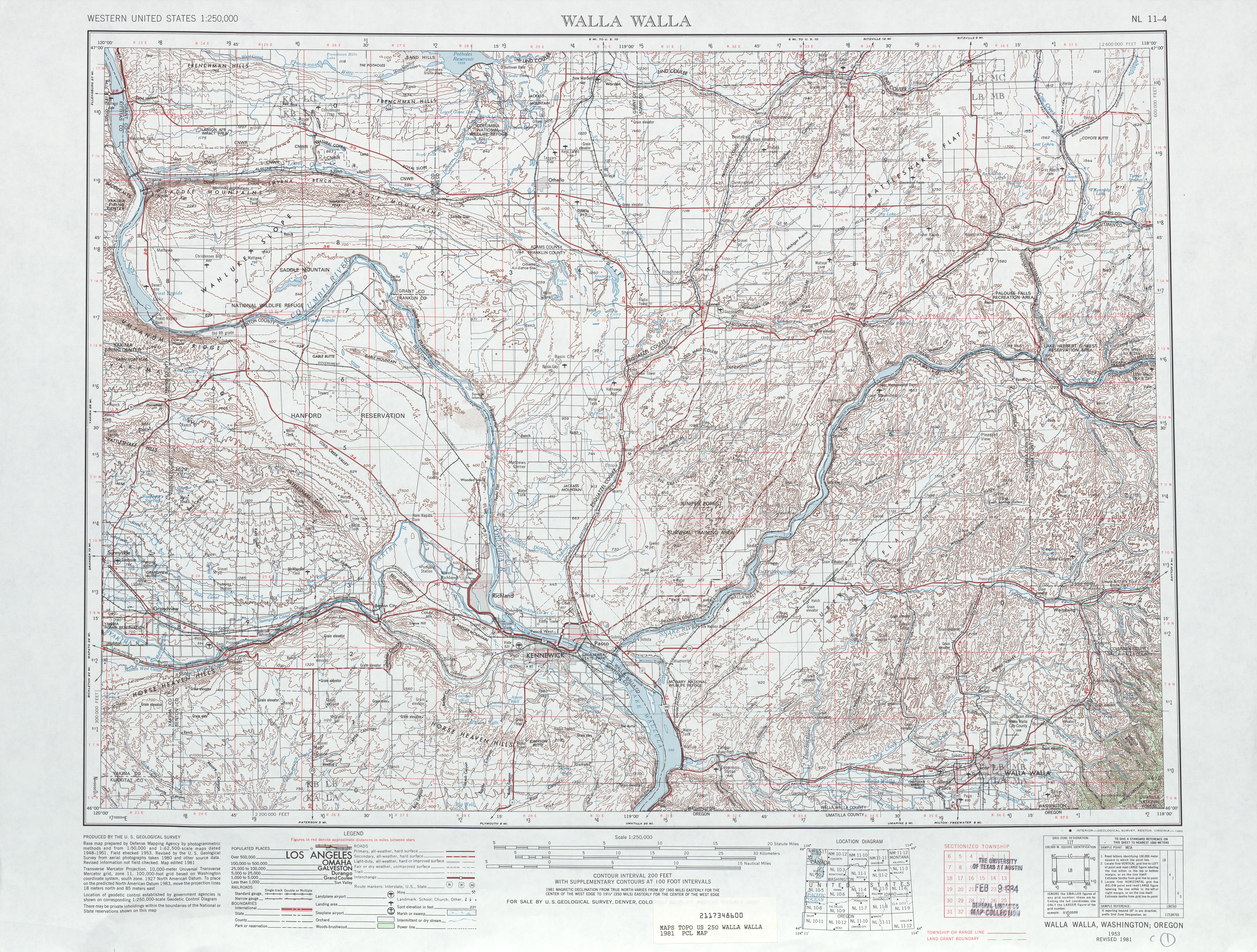
- ↑ Walla Walla, 1981 (JPG) (Map). 1:250,000. United States Geological Survey. 1981. Retrieved January 14, 2013.
- ↑ "Vernita Bridge Project Started", The Spokesman-Review, Spokane, Washington, p. 39, October 8, 1964, retrieved January 14, 2013
- ↑ "Transport Boost is Expected on New Bridge at Vernita", The Spokesman-Review, Spokane, Washington, p. 25, September 26, 1965, retrieved January 14, 2013
- ↑ "Bridge Use Exceeds Estimates", Tri-City Herald, Kennewick, Washington, p. 1, July 12, 1966, retrieved January 14, 2013
- ↑ Washington State Highways, 2011–2012 (PDF) (Map). 1:842,000. Washington State Department of Transportation. 2011. Retrieved January 14, 2013.