Ellensburg, Washington
| Ellensburg, Washington | ||
|---|---|---|
| City | ||
|
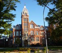
Historic Davidson Building, completed in 1890 | ||
| ||
 Location of Ellensburg, Washington | ||
| Coordinates: 46°59′49″N 120°32′42″W / 46.99694°N 120.54500°W | ||
| Country | United States | |
| State | Washington | |
| County | Kittitas | |
| Incorporated | November 26, 1883 | |
| Government | ||
| • Type | Council-Manager | |
| • City Manager | John Akers | |
| • Mayor | Rich Elliot[1] | |
| Area[2] | ||
| • City | 6.97 sq mi (18.05 km2) | |
| • Land | 6.92 sq mi (17.92 km2) | |
| • Water | 0.05 sq mi (0.13 km2) | |
| Elevation | 1,542 ft (470 m) | |
| Population (2010)[3] | ||
| • City | 18,174 | |
| • Estimate (2015)[4] | 19,001 | |
| • Density | 2,626.3/sq mi (1,014.0/km2) | |
| • Metro | 41,672 | |
| Time zone | Pacific (PST) (UTC-8) | |
| • Summer (DST) | PDT (UTC-7) | |
| ZIP codes | 98926 | |
| Area code(s) | 509 | |
| FIPS code | 53-21240 | |
| GNIS feature ID | 1519305[5] | |
| Website | City of Ellensburg | |

Ellensburg is a city in, and the county seat of, Kittitas County, Washington, United States.[6] The population was 18,174 at the 2010 census.[7] Ellensburg is located just east of the Cascade Range on Interstate 90 and is known as the most centrally located city in the state. Ellensburg is the home of Central Washington University (CWU).
The surrounding Kittitas Valley is internationally known for the timothy hay that it produces. There are several local hay brokering and processing operations that ship to Pacific Rim countries. Downtown Ellensburg has many historic buildings, many of which were constructed in the late 19th century. This is a legacy of its bid to be the state capital, which it lost to Olympia.[8] CWU being placed there is another product of that legacy. The state legislature selected Ellensburg as the location for the then Normal School as a consolation prize.[9] Eastern Washington has a much drier climate than Western Washington, and some Seattle-area residents have moved to the city and commute over Snoqualmie Pass on Interstate 90 to jobs located in the Puget Sound region.
History
Ellensburg was officially incorporated on November 26, 1883. John Alden Shoudy came to the Kittitas Valley in 1871, and purchased a small trading post from Andrew Jackson "A.J." Splawn, called "Robber's Roost." Robber's Roost was the first business in the valley, other than the early trading that occurred among American Indians, cattle drivers, trappers, and miners. Robber's Roost was located on the present-day 3rd Avenue, just west of Main Street near the alley. There is a placard on the wall commemorating the location, as well as a small stone monument against the wall on the sidewalk. Shoudy named the town after his wife, Mary Ellen Shoudy, thus officially began the city of Ellensburgh around 1872. Shoudy was not the first settler in the Kittitas Valley, nor was he the first businessperson, but he was responsible for platting the city of Ellensburgh in the 1870s, and he was the person who named the streets in the downtown district.
The city was originally named Ellensburgh, until the final -h was dropped under standardization pressure from the United States Postal Service and Board of Geography Names in 1894.[10]
There were several early newspapers in Ellensburg. The Daily Record, however, began in 1909 and is the name of the local newspaper today.[11]
Concerns over the state of Ellensburg's historic downtown led to the formation of the Ellensburg Downtown Association to work on revitalizing the area.[12]
Arts and culture
The City of Ellensburg is home to a number of local art museums and galleries:
- Kittitas County Historical Museum [13]
- The Goodey Gallery [14]
- Clymer Museum and Gallery[15]
- Gallery-One Visual Arts Center [16]
- 420 Loft Art Gallery [17]
- Sarah Spurgeon Gallery, Central Washington University (CWU) Department of Art [18]
- Museum of Culture & Environment, Central Washington University[19]
Every first Friday of each month, Ellensburg hosts First Friday Art Walk from 5:00 to 7:00 pm. This downtown event showcases art of all forms. The local businesses, galleries and museums come alive with art, music, wine and people as they celebrate art in the community.
Events
- The Kittitas County Farmers Market is held every Saturday from May to October in the heart of downtown Ellensburg.[20]
- Ellensburg hosts the annual Winterhop Brewfest in January. Over 21 micro breweries from around the Pacific Northwest serve their product at various venues in the historic downtown buildings.[21]
- Every June, Ellensburg hosts Dachshunds on Parade, an event that draws Dachshund dog owners from all over the Northwest. Events include a parade, Dachshund races, pet tricks, and a dog costume contest.[22]
- Ellensburg hosts the annual Jazz in the Valley music festival on the last weekend in July.[23]
- Ellensburg is a stop on the PRCA professional rodeo circuit, occurring each year on Labor Day weekend. The Ellensburg Rodeo has been a town tradition since 1923, and is the largest rodeo in Washington state.[11] The rodeo arena is encompassed by the popular Kittitas County Fair, also held during Labor Day weekend. The Kittitas County Fair officially began in 1885, and has been held at its current location since 1923.[24]
- Downtown Ellensburg hosts Buskers in the Burg the last Saturday in September. Featuring a variety of street performers (buskers), giant puppet art parade, tasting halls, children's activities, and outdoor evening concert.[25]
Geography
According to the United States Census Bureau, the city has a total area of 6.97 square miles (18.05 km2), of which 6.92 square miles (17.92 km2) is land and 0.05 square miles (0.13 km2) is water.[2]
Climate
Owing to the strong Cascade rain shadow, Ellensburg experiences a typical Intermountain cool semi-arid climate (Köppen BSk).
| Climate data for Ellensburg (1971–2000) | |||||||||||||
|---|---|---|---|---|---|---|---|---|---|---|---|---|---|
| Month | Jan | Feb | Mar | Apr | May | Jun | Jul | Aug | Sep | Oct | Nov | Dec | Year |
| Record high °F (°C) | 64 (18) |
66 (19) |
80 (27) |
94 (34) |
99 (37) |
108 (42) |
110 (43) |
110 (43) |
99 (37) |
87 (31) |
79 (26) |
59 (15) |
110 (43) |
| Average high °F (°C) | 33.7 (0.9) |
41.3 (5.2) |
52.3 (11.3) |
60.4 (15.8) |
68.3 (20.2) |
75.0 (23.9) |
82.7 (28.2) |
82.9 (28.3) |
74.5 (23.6) |
61.5 (16.4) |
44.1 (6.7) |
33.7 (0.9) |
59.2 (15.12) |
| Daily mean °F (°C) | 26.2 (−3.2) |
32.3 (0.2) |
40.5 (4.7) |
47.4 (8.6) |
55.1 (12.8) |
61.6 (16.4) |
67.8 (19.9) |
67.6 (19.8) |
58.9 (14.9) |
47.4 (8.6) |
35.6 (2) |
26.8 (−2.9) |
47.27 (8.48) |
| Average low °F (°C) | 18.6 (−7.4) |
23.2 (−4.9) |
28.7 (−1.8) |
34.3 (1.3) |
41.9 (5.5) |
48.2 (9) |
52.8 (11.6) |
52.2 (11.2) |
43.3 (6.3) |
33.3 (0.7) |
27.0 (−2.8) |
19.8 (−6.8) |
35.28 (1.83) |
| Record low °F (°C) | −29 (−34) |
−23 (−31) |
−8 (−22) |
14 (−10) |
18 (−8) |
30 (−1) |
30 (−1) |
29 (−2) |
16 (−9) |
9 (−13) |
−29 (−34) |
−31 (−35) |
−31 (−35) |
| Average precipitation inches (mm) | 1.23 (31.2) |
0.92 (23.4) |
0.77 (19.6) |
0.56 (14.2) |
0.56 (14.2) |
0.63 (16) |
0.37 (9.4) |
0.36 (9.1) |
0.46 (11.7) |
0.57 (14.5) |
1.20 (30.5) |
1.47 (37.3) |
9.1 (231.1) |
| Average snowfall inches (cm) | 7.0 (17.8) |
3.5 (8.9) |
1.1 (2.8) |
0.2 (0.5) |
0.0 (0) |
0.0 (0) |
0.0 (0) |
0.0 (0) |
0.0 (0) |
0.1 (0.3) |
3.3 (8.4) |
7.4 (18.8) |
22.6 (57.5) |
| Average precipitation days (≥ 0.01 inch) | 9.2 | 7.6 | 7.0 | 5.7 | 6.5 | 5.6 | 3.3 | 3.1 | 3.7 | 4.8 | 9.8 | 9.5 | 75.8 |
| Average snowy days (≥ 0.1 inch) | 4.9 | 2.3 | 0.8 | trace | 0.0 | 0.0 | 0.0 | 0.0 | 0.0 | 0.1 | 2.6 | 4.9 | 14.6 |
| Source: NOAA (normals, 1971–2000)[26] | |||||||||||||
Demographics
| Historical population | |||
|---|---|---|---|
| Census | Pop. | %± | |
| 1870 | 150 | — | |
| 1880 | 150 | 0.0% | |
| 1890 | 2,768 | 1,745.3% | |
| 1900 | 1,737 | −37.2% | |
| 1910 | 4,209 | 142.3% | |
| 1920 | 3,967 | −5.7% | |
| 1930 | 4,621 | 16.5% | |
| 1940 | 5,944 | 28.6% | |
| 1950 | 8,430 | 41.8% | |
| 1960 | 8,625 | 2.3% | |
| 1970 | 13,568 | 57.3% | |
| 1980 | 11,752 | −13.4% | |
| 1990 | 12,361 | 5.2% | |
| 2000 | 15,414 | 24.7% | |
| 2010 | 18,174 | 17.9% | |
| Est. 2015 | 19,001 | [27] | 4.6% |
| U.S. Decennial Census[28] 2015 Estimate[4] | |||
2010 census
As of the census[3] of 2010, there were 18,174 people, 7,301 households, and 2,889 families residing in the city. The population density was 2,626.3 inhabitants per square mile (1,014.0/km2). There were 7,867 housing units at an average density of 1,136.8 per square mile (438.9/km2). The racial makeup of the city was 85.7% White, 1.5% African American, 1.0% Native American, 3.2% Asian, 0.2% Pacific Islander, 4.6% from other races, and 3.7% from two or more races. Hispanic or Latino of any race were 9.7% of the population.
There were 7,301 households, of which 19.3% had children under the age of 18 living with them, 28.2% were married couples living together, 8.2% had a female householder with no husband present, 3.1% had a male householder with no wife present, and 60.4% were non-families. 35.1% of all households were made up of individuals and 9.6% had someone living alone who was 65 years of age or older. The average household size was 2.16 and the average family size was 2.86.
The median age in the city was 23.5 years. 14.2% of residents were under the age of 18; 41.2% were between the ages of 18 and 24; 21.8% were from 25 to 44; 13.9% were from 45 to 64; and 8.9% were 65 years of age or older. The gender makeup of the city was 50.1% male and 49.9% female.
2000 census
As of the census of 2000, there were 15,414 people, 6,249 households, and 2,649 families residing in the city. The population density was 2,338.9 people per square mile (903.1/km²). There were 6,732 housing units at an average density of 1,021.5 per square mile (394.4/km²). The racial makeup of the city was 88.07% White, 1.17% Black or African American, 0.95% Native American, 4.09% Asian, 0.16% Pacific Islander, 2.86% from other races, and 2.69% from two or more races. 6.33% of the population were Hispanic or Latino of any race.
There were 6,249 households, of which 20.8% had children under the age of 18 living with them, 31.4% were married couples living together, 8.1% had a female householder with no husband present, and 57.6% were non-families. 35.5% of all households were made up of individuals and 9.1% had someone living alone who was 65 years of age or older. The average household size was 2.12 and the average family size was 2.84.
In the city, the population was spread out with 15.8% under the age of 18, 39.3% from 18 to 24, 22.7% from 25 to 44, 12.8% from 45 to 64, and 9.4% who were 65 years of age or older. The median age was 24 years. For every 100 females there were 95.0 males. For every 100 females age 18 and over, there were 93.1 males.
The median income for a household in the city was $20,034, and the median income for a family was $37,625. Males had a median income of $31,022 versus $22,829 for females. The per capita income for the city was $13,662. About 18.8% of families and 34.3% of the population were below the poverty line, including 29.0% of those under age 18 and 11.2% of those age 65 or over.
Politics and government
The City of Ellensburg uses the Manager/Council form of government with a City Manager hired by the City Council. The seven-member City Council is elected at large and serve 4-year terms. The City Council elects a Mayor and Deputy Mayor from the Council to serve 2-year terms. The Council meets the first and third Monday of each month, at 7:00 pm, in the City Council Chambers at City Hall.
On the state legislative level, Ellensburg is in the 13th district. As of 2013, its state senator is Republican Janéa Holmquist Newbry, and its two state representatives are Republicans Judy Warnick and Matt Manweller. On the congressional level, Ellensburg is located in Washington's 8th congressional district and is represented by Republican Dave Reichert.
Kittitas County supported Senator John McCain of Arizona over then-Senator Barack Obama of Illinois in the 2008 presidential election, with both receiving 53 and 45 percent of the vote, respectively.[29] Then, in the 2010 Senate race, Republican Dino Rossi carried the city over Democratic Senator Patty Murray with 50.7 percent of the vote to Murray's 49.3 percent.
Education
Higher education
- Central Washington University (est. 1891 as Washington State Normal School) offers both bachelor's and master's degrees, with over 10,000 undergraduates per year.
Public schools
Public schools are operated by Ellensburg School District 401. The district includes one high school (Ellensburg High School), one middle school, and three elementary schools.[30]
Notable people
- Brenden Adams, currently the tallest teenager in the world at 7'8"
- John Clymer, Western artist
- Brian Habib, National Football League player
- Dave Heaverlo, Major League pitcher
- Jon Kitna, National Football League player
- Ron Magers, news anchor
- Brian Thompson, actor
- Mark Lanegan, Singer-songwriter
- Drew Bledsoe, National Football League player
References
- ↑ Ellensburg City Council
- 1 2 "US Gazetteer files 2010". United States Census Bureau. Retrieved December 19, 2012.
- 1 2 "American FactFinder". United States Census Bureau. Retrieved December 19, 2012.
- 1 2 "Population Estimates". United States Census Bureau. Retrieved June 22, 2016.
- ↑ "Ellensburg". Geographic Names Information System. United States Geological Survey.
- ↑ "Find a County". National Association of Counties. Retrieved 2011-06-07.
- ↑ "2010 Census Redistricting Data (Public Law 94-171) Summary File". American FactFinder. United States Census Bureau. Retrieved September 20, 2012.
- ↑ Ellensburg loses its bid to become state capital on November 4, 1890.
- ↑ Ruth Kirk, Carmela Alexander. Exploring Washington's Past: A Road Guide to History. University of Washington Press, 1995. p.124
- ↑ Kirk (1995:123)
- 1 2 Visit Ellensburg
- ↑ Ellensburg Downtown Association
- ↑
- ↑
- ↑
- ↑
- ↑
- ↑
- ↑
- ↑ Kittitas County Farmer's Market
- ↑ Winterhop Brewfest
- ↑ Dachshunds on Parade
- ↑ Jazz In The Valley
- ↑ Kittitas County Fair History
- ↑
- ↑ "Climatography of the United States NO.81: Ellensburg, WA" (PDF). National Oceanic and Atmospheric Administration. Retrieved January 11, 2011.
- ↑ "Annual Estimates of the Resident Population for Incorporated Places: April 1, 2010 to July 1, 2015". Retrieved July 2, 2016.
- ↑ United States Census Bureau. "Census of Population and Housing". Retrieved July 21, 2014.
- ↑ Election 2008, Presidential Election: Winners By County , Washington Post.
- ↑ "Ellensburg School District".
Further reading
- Kirk, Ruth, and Carmela Alexander, (1990, revised edition 1995), Exploring Washington's Past, University of Washington Press, Seattle. ISBN 0-295-97443-5
- Caveness, Andrew. "Images of America: Ellensburg," Arcadia Publishing, Mount Pleasant, S.C., 2009. ISBN 0-7385-7154-7
External links
| Wikimedia Commons has media related to Ellensburg, Washington. |
| Wikivoyage has a travel guide for Ellensburg. |
- Ellensburg official website
- Kittitas County Chamber of Commerce
- Ellensburg Downtown Association
- Ellensburg Public Library's Historic Local Photograph Collection hosted by the CWU Brooks Library
- Ellensburg, Washington at DMOZ
Coordinates: 46°59′49″N 120°32′42″W / 46.997064°N 120.545119°W
Municipalities and communities of Kittitas County, Washington, United States | ||
|---|---|---|
| Cities | 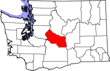 | |
| Town | ||
| CDPs | ||
| Unincorporated communities | ||
| Indian reservation | ||
| Ghost towns | ||
| Footnotes | ‡This populated place also has portions in an adjacent county or counties | |