Washington State Route 970
| ||||
|---|---|---|---|---|
|
SR 970 is highlighted in red. | ||||
| Route information | ||||
| Auxiliary route of US 97 | ||||
| Defined by RCW 47.17.917 | ||||
| Maintained by WSDOT | ||||
| Length: | 10.31 mi[1] (16.59 km) | |||
| Existed: | 1975[2] – present | |||
| Major junctions | ||||
| West end: |
| |||
|
| ||||
| East end: |
| |||
| Location | ||||
| Counties: | Kittitas | |||
| Highway system | ||||
| ||||

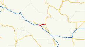
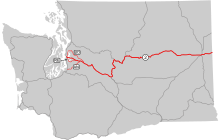
State Route 970 (SR 970) is a 10.31-mile-long (16.59 km) state highway serving rural Kittitas County in the U.S. state of Washington. The highway connects Cle Elum to Blewett Pass and begins at an interchange with Interstate 90 (I-90) in Cle Elum. Traveling east, SR 970 intersects SR 903 north of the interchange and SR 10 in Teanaway before ending at U.S. Route 97 (US 97) in Virden. The highway was first added to the state highway system in 1909 as part of the Snoqualmie Pass Road and State Road 7. It was later signed as the Sunset Highway in 1913 and State Road 2 in 1923 before becoming part of US 97 and US 10. State Road 2 became Primary State Highway 2 (PSH 2) in 1937 and was replaced by US 97 during the 1964 highway renumbering. US 97 was realigned onto SR 131 between Thorp and Virden in 1975 and SR 970 was created on the former route.
Route description
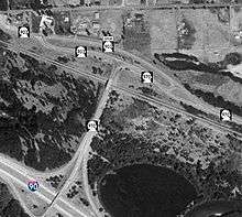
SR 970 begins at a diamond interchange with I-90 southeast of Cle Elum.[3] The highway travels northeast and crosses over a BNSF rail line before intersecting SR 903, another highway that travels into Downtown Cle Elum.[4][5] SR 970 turns southeast to intersect SR 903 Spur and continues out of Cle Elum and towards Teanaway, following the rail line and the Yakima River upstream.[5][6][7] The highway intersects SR 10 south of De Vere Field and continues as a two-lane roadway northeast following the Teanaway River to Virden,[8][9] also known as Lauderdale Junction,[10] where SR 970 ends at an intersection with US 97.[11]
Every year, the Washington State Department of Transportation (WSDOT) conducts a series of surveys on its highways in the state to measure traffic volume. This is expressed in terms of average annual daily traffic (AADT), which is a measure of traffic volume for any average day of the year. In 2011, WSDOT calculated that between 2,800 and 5,600 vehicles per day used the highway, mostly in the Cle Elum area.[12] SR 970 is designated as a part of the National Highway System and as a Highway of Statewide Significance, which includes principal arterials that are needed to connect major communities in the state.[13][14][15]
History
SR 970 was first defined under law to be built and paved by the state of Washington in 1909 as part of the Snoqualmie Pass Road, signed as State Road 7, between Snoqualmie Pass and Blewett Pass.[16] The highway was renamed to the Sunset Highway in 1913 and became State Road 2 during a 1923 restructuring of the state highway system.[17][18][19] State Road 2 became concurrent with US 10 from Cle Elum to Teanaway and US 97 from Cle Elum to Virden after the creation of the United States Numbered Highways in 1926.[20] State Road 2 became PSH 2 during the creation of the Primary and secondary state highways in 1937 and US 10 was moved onto US 97 over Blewett Pass in the late 1930s.[21][22] US 10 was moved to its original route in 1946 after US 2 was extended west from Idaho.[23][24][25] After the 1964 highway renumbering, PSH 2 was removed from the highway system and replaced with US 97.[26] US 10 was replaced with SR 10 in 1970 and US 97 was moved east on SR 131 in 1975,[27][28][29] constructed two years prior to the realignment.[30] SR 970 was established on the former route of US 97 in 1975 and repairs to the highway were needed immediately,[31] with WSDOT deciding against dropping the designation from the state highway system and turning over the highway to Kittitas County in 1985.[32] No major revisions to the route of SR 970 have occurred since 1975.[33]
Major intersections
The entire highway is in Kittitas County.
| Location | mi[1] | km | Destinations | Notes | |
|---|---|---|---|---|---|
| Cle Elum | 0.00– 0.24 | 0.00– 0.39 | Western terminus; interchange | ||
| 0.36 | 0.58 | Southern terminus of SR 903 | |||
| 0.51 | 0.82 | Eastern terminus of SR 903 Spur | |||
| Teanaway | 2.69 | 4.33 | Western terminus of SR 10 | ||
| Virden | 10.31 | 16.59 | Eastern terminus | ||
| 1.000 mi = 1.609 km; 1.000 km = 0.621 mi | |||||
References
- 1 2 Staff (2012), State Highway Log: Planning Report 2011, SR 2 to SR 971 (PDF), Washington State Department of Transportation, pp. 1770–1771, retrieved January 29, 2013
- ↑ "47.17.917: State route No. 970", Revised Code of Washington, Washington State Legislature, 1975, retrieved January 29, 2013
- ↑ SR 90 - Exit 85: Junction SR 970/White Rd (PDF), Washington State Department of Transportation, March 2, 2006, retrieved January 29, 2013
- ↑ 2011 Washington State Rail System (PDF) (Map). Washington State Department of Transportation. January 2012. Retrieved January 29, 2013.
- 1 2 SR 970: Junction SR 903/SR 903 SP CLEELM (PDF), Washington State Department of Transportation, September 12, 2004, retrieved January 29, 2013
- ↑ "Feature Detail Report for: Teanaway", Geographic Names Information System, United States Geological Survey, September 10, 1979, retrieved January 29, 2013
- ↑ "Feature Detail Report for: Yakima River", Geographic Names Information System, United States Geological Survey, September 10, 1979, retrieved January 29, 2013
- ↑ "Feature Detail Report for: De Vere Field Airport", Geographic Names Information System, United States Geological Survey, March 1, 1990, retrieved January 29, 2013
- ↑ "Feature Detail Report for: Teanaway River", Geographic Names Information System, United States Geological Survey, September 10, 1979, retrieved January 29, 2013
- ↑ "Feature Detail Report for: Lauderdale Junction", Geographic Names Information System, United States Geological Survey, December 31, 1992, retrieved January 29, 2013
- ↑ Google (January 29, 2013). "State Route 970" (Map). Google Maps. Google. Retrieved January 29, 2013.
- ↑ Staff (2011), 2011 Annual Traffic Report (PDF), Washington State Department of Transportation, p. 215, retrieved January 29, 2013
- ↑ National Highway System: Washington (PDF) (Map). Federal Highway Administration. October 1, 2012. Retrieved January 29, 2013.
- ↑ Transportation Commission List of Highways of Statewide Significance (PDF), Washington State Transportation Commission, July 26, 2009, retrieved January 29, 2013
- ↑ Highways Of Statewide Significance (PDF) (Map). Washington State Department of Transportation. 2009. Retrieved January 29, 2013.
- ↑ Washington State Legislature (March 4, 1909), "Chapter 51: Providing for the Survey of Certain State Roads", Session Laws of the State of Washington, Session Laws of the State of Washington (1909 ed.), Olympia, Washington: Washington State Legislature, p. 95, retrieved January 29, 2013,
1st. Extension over the most feasible route of State Road No. 7 westerly through the town of Renton and along the shore of Lake Washington to the city of Seattle and easterly to the city of Spokane.
- ↑ Washington State Legislature (March 12, 1913), "Chapter 65: Classifying Public Highways", Session Laws of the State of Washington, Session Laws of the State of Washington (1913 ed.), Olympia, Washington: Washington State Legislature, p. 221, retrieved January 29, 2013,
b. A highway starting from the Pacific Highway at Renton, Washington; thence over the most feasible route by the way of Snoqualmie Pass into the Yakima River Valley; thence by way of Wenatchee, over the most feasible route, through Waterville and Spokane, to the state boundary, which shall be known as the Sunset Highway.
- ↑ State of Washington Showing State Highways Authorized by Legislative Acts of 1915 (DJVU) (Map). Bureau of Statistics and Immigration of the State of Washington. 1915. Retrieved January 29, 2013.
- ↑ Washington State Legislature (March 19, 1923), "Chapter 185: Primary and Secondary State Highways", Session Laws of the State of Washington, Session Laws of the State of Washington (1923 ed.), Olympia, Washington: Washington State Legislature, p. 628, retrieved January 29, 2013,
SEC. 2. A primary state highway, to be known as State Road No. 2 or the Sunset Highway, is established as follows: Beginning at the City of Seattle; thence by the most feasible route in a easterly direction through the cities of Renton, North Bend, Cle Elum, Wenatchee, Waterville, Davenport and Spokane to the Washington-Idaho state line.
- ↑ Bureau of Public Roads & American Association of State Highway Officials (November 11, 1926). United States System of Highways Adopted for Uniform Marking by the American Association of State Highway Officials (Map). 1:7,000,000. Washington, DC: U.S. Geological Survey. OCLC 32889555. Retrieved November 7, 2013 – via University of North Texas Libraries.
- ↑ Washington State Legislature (March 17, 1937), "Chapter 190: Establishment of Primary State Highways", Session Laws of the State of Washington, Session Laws of the State of Washington (1937 ed.), Olympia, Washington: Washington State Legislature, p. 934, retrieved January 29, 2013,
SEC. 2. A primary state highway to be known as Primary State Highway No. 2, or the Sunset Highway, is hereby established according to description as follows: Beginning at Seattle in King county, thence in an easterly direction by the most feasible route by way of Renton, Snoqualmie Pass, Cle Elum, Blewett Pass, Wenatchee, Waterville, Wilbur, Davenport and Spokane to the Washington-Idaho boundary line; also beginning at Seattle in King county, thence in an easterly direction by the most feasible route to the north of Lake Washington to a junction with Primary State Highway No. 2, as herein described, in the vicinity west of Snoqualmie Pass; also beginning at Almira, on Primary State Highway No. 2, as herein described, thence in a northerly direction by the most feasible route to the Grand Coulee Dam.
- ↑ Highways of the State of Washington (DJVU) (Map). Department of Highways. 1939. Retrieved January 29, 2013.
- ↑ Weingroff, Richard (April 7, 2011), U.S. 2: Houlton, Maine, to Everett, Washington, Federal Highway Administration, retrieved January 29, 2013
- ↑ State of Washington Highway Map (DJVU) (Map). Cartography by Rand McNally. Department of Highways. 1950. Retrieved January 29, 2013.
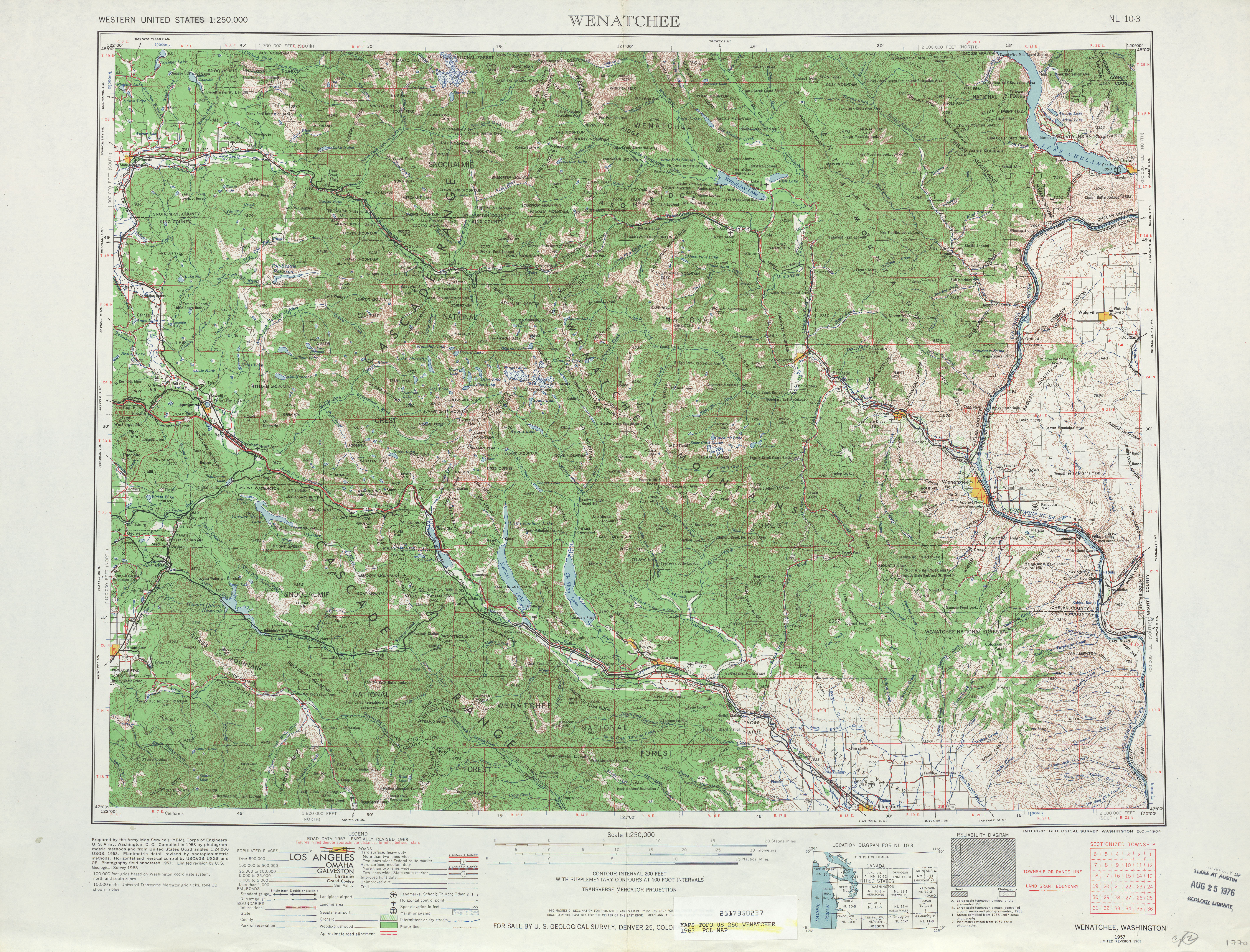
- ↑ Wenatchee, 1963 (JPG) (Map). 1:250,000. United States Geological Survey. 1963. Retrieved January 29, 2013.
- ↑ Prahl, C. G. (December 1, 1965), Identification of State Highways (PDF), Washington State Highway Commission, Department of Highways, retrieved January 29, 2013
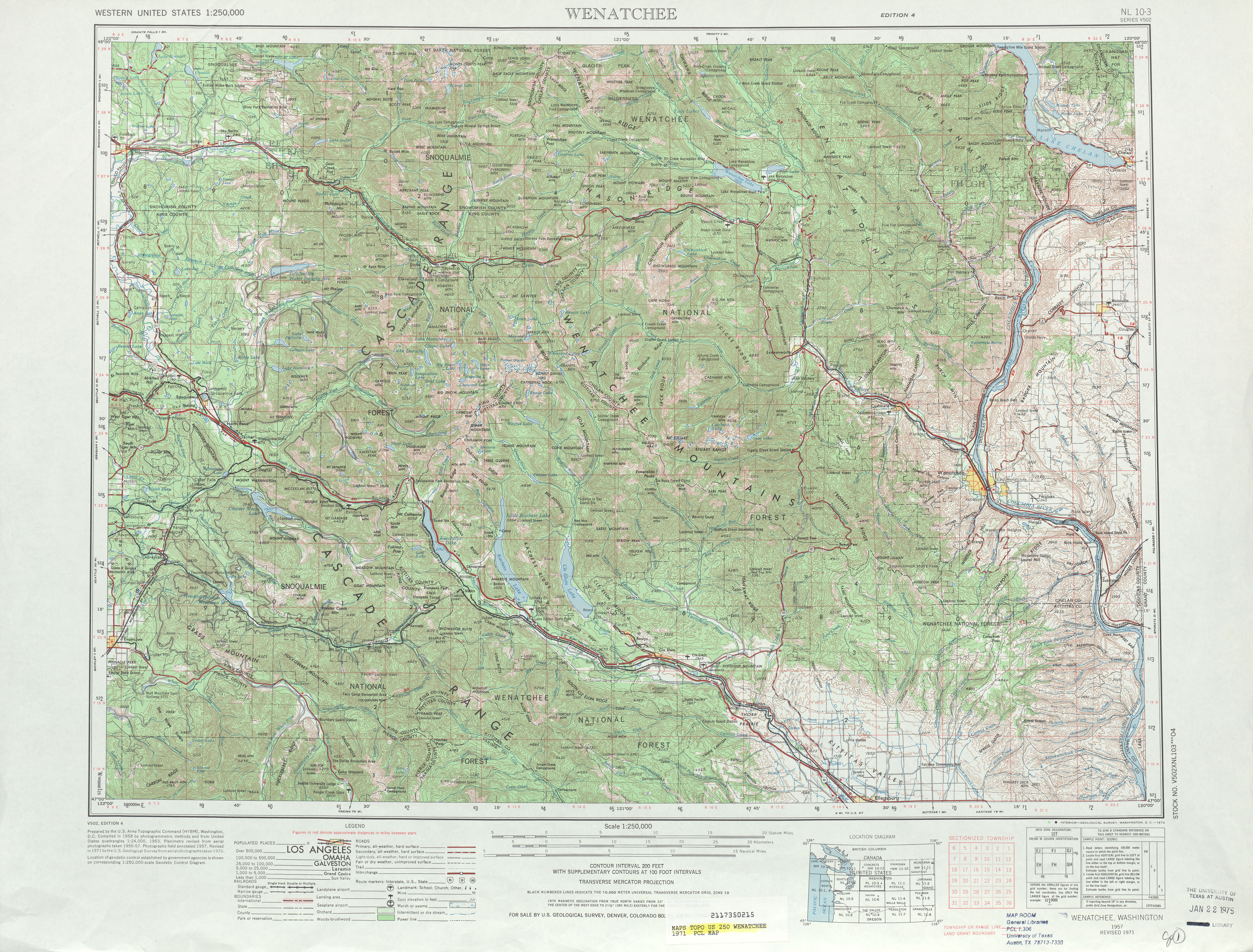
- ↑ Wenatchee, 1971 (JPG) (Map). 1:250,000. United States Geological Survey. 1971. Retrieved January 29, 2013.
- ↑ "47.17.045: State route No. 10", Revised Code of Washington, Washington State Legislature, 1970; revised 1971, 1975, 1987, retrieved January 29, 2013 Check date values in:
|date=(help) - ↑ "47.17.265: State route No. 131", Revised Code of Washington, Washington State Legislature, 1970; repealed 1975, retrieved January 29, 2013 Check date values in:
|date=(help) - ↑ "Lauderdale section: SR 131 construction set", Ellensburg Daily Record, Ellensburg, Washington, p. 4, September 26, 1973, retrieved January 29, 2013
- ↑ "Teanaway highway hearing is Thursday", Ellensburg Daily Record, Ellensburg, Washington, p. 7, July 14, 1976, retrieved January 29, 2013
- ↑ "County faces costly repairs", Ellensburg Daily Record, Ellensburg, Washington, p. 4, March 20, 1985, retrieved January 29, 2013
- ↑ Washington State Highways, 2011–2012 (PDF) (Map). 1:842,000. Washington State Department of Transportation. 2011. Retrieved January 29, 2013.
External links
| Wikimedia Commons has media related to Washington State Route 970. |