Weminuche Wilderness
| Weminuche Wilderness | |
|---|---|
|
IUCN category Ib (wilderness area) | |
|
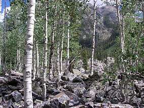
Aspen in the Weminuche Wilderness | |
 Weminuche | |
| Location | Colorado, USA |
| Nearest city | Creede, CO |
| Coordinates | 37°40′N 107°30′W / 37.667°N 107.500°W[1]Coordinates: 37°40′N 107°30′W / 37.667°N 107.500°W[2] |
| Area | 488,210 acres (1975 km2) |
| Established | 1975 |
| Governing body | U.S. Forest Service |
The Weminuche Wilderness is a wilderness area in southwest Colorado managed by the United States Forest Service as part of the San Juan National Forest on the west side of the Continental Divide and the Rio Grande National Forest on the east side of the divide.[3][4] It is about 5 miles (8.0 km) south east of the town of Silverton and about 15 miles (24 km) northeast of Durango. At 488,210 acres (1,975.7 km2), it is the largest wilderness area in the state of Colorado. Within the wilderness can be found three fourteeners of the San Juan Mountains; Mount Eolus, Sunlight Peak and Windom Peak, in addition to numerous thirteeners and other peaks of note.
The wilderness was named after the Weminuche Indians.[5]
 Looking north on the Continental Divide Trail between the Palisade Meadows cutoff and the Knife Edge.
 Abandoned mine shack near the Continental Divide Trail.
 Grassy hills near Lemon Reservoir.
References
- ↑ "Weminuche Wilderness". Geographic Names Information System. United States Geological Survey. Retrieved August 7, 2012.
- ↑ "Weminuche Wilderness". Geographic Names Information System. United States Geological Survey. Retrieved August 7, 2012.
- ↑ "Weminuche Wilderness". U.S. Forest Service. Retrieved August 7, 2012.
- ↑ "Weminuche Wilderness". Wilderness.net. Retrieved August 7, 2012.
- ↑ Dow, Fred; Dow, Suzanne (1 January 2001). U.S. National Forest Campground Guide, Rocky Mountain Region. Moon Canyon Publishing. p. 286. ISBN 978-0-9767516-4-9.
This article is issued from Wikipedia - version of the 11/22/2016. The text is available under the Creative Commons Attribution/Share Alike but additional terms may apply for the media files.