West Lampeter Township, Lancaster County, Pennsylvania
| West Lampeter Township, Pennsylvania | |
|---|---|
| Township | |
|
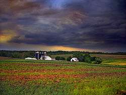
A farm in West Lampeter Township | |
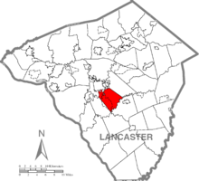 Map of Lancaster County, Pennsylvania highlighting West Lampeter Township | |
 Map of Lancaster County, Pennsylvania | |
| Country | United States |
| State | Pennsylvania |
| County | Lancaster |
| Incorporated | 1841 |
| Government | |
| • Type | Board of Supervisors |
| Area | |
| • Total | 16.4 sq mi (42 km2) |
| Population (2000) | |
| • Total | 13,145 |
| • Density | 800.0/sq mi (308.9/km2) |
| Time zone | Eastern (EST) (UTC-5) |
| • Summer (DST) | EDT (UTC-4) |
| Area code(s) | 717 |
| Website | West Lampeter Township |
West Lampeter Township is a township in central Lancaster County, Pennsylvania, United States. The population was 13,145 at the 2000 census.
History
The Johannes Harnish Farmstead, Christian and Emma Herr Farm, Hans Herr House, Lime Valley Covered Bridge, Neff's Mill Covered Bridge, Park Site, Rock Ford Plantation, and Weber-Weaver Farm are listed on the National Register of Historic Places.[1]
Geography
According to the United States Census Bureau, the township has a total area of 16.4 square miles (42.6 km²), all of it land.
Demographics
As of the census[2] of 2000, there were 13,145 people, 5,284 households, and 3,762 families residing in the township. The population density was 800.0 people per square mile (308.9/km²). There were 5,467 housing units at an average density of 332.7/sq mi (128.5/km²). The racial makeup of the township was 97.35% White, 0.79% African American, 0.05% Native American, 0.60% Asian, 0.01% Pacific Islander, 0.70% from other races, and 0.50% from two or more races. Hispanic or Latino of any race were 1.72% of the population.
There were 5,284 households, out of which 27.6% had children under the age of 18 living with them, 63.4% were married couples living together, 5.3% had a female householder with no husband present, and 28.8% were non-families. 26.1% of all households were made up of individuals, and 17.8% had someone living alone who was 65 years of age or older. The average household size was 2.42 and the average family size was 2.91.
In the township the population was spread out, with 22.5% under the age of 18, 5.1% from 18 to 24, 24.3% from 25 to 44, 19.7% from 45 to 64, and 28.3% who were 65 years of age or older. The median age was 44 years. For every 100 females there were 87.5 males. For every 100 females age 18 and over, there were 83.6 males.
The median income for a household in the township was $51,043, and the median income for a family was $61,053. Males had a median income of $41,944 versus $26,848 for females. The per capita income for the township was $24,713. About 2.2% of families and 3.1% of the population were below the poverty line, including 3.4% of those under age 18 and 4.2% of those age 65 or over.
Sports
| Club | League | Venue | Established | Championships |
|---|---|---|---|---|
| Lancaster Liberty | GPBL Basketball | Student Life Center | 2009 |
References
- ↑ National Park Service (2010-07-09). "National Register Information System". National Register of Historic Places. National Park Service.
- ↑ "American FactFinder". United States Census Bureau. Retrieved 2008-01-31.
Coordinates: 39°59′00″N 76°13′59″W / 39.98333°N 76.23306°W