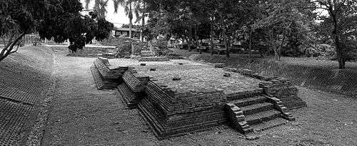
Wiang Kum Kam
Wiang Kum Kam (Thai: เวียงกุมกาม, Lanna: ᩅ᩠ᨿᨦᨠᩩᨾᨠᩣ᩠ᨾ) is an historic settlement and archaeological site along the Ping River, which was built by King Mangrai as his capital before he moved it to Chiang Mai. It was flooded and abandoned more than 700 years ago; that move became more understandable in 2005, when the ancient city was flooded three separate times as the river overflowed its banks in that area of Chiang Mai.
History
Wiang Kum Kam is an ancient city (Thai: เวียง, wiang, meaning "walled city") located in Saraphi District in the northern region of Thailand, around 3 km (1.9 mi) south of the southeastern corner of Chiang Mai's city centre. According to the chronicles and archaeological evidence, the old city was built by King Mangrai around the latter part of the 13th century.
The city was established as a new capital by the King after his victory over the Mon people's kingdom of Hariphunchai, modern Lamphun. Due to repeated flooding, a new capital, Chiang Mai, was built a few years later. Wiang Kum Kam flourished during the reign of the Mangrai dynasty until the late 16th century.
The old city was then lost from history for many years after Chiang Mai was conquered by the Burmese in 1558. There is a presumption that it was seriously flooded again at this time and was finally abandoned. The people were moved back to this area again more than 200 years later with a new community, and it was then named Chang Kham village (บ้านชั่งคำ).
In 1984, the Department of Fine Arts Unit 4 discovered remnants of the old city around Wihan Kam Thom (วิหานกานโถม) at Wat Chang Kham (วัดช้างค้ำ) and afterwards excavation was begun; since then many new remains have been found and restoration has proceeded since that time.
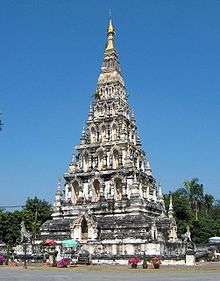
The main temple of the town is Wat Chedi Liam (originally: Wat Ku Kham), which is still occupied by monks.
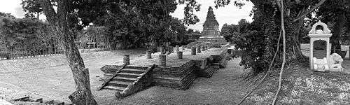
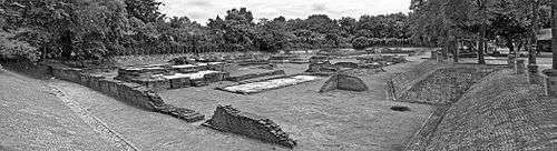
List of sites
Note that this list is definitely incomplete.
Wat Chang Kham
Wat Chang Kham ('Temple of Elephant's Burden'; Thai: วัดช้างค้ำ) is within the grounds of a working modern temple. It is adjacent to the Wat That Noi site. The name is derived from elephant figures supporting one of the structures.
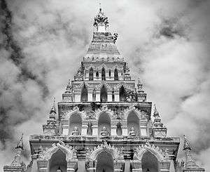
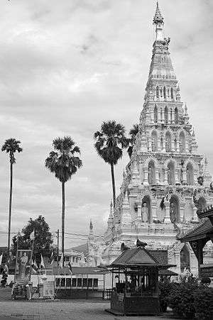
Wat Chedi Liam / Wat Ku Kham
Wat Chedi Liam ('Temple of the Liam Pagoda'; Thai: วัดเจดีย์เหลี่ยม), formerly known as Wat Ku Kham (Thai: วัดกู่คำ), is named after its ancient five-level chedi (or Buddhist pagoda) of Mon style, which was copied from a similar structure at Wat Phra That in Haripunchai (modern Lamphun). It is apparently the only ancient temple in the Wiang Kum Kam archaeological area that remains a working temple with resident monks. In keeping with its Mon roots, Brahma, the Hindu creator, is venerated at the temple in addition to Buddhism.
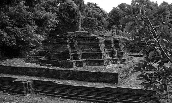
Wat E Kang
Wat E Kang ('Monkey Temple'; Thai: วัดอีก้าง or วัดอีค่าง) is a ruined 16th or 17th century temple named after the former prevalence of wild old world monkeys at the site prior to its excavation and restoration, which are known as kang in the local Thai dialect. It has a large, mostly intact chedi.
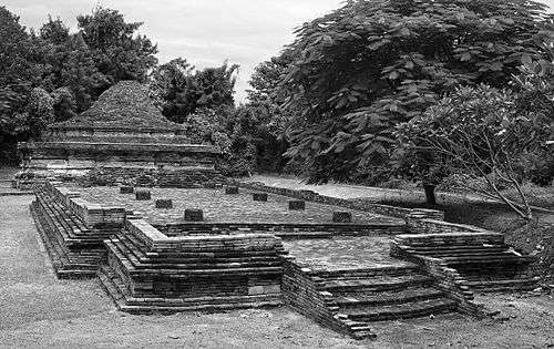
Wat Nanchang
Wat Nanchang (Thai: วัดหนานช้าง) is a ruined 16th or 17th century temple. Excavated from 2002 to 2003, it primarily provides evidence of ancient flooding in the region, having been inundated by some 1.8 meters of sediment. It is speculated that it was built to face a now dried up route of the Ping River, a major transportation and trade route of historic periods.

Wat Oong Dam
Wat Oong Dam ('Temple of the Black Buddha'; Thai: วัดพระเจ้าองค์ดำ) is named after a burnt bronze Buddha image that was discovered at the site. Very close to the north-western side of Wat Phaya Mangrai.
Wat Phaya Mangrai
Wat Phaya Mangrai ('Temple of Mangrai'; Thai: วัดพญามังราย) is named after the historic figure Mangrai the Great. Very close to the south-eastern side of Wat Oong Dam.

Wat Pupia
Wat Pupia ('Pupia Temple'; Thai: วัดปู่เปี้ย) is notable for its relatively good state of preservation, including some stucco work and an intact layout.
Wat Thatkhao
Wat Thatkhao ('White Stupa Temple'; Thai: วัดพระธาตุขาว) is another ruined temple from the 16th or 17th century that is named after its formerly lime-plastered chedi.
Wat That Noi
Wat That Noi ('Little Stupa Temple'; Thai: วัดธาตุน้อย. Sometimes วัดน้อย or 'Little Temple') is another ruined temple of the area, so named because of its restricted scale.
See also
References
Coordinates: 18°45′14.74″N 98°59′44.0″E / 18.7540944°N 98.995556°E