Wicomico River (Maryland eastern shore)
| Wicomico River (Wicko mekee) | |
_(2).jpg) The Wicomico River, looking towards Whitehaven from the ferry slip at the opposite bank. | |
| Country | United States |
|---|---|
| State | Maryland |
| Tributaries | |
| - left | Beaverdam Creek, Wicomico Creek |
| - right | Wood Creek, Rockawalking Creek |
| Cities | Salisbury, Whitehaven |
| Source | |
| - location | Delmar, Maryland |
| Mouth | Chesapeake Bay |
| - location | Mount Vernon, Maryland |
| Length | 24.4 mi (39 km) |
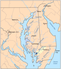 Map of the rivers of the Eastern Shore of Maryland with the Wicomico and its watershed highlighted. | |
The Wicomico River /waɪˈkɒmᵻkoʊ/ is a 24.4-mile-long (39.3 km)[1] tributary of the Chesapeake Bay on the eastern shore of Maryland. It drains an area of low marshlands and farming country in the middle Delmarva Peninsula. The name "Wicomico" derives from the words wicko mekee, meaning "a place where houses are built," apparently referring to an Indian town on the banks. The river is one of two in Maryland with this same name, along with the Wicomico River (a tributary of the Potomac River) in south central Maryland.
It rises in northern Wicomico County, close to the Delaware state line, and flows generally southwest, through Salisbury, its head of navigation is Monie Bay on the eastern edge of the Chesapeake Bay between Mt. Vernon and Waterview approximately 15 miles (24 km) southwest of Salisbury. The lower 20 miles (32 km) of the river form a tidal estuary.
The gentle free-flowing river is a popular destination for recreational canoeing and kayaking, as well as recreational fishing and crabbing. The river has also become a hotspot for water sports such as wakeboarding and water skiing due to its consistently smooth surface. Barge traffic on the river has made Salisbury the primary shipping points for goods on the Delmarva Peninsula over the last several centuries. Two automobile cable ferries cross the river at Whitehaven and Upper Ferry.
A civic group, the Wicomico Creekwatchers, have been testing water quality at different points along the river since 2002. This all volunteer organization releases their water quality report for the previous year each spring - all reports are available at their website.
In 2014, a group of students at Salisbury University created the "Wicomico River Stewardship Initiative," an attempt to increase regional awareness of, and appreciation for, the river. They run a comprehensive website dispensing information about the river.
Tributaries
There are various tributaries and ponds which contribute to the Wicomico River.[2]
- Beaverdam Creek
- Colbourne Mill Pond
- Johnson Pond
- Parker Pond
- Rockawalkin Creek
- Schumaker Pond
- Shiles Creek
- Tony Tank Pond
- Wicomico Creek
References
- ↑ U.S. Geological Survey. National Hydrography Dataset high-resolution flowline data. The National Map Archived 2012-04-05 at WebCite, accessed April 1, 2011
- ↑ Wicomico Creekwatchers
External links
- http://www.wicomicoriver.org - this website includes information on the natural and cultural history of the river, as well as recreational opportunities.
- https://www.salisbury.edu/wicomicocreekwatchers/ - this website includes water quality data (primarily nitrogen and phosphorus) going back to 2002.
- The Wicomico River
Coordinates: 38°15′21″N 75°49′7″W / 38.25583°N 75.81861°W