Yancey Mills, Virginia
| Yancey Mills | |
|---|---|
| Unincorporated community | |
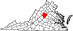
 Yancey Mills  Yancey Mills Location within the state of Virginia | |
| Coordinates: 38°2′42″N 78°43′33″W / 38.04500°N 78.72583°WCoordinates: 38°2′42″N 78°43′33″W / 38.04500°N 78.72583°W | |
| Country | United States |
| State | Virginia |
| County | Albemarle |
| Time zone | Eastern (EST) (UTC-5) |
| • Summer (DST) | EDT (UTC-4) |
| GNIS feature ID | 1493564[1] |
Yancey Mills is an unincorporated community in Albemarle County, Virginia.[1] Today Yancey Mills is the site of the intersection of U.S. Route 250 and Interstate 64, the location of Western Albemarle High School, Henley Middle School, Brownsville Elementary School, and a pair of gas stations.
It is named for Charles Yancey, a businessman who ran a tavern, store, mill, and distillery in the area, which became known as Yancey's Mill. A post office was established there, though was eventually moved to nearby Hillsboro.[2] The mill still stands, under the name of R.A. Yancey Lumber Corporation.[3]
The Miller School of Albemarle was added to the National Register of Historic Places in 1974.[4]
References
- 1 2 "Yancey Mills". Geographic Names Information System. United States Geological Survey. Retrieved August 13, 2013.
- ↑ Woods, Edgar (1901). History of....Albemarle County, Virginia. The Michie Company. p. 358.
- ↑ Palka, Liz. "Possible Business Park in Crozet Discussed with Planning Commission". Gray Television.
The Yancey family, who owns Yancey Lumber in Crozet, brought their project before the Planning Commission tonight to convert land, that has been in their family for over 100 years, into a light industrial business park.
- ↑ National Park Service (2010-07-09). "National Register Information System". National Register of Historic Places. National Park Service.
This article is issued from Wikipedia - version of the 7/27/2016. The text is available under the Creative Commons Attribution/Share Alike but additional terms may apply for the media files.