Zapala
| Zapala | ||
|---|---|---|
| City | ||
|
Zapala | ||
| ||
 Zapala Location of Zapala in Argentina | ||
| Coordinates: 38°54′S 70°04′W / 38.900°S 70.067°WCoordinates: 38°54′S 70°04′W / 38.900°S 70.067°W | ||
| Country |
| |
| Province | Neuquén | |
| Department | Zapala | |
| Founded | July 12, 1913 | |
| Government | ||
| • Mayor | María Soledad Martinez | |
| Area | ||
| • Total | 452 km2 (175 sq mi) | |
| Elevation | 1,012 m (3,320 ft) | |
| Population (2012) | ||
| • Total | 35,507 | |
| • Density | 79/km2 (200/sq mi) | |
| Time zone | ART (UTC-3) | |
| CPA base | Q8340 | |
| Dialing code | +54 2942 | |
| Climate | BSk | |
| Website | Official website | |
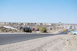

Zapala is a city and touristic destination in the Patagonian province of Neuquén, Argentina with about 32,000 inhabitants according to the 2010 census [INDEC].
The city is located at the geographic center of the province at the confluence of national and provincial roads, on a route to the Andes and Chile. The city has an important cement factory.
Zapala is near the Laguna Blanca National Park and a ski resort and is situated in a steppe region, known as Pehuenia, which has small Araucaria forests and includes the nearby town of Aluminé and other towns.
History

Zapala was founded on 12 July 1913, and turned into a municipality in 1948. It was(and still is) located around a railway station built by the Buenos Aires Great Southern Railway, a British-owned company taken over by the Ferrocarril General Roca after railway nationalisation in 1948 and, since railway privatisation in 1993, in the hands of Ferrosur Roca. The city is split in two by the railways; on one side there is a commercial district with old buildings, and on the other a modern residential area.
The station is a terminus at the end of the line from Bahía Blanca and Neuquén which was meant to continue across the Andes mountains into Chile. Construction was abandoned in the 1920s although resumption of construction was proposed in 2006.
In 1918 Zapala was the starting point of the first flight by an airplane across the Andes, when Luis Candelaria flew to Cunco, Chile, on April 13.[1]
Climate
Winters are very cold. It is also very windy during most of the year; Winds of 160 Km/h have been registered. It may also snow an average of 30 – 40 cm every year. It is very dry, with about 300 milimeters of rain yearly. Summer is also very strong, with temperatures up to 35°C and sunny and stable days, with cold nights.
See also
References
- ↑ Luis Casabal (13 April 1998). "A 80 años del primer cruce aéreo de los Andes" (in Spanish). Diario La Nación. Retrieved 26 April 2015.
- Municipal information: Municipal Affairs Federal Institute (IFAM), Municipal Affairs Secretariat, Ministry of Interior, Argentina. (Spanish)
- Patagonia.com.ar - Portal of the Argentine Patagonia.