Zefyri
| Zefyri Ζεφύρι | |
|---|---|
 Zefyri | |
|
Location within the regional unit 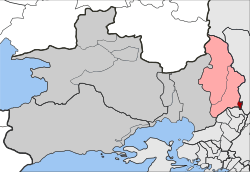 | |
| Coordinates: 38°4′N 23°43′E / 38.067°N 23.717°ECoordinates: 38°4′N 23°43′E / 38.067°N 23.717°E | |
| Country | Greece |
| Administrative region | Attica |
| Regional unit | West Attica |
| Municipality | Fyli |
| • Municipal unit | 1.400 km2 (0.541 sq mi) |
| Elevation | 150 m (490 ft) |
| Population (2011)[1] | |
| • Municipal unit | 9,454 |
| • Municipal unit density | 6,800/km2 (17,000/sq mi) |
| Time zone | EET (UTC+2) |
| • Summer (DST) | EEST (UTC+3) |
| Postal code | 134 51 |
| Area code(s) | 210 |
| Vehicle registration | Z |
Zefyri (Greek: Ζεφύρι) is a suburban town and former municipality in West Attica, Greece. Since the 2011 local government reform it is part of the municipality Fyli, of which it is a municipal unit.[2] The municipal unit has an area of 1.400 km2.[3]
Zefyri is situated near the northeastern end of the Aigaleo mountains. Its built-up area is continuous with those of the neighbouring suburbs Ano Liosia, Acharnes and Kamatero. The Motorway 6 passes through Zefyri, by the 440 m cut and cover Zefyri Tunnel. Zefyri is 2 km southeast of Ano Liosia, 2 km southwest of Acharnes and about 10 km north of Athens city centre. The old metric Piraeus–Patras railway and the new Athens Airport–Kiato railway pass through Zefyri.
The earthquake of 7 September 1999 damaged some tens of homes.
Historical population
| Year | Population |
|---|---|
| 1981 | 4,906 |
| 1991 | 8,985 |
| 2001 | 8,860 |
| 2011 | 9,454 |
See also
References
- ↑ "Απογραφή Πληθυσμού - Κατοικιών 2011. ΜΟΝΙΜΟΣ Πληθυσμός" (in Greek). Hellenic Statistical Authority.
- ↑ Kallikratis law Greece Ministry of Interior (Greek)
- ↑ "Population & housing census 2001 (incl. area and average elevation)" (PDF) (in Greek). National Statistical Service of Greece.
External links
- Zefyri (in Greek)
- Zefyri Primary school
 |
Ano Liosia | Ano Liosia | Acharnes | |
| |
Acharnes | |||
| ||||
| | ||||
| Kamatero |