Zgharta District
| Zgharta District | |
|---|---|
| District | |
| زغرتا | |
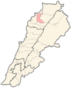 Location in Lebanon | |
| Country |
|
| Governorate | North Governorate |
| Capital | Zgharta |
| Area | |
| • Total | 70 sq mi (182 km2) |
| Time zone | EET (UTC+2) |
| • Summer (DST) | EEST (UTC+3) |
Zgharta District (Arabic: زغرتا) is a district (qadaa) of the North Governorate, northern Lebanon. It's capital is the city of Zgharta.
Geography
The administrative center is the city of Zgharta. The district has 101 populated areas with 30 municipalities covering 37 villages. Some areas share the same municipality such as Ehden/Zgharta, Kfarsghab/Morh Kfarsghab, and Miziara/Harf Miziara. And there is one Municipalities Union.
The district at elevations from 40–2,550 metres (130–8,370 ft), from near the coast to its highest point in the Mount Lebanon mountain range.
The highest populated part of the district overlooks the Qozhaya Valley, which is the northern branch of the Holy Valley of Qadisha, a UNESCO World Heritage Site. The Horsh Ehden Nature Reserve is in the mountains within the district. This higher part of the district is a visitor destination, including the Monastery of Mar Sarkis and the Monastery of Qozhaya areas.
Economy
Agriculture stays the main activity of the district with an important olive oil production in the coastal area and fruits (apple and pears) in the mountain area. The recent years saw the development of a modest service sector around the economic pole of Zgharta.
Population
The officially registered persons in the district are estimated to 90,000 (est. 1998). Around 50% of the district population lives in the economic pole of Zgharta: Zgharta, Rachiine, Kfardlakos, Kfarhata, Mijdlayiah, Ardeh, Harf Ardeh. The majority of the population is Maronite Catholics, with a minority of Greek Orthodox, Armenians, Sunnite Muslims and others.
Towns and villages
References
Capital: Zgharta | ||
| Towns and villages |
| |
| Notable landmarks | ||
| History | ||
| Notable people |
| |
| Society |
| |
| Beirut Governorate | ||
|---|---|---|
| Mount Lebanon Governorate | ||
| North Governorate | ||
| Beqaa Governorate | ||
| South Governorate | ||
| Nabatieh Governorate | ||