Ænon
 Part of the Madaba Map showing Ænon |
Ænon, more commonly written Aenon, is the site mentioned by the Gospel of John as the place where John was baptising after his encounter with Jesus.[1][2]
"Ænon" is the Greek rendition of the Semitic term for "spring" or "natural fountain", like the Hebrew and Arabic 'ayn. In the water-poor Middle East, places owning a spring tend to be named after that water source, so that toponyms consisting of or containing the Construct state word "ein-" are common. The particular site mentioned in the Gospel of John is therefore closer identified as "Aenon near Salim". John 3:23 is the only place in the Bible where the name Aenon is found.
The name Aenon is commonly used amongst Baptist organizations and churches.
Identification attempts
Based on the Gospel text
Both names, "Aenon" and "Salim", are not unique, and the Gospel text offers only two additional hints about where Aenon might be located: the most direct information is that "there was plenty of water there" (John 3:22), and the second is that it was west of the River Jordan because at Aenon John's disciples talk of the site where John first encountered Jesus as being "on the other side of the Jordan" (John 3:26), which is taken to mean east of the river. We also know from John 1:28 that that first encounter happened at "Bethany on the other side of the Jordan".[3]
One possible location is near the upper source of the Wadi Fa'rah, an open valley extending from Mount Ebal to the Jordan River which is full of springs. There is a place called 'Ainun four miles north of the springs (see Easton's Bible Dictionary).[3]
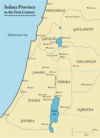
Another possible location, which is supported by Eusebius' description in his Onomasticon, is at "a village in the (Jordan) valley, at the eighth milestone from Scythopolis (Beit She'an), ... called Salumias."[4] This view was already supported by the 19th-century Smith's Bible Dictionary and the 1915 International Standard Bible Encyclopedia[3] and is still favoured by some.[5][6]
Based on the Madaba Map
The 6th-century Madaba Map shows the location of Ænon right across the Jordan from Bethabara, near Jericho. Bethabara is in some, but not all, versions of the Gospel of John the place where John was baptising during his encounter with Jesus (John 1:28). The map and archaeological findings at the site indicate that at least during part of the Byzantine Period, this was the site venerated as Aenon. The two relevant map inscriptions read
- Αίνών ένθα νύν ό Σαπσαφάς: "Ænon, where now is Sapsaphas"
- Βέθαβαρά το τού άγίου Ιωάννου τού βαπτίσματος: "Bethabara, the place of baptism of St. John"
Interestingly, with the Dead Sea shown on the right side of the map giving context, Bethabara is on the west of the Jordan, while Ænon is on the east.
See also
- Al Maghtas, the traditional site of Jesus' baptism
- Baptism of Jesus
- Bethabara, a name used by some versions of the New Testament for the site of Jesus' baptism
- Chronology of Jesus
- Ministry of Jesus
- New Testament places associated with Jesus
- Qasr el Yahud, the West Bank side of Al Maghtas
References
- ↑ Nichols, Lorna Daniels (2009). Big Picture of the Bible: New Testament. ISBN 1-57921-928-4. page 12.
- ↑ Sloyan, Gerard Stephen (1987). John. ISBN 0-8042-3125-7. page 11.
- 1 2 3 "Aenon". BibleHub.com. Retrieved 20 March 2015.
- ↑ Michele Piccirillo; Eugenio Alliata; Stefano de Luca (2000). "Aenon near Salem which is also Saloumias - (Kh. Khisas al-Dayr)". The Madaba Map: a virtual travel through the Holy Places. Studium Biblicum Franciscanum - Jerusalem. Retrieved 25 January 2016.
- ↑ Shimon Gibson (2004). The Cave of John the Baptist: The Stunning Archaeological Discovery that has Redefined Christian History. New York: Doubleday. ISBN 9780385503471. Retrieved 25 January 2016.
About twelve kilometres (or eight miles according to Eusebius) to the south of Beth Shean (Scythopolis), there is a region which would fit Aenon perfectly. This location has numerous springs: I have counted thirteen of them in a small area four by four kilometres and, interestingly, Ambrose in his writings (II, 1432) claimed that there were twelve springs at 'Ennon'. On the north side of this area is Tell Shalem, which undoubtedly must be Salim/Salumnias (map ref. 2098-1998), and so the place where John baptised at Aenon may have been at any of the springs in the vicinity of Tell Shalem.
- ↑ John Henry Bernard (2000). A Critical and Exegetical Commentary on the Gospel According to St. John. International Critical Commentary Series. Bloomsbury T&T Clark. p. 128. ISBN 9780567050243. Retrieved 25 January 2016.
-
 This article incorporates text from a publication now in the public domain: Easton, Matthew George (1897). "Ænon". Easton's Bible Dictionary (New and revised ed.). T. Nelson and Sons.
External links
Coordinates: 31°50′15″N 35°32′58″E / 31.83750°N 35.54944°E