Łęczna County
| Łęczna County Powiat łęczyński | |||
|---|---|---|---|
| County | |||
| |||
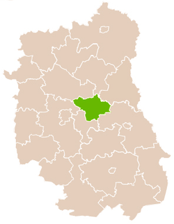 Location within the voivodeship | |||
| Coordinates (Łęczna): 51°18′N 22°53′E / 51.300°N 22.883°ECoordinates: 51°18′N 22°53′E / 51.300°N 22.883°E | |||
| Country |
| ||
| Voivodeship | Lublin | ||
| Seat | Łęczna | ||
| Gminas | |||
| Area | |||
| • Total | 633.75 km2 (244.69 sq mi) | ||
| Population (2006) | |||
| • Total | 57,314 | ||
| • Density | 90/km2 (230/sq mi) | ||
| • Urban | 21,689 | ||
| • Rural | 35,625 | ||
| Car plates | LLE | ||
| Website | http://www.leczna.pl/ | ||

Łęczna County (Polish: powiat łęczyński) is a unit of territorial administration and local government (powiat) in Lublin Voivodeship, eastern Poland. It was established on January 1, 1999, as a result of the Polish local government reforms passed in 1998. Its administrative seat and only town is Łęczna, which lies 23 kilometres (14 mi) east of the regional capital Lublin.
The county covers an area of 633.75 square kilometres (244.7 sq mi). As of 2006, its total population is 57,314, out of which the population of Łęczna is 21,689 and the rural population is 35,625.
Neighbouring counties
Łęczna County is bordered by Parczew County to the north, Włodawa County and Chełm County to the east, Świdnik County to the south-west, Lublin County to the west, and Lubartów County to the north-west.
Administrative division
The county is subdivided into six gminas (one urban-rural and five rural). These are listed in the following table, in descending order of population.
| Gmina | Type | Area (km²) |
Population (2006) |
Seat |
| Gmina Łęczna | urban-rural | 74.9 | 25,178 | Łęczna |
| Gmina Milejów | rural | 115.7 | 9,256 | Milejów-Osada |
| Gmina Cyców | rural | 147.9 | 7,516 | Cyców |
| Gmina Spiczyn | rural | 83.1 | 5,492 | Spiczyn |
| Gmina Ludwin | rural | 120.5 | 4,985 | Ludwin |
| Gmina Puchaczów | rural | 91.7 | 4,887 | Puchaczów |
References
| Seat |  | |
|---|---|---|
| Urban-rural gmina | ||
| Rural gminas | ||
| City counties |
|  |
|---|---|---|
| Land counties | ||