1771 Great Yaeyama Tsunami
  | |
| Date | April 24, 1771 |
|---|---|
| Magnitude | 7.2 Ms[1] |
| Epicenter | 24°00′N 124°18′E / 24.0°N 124.3°ECoordinates: 24°00′N 124°18′E / 24.0°N 124.3°E |
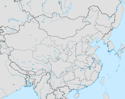
| Areas affected | Ryūkyū Kingdom: Ryukyu Islands |
| Tsunami | Yes |
| Casualties | 13,486 deaths |
The 1771 Great Yaeyama Tsunami (also called 明和の大津波, the Great Tsunami of Meiwa) was caused by the Yaeyama Great Earthquake at about 8 A.M. on April 24, 1771, south-southeast of Ishigaki Island, part of the former Ryūkyū Kingdom and now forming part of present-day Okinawa, Japan. According to records, 8,439 persons were killed on Ishigaki Island and 2,548 on Miyako Island.

Earthquake analysis
According to the Japanese government publication Rika-Nenpyō (理科年表) or Chronological Scientific Tables,[2] the epicenter was 40 km south-southeast of Ishigaki Island with a magnitude of 7.4. According to the Mamoru Nakamura Laboratory, University of the Ryukyus, the earthquake was due to the activity of the fault east of Ishigaki and it is estimated that the magnitude was 7.5.[3] Further simulation led to the activity of faults in the Ryukyu oceanic trench and the magnitude was 8.0. Also, there is a hypothesis that claims the magnitude was 8.5.[4][5] The depth was 6 kilometres (3.7 mi).[6] This trench lies between the Philippine Sea Plate and the Eurasian Plate.
Damage
Earthquake
It is considered that the earthquake registered an intensity of 4(on the Japanese scale) in Yaeyama, and the damage by the earthquake was not as serious as the tsunami.
Tsunami
The dead and missing amounted to 12,000 people, and more than 2,000 houses were destroyed on Ishigaki and Miyakojima. Agriculture was severely damaged because of sea water invasion and the population decreased to about one third of what it was before the earthquake. On Ishigaki island, the wave was 40 to 80 meters high. There are many huge rocks believed to have been left by the earthquake. There was a legend that an islet disappeared, but this has never been verified.
See also
Footnotes
- ↑ National Geophysical Data Center. "Comments for the Significant Earthquake". Retrieved 22 July 2011.
- ↑ "理科年表-オフィシャルサイト".
- ↑
- ↑ 阿部勝征(1999) 阿部勝征(1999): 遡上高を用いた津波マグニチュードMtの決定 -歴史津波への応用-, 地震, 第2輯, 第52巻, 369-377.
- ↑ 阿部勝征 「津波地震とは何か」『月刊地球』Vol.25, No.5, p340
- ↑ http://seis.sci.u-ryukyu.ac.jp/hazard/EQ/1771yaeyama2/1771tsunami_2.html Meiwa earthquake was magnitude 8