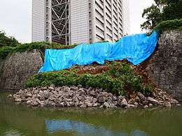
2009 Shizuoka earthquake
 | |
 | |
| Date | 10 August 2009 UTC |
|---|---|
| Magnitude | 6.4 Mw |
| Depth | 26 km |
| Epicenter | 34°46′41″N 138°16′34″E / 34.778°N 138.276°ECoordinates: 34°46′41″N 138°16′34″E / 34.778°N 138.276°E |
| Areas affected | Japan |
| Casualties |
1 fatality 134 injuries |
| Wikimedia Commons has media related to 2009 Shizuoka earthquake. |
The 2009 Shizuoka earthquake occurred with a magnitude of 6.4 [1][2] that hit Shizuoka Prefecture in the south of Honshū, Japan, on August 11 at 05:07 local time (August 10, 20:07 UTC).
Overview
The seismic intensity was observed as shindo 6- in Izu, Yaizu, Makinohara, Omaezaki, Shizuoka.[3]
One woman was killed in Shizuoka, 134 people were injured, and 6,000 buildings received at least minor damage. In addition, the shoulder of Tōmei Expressway was damaged.[4][5][6]
In this area, it is presumed that an M8 class Tokai earthquake will occur in the near future.[7]
See also
- Earthquake Early Warning (Japan)
- Fault (geology)
- List of earthquakes in 2009
- List of earthquakes in Japan
- Yoshinobu Ishikawa
References
- ↑ Magnitude 6.4 - NEAR THE SOUTH COAST OF HONSHU, JAPAN
- ↑ Magnitude 6.5 by Japan Meteorological Agency (JMA) 平成21年8月11日の駿河湾の地震(Japanese) - JMA. Accessed 2009-08-16. Archived 2009-08-22.
- ↑ 2009年8月11日05時07分ころの駿河湾の地震について(Japanese) - JMA. Accessed 2009-08-16. Archived 2009-08-22.
- ↑ Strong quakes hit Japan and India
- ↑ Quake-prone Japan still waiting for 'the big one'
- ↑ 駿河湾を震源とする地震(第15報):訂正(Japanese) - Fire and Disaster Management Agency (FDMA). Accessed 2009-08-16. Archived 2009-08-22.
- ↑ 相模トラフ沿いの地震活動の長期評価について(Japanese) - The Headquarters for Earthquake Research Promotion. Accessed 2009-08-16. Archived 2009-08-22.
External links
- M6.2 - near the south coast of Honshu, Japan - United States Geological Survey
- 気象庁 | 平成21年(2009年)8月11日の駿河湾の地震 - Japan Meteorological Agency
This article is issued from Wikipedia - version of the 11/25/2016. The text is available under the Creative Commons Attribution/Share Alike but additional terms may apply for the media files.