2009 Karonga earthquakes
 | |
| Date | December 6–19, 2009 |
|---|---|
| Magnitude | Mw ~6.0 |
| Casualties | 4 deaths |
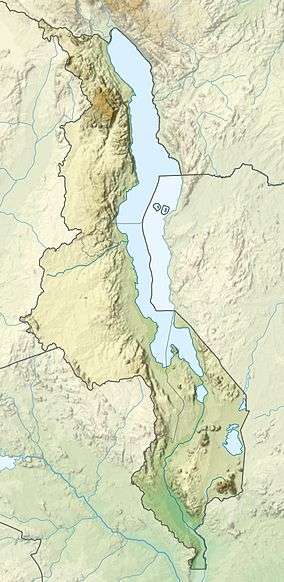
The 2009 Karonga earthquakes occurred near Karonga, Malawi in December 2009 near the northern tip of Lake Malawi in southeast Africa.
List of shocks
| Date | Local Time (UTC +2) |
Magnitude (Mw) |
Latitude | Longitude | Depth | Casualties |
|---|---|---|---|---|---|---|
| December 6, 2009 | 19:36 | 5.8 | 10.16°S | 33.82°E | 10 km[1] | |
| December 8, 2009 | 05:08 | 5.9 | 9.948°S | 33.878°E | 8 km[2] | 1[3] |
| December 12, 2009 | 04:27 | 5.4 | 9.96°S | 33.88°E | 10 km[4] | |
| December 19, 2009 | 15:02 | 6.0 | 10.108°S | 33.818°E | 6 km | 3[3] |
Damage
Over 1000 houses collapsed, 4 people were killed and 300 people were wounded in this earthquake sequence.[5]
Extent
The 6.0 earthquake could also be felt in Tanzania and Zambia.[6]
Geology
Being in the southern East African Rift, the 100 km-long Livingstone Fault marks the limit of the Karonga Basin. The earthquakes were about 50 km west of the Livingstone Fault. A research of J. Biggs et al. shows that one of the west dipping faults which cut the Karonga Basin might rupture in the earthquakes.[7]
References
- ↑ "M5.8 – Malawi". Earthquake.usgs.gov. Retrieved 2010-08-01.
- ↑ "M5.9 – Malawi". Earthquake.usgs.gov. Retrieved 2010-08-01.
- 1 2 "Significant Earthquakes of the World". Earthquake.usgs.gov. Retrieved 2010-08-01.
- ↑ "M5.4 – Malawi". Earthquake.usgs.gov. Retrieved 2010-08-01.
- ↑ "COMET - Centre for the Observation and Modelling of Earthquakes and Tectonics | Homepage". Comet.nerc.ac.uk. Archived from the original on 13 August 2010. Retrieved 2010-08-01.
- ↑ "PAGER - M 6.0 - MALAWI". Earthquake.usgs.gov. Retrieved 2010-08-01.
- ↑ http://www.knmi.nl/~graafdem/publications/2010_ESA_LP_Dransfeld_etal.pdf
This article is issued from Wikipedia - version of the 9/13/2016. The text is available under the Creative Commons Attribution/Share Alike but additional terms may apply for the media files.