A15 road (England)
| |
|---|---|
 | |
| Route information | |
| Length: | 96.00 mi (154.50 km) |
| Major junctions | |
| North end: | Hessle |
|
[[Image:Motorway Left.svg|[ |x30px|link=]] [[Image:Motorway Left.svg|[ |x22px|link=]] | |
| South end: | Norman Cross |
| Location | |
| Primary destinations: | Lincoln, Sleaford, Peterborough |
| Road network | |
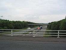
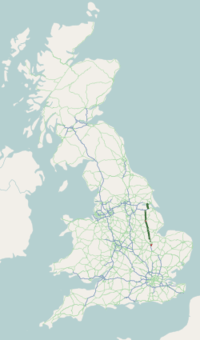
The A15 is a major road in England. It runs north from Peterborough via Market Deeping, Bourne, Sleaford and Lincoln along a variety of ancient, Roman, and Turnpike alignments before it is interrupted at its junction with the M180 near Scawby. The road restarts 10 miles (16 km) east, and then continues north past Barton-upon-Humber, crossing the Humber on the Humber Bridge before terminating at Hessle near Kingston upon Hull.
Driving conditions
According to the AA, the route is 95 miles (153 km) long, and should take 2 1⁄4 hours. Norman Cross – Bourne takes 33 minutes, Bourne to Lincoln takes 46 minutes and Lincoln to the Humber Bridge takes 54 minutes.
A section of the A15 (between Scampton and the M180) provides the longest stretch of straight road in the UK.[1][2]
Route
Peterborough
.jpg)
_Dec_2012.jpg)
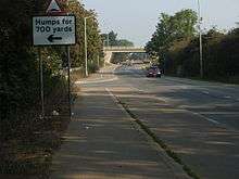
The A15 is Peterborough's main connecting road from the south to the A1(M), joining[3] near Stilton, at Norman Cross. It begins as London Road at junction[4] 16 of the A1(M) with the B1043 (former A1) in Cambridgeshire and the district of North West Cambridgeshire. From here to Yaxley it passes the Norman Cross Hotel[5] and follows[6] the City of Peterborough and Cambridgeshire boundary, where there is a junction with the B1091 (for Farcet).
It enters the City of Peterborough near Hampton Vale on the left, and meets the A1260 The Serpentine, which leads to two much faster routes around Peterborough. Next is a roundabout for the Cygnet Park business park on the left, home of the new headquarters of News International. It enters Old Fletton near the headquarters of Hotpoint to the left. There is a staggered junction with the A1129 and it crosses the East Coast Main Line. It passes[7] Peterborough United on the right in New Fletton. It meets the start of the A605 at a roundabout and crosses the River Nene.
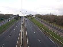
The A15 takes two routes through Peterborough:
- The route on the west side begins as Bourges Boulevard[8] at Peterborough Crown Court, meets the A1179 (former A47), passes the Peterborough railway station and meets three roundabouts near Millfield and New England. It follows the East Coast Main Line and becomes Lincoln Road and Werrington Parkway[9] after the A47 GSJ. It passes four roundabouts, crossing the Peterborough to Lincoln Line.
- The route on the east side starts at the Eye roundabout[10] with the A1139 at Newark, then follows the dual-carriageway Paston Parkway, which meets[11] the A47. It continues as a dual-carriageway (opened in spring 2008) at the next roundabout at Gunthorpe and follows the Car Dyke then meets another roundabout at Werrington before becoming a single carriageway and crosses the Spalding railway between Werrington and Glinton .
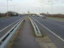
Both routes head through Werrington (passing either side) before joining again at Glinton with the roundabout with the B1443. There is another roundabout.[12] with the B1443 (for Helpston). It passes Etton and meets a roundabout with the B1524[13] (former route through Market Deeping), B1162 (for Northborough to the right) and an exit for Maxey to the right.
Kesteven
Just south of the Welland Gate roundabout on the A1175 and B1166, it crosses the River Welland so entering South Kesteven in Lincolnshire. The roundabout marks the western end of the £7 million 4-mile (6.4 km) Market Deeping bypass, finished in July 1998. The A15 and A1175 roads are now merged in a 1-mile (1.6 km) dual-carriageway stretch. It meets the B1524 (former route) at a roundabout and heads to the left as Peterborough Road[14] Bourne Road and Deeping Road.
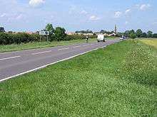
North of Baston is the Waterside Garden Centre[15] close to where it meets the north-south Roman Road King Street, which it follows until just north of Bourne. It goes over the River Glen at the point it is crossed by the Macmillan Way, at Kate's Bridge.
There is a left turn for Obthorpe and it goes through Thurlby, passing the Horseshoe[16] pub, then Northorpe, before coming to the small town of Bourne. It meets the recently diverted A151 at a new roundabout (the A151 leaves to the right 110 yards (100 m) further on), where the road becomes South Road. It passes Bourne Grammar School, then after some treacherous bends near Bourne Abbey becomes South Street, with the town's Heritage centre[17] and war memorial gardens on the left by the Bourne Eau.[18] At the crossroads in the centre of town it crosses the B1193 (original route of the A151) in the historic market place(52°46.0920′N 0°22.6320′W / 52.7682000°N 0.3772000°W), where are located the Nags Head, Angel Hotel, Burghley Arms.[19][20] As North Street, it passes the Burghley Centre[21] (shops), and Bourne Bus Station. At the two miniature roundabouts the name changes to North Road, which name it keeps until it reaches Morton.
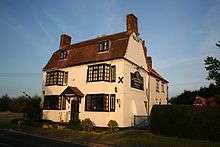
Just outside Bourne, at 52°47′59″N 0°24′55″W / 52.79975°N 0.41525°W, the route of (Roman) King Street heads off across the fields to Stainfield and Ancaster but the A15 continues north along the line of another Roman road, Mareham Lane. It passes close to Dyke, and goes through Morton as Bourne Road, passing the Lord Nelson[22] pub. It becomes Folkingham Road[23] there is a right turn for Haconby and a junction with the B1177 (for Billingborough). Close by are Rippingale and Kirkby Underwood. Between Rippingale and Aslackby a wooded lay-by known locally as 'Turnpike Bar' marks the deviation from the line of the Roman Road Mareham Lane52°50′45″N 0°23′22″W / 52.84591°N 0.3895°W. The A15 passes by Aslackby and the Robin Hood and Little John,[24] and then through the middle of Folkingham.[25]
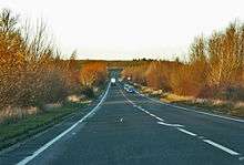
There is the Threekingham Bar roundabout[26] with the east-west A52, and it goes through Osbournby, as London Road the primary school].[27] It passes the Tally Ho Inn][28][29] near Aswarby, then there are left turns for Aunsby and Swarby. Sleaford and Silk Willoughby][30] were on the A15, which slowed traffic down as the traffic went across a level crossing and through Sleaford's shopping area. The £5.7 million bypass opened on 16 September 1993, by Douglas Hogg, where there is a roundabout with the A153 and B1517. The A15 crosses the railway[31] and River Slea, and then leaves the bypass at the Holdingham Roundabout with the A17 and B1518 (former route).
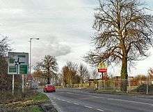
As Lincoln Road, it goes close to Leasingham meeting the B1209. There is a junction[32] Cranwell with the B1429. It meets the B1191 (for Scopwick), B1202 (for Boothby Graffoe to the west and Metheringham to the east) next to the former RAF Coleby Grange, and B1178 (for Harmston), where it passes Dunston Pillar. At Nocton Heath, it passes the Kitchen[33] cafe.[34] On the route to Lincoln, it goes near to two RAF bases – RAF Digby, which is used for communications rather than as a flying station, and across the end[35] of the runway of RAF Waddington, which flies AWACS and Nimrod aircraft. A parking place and cafe are provided for plane spotters on the eastern side of the road.

Next[36] to the runway at Waddington is an old Vulcan, carrying the number of the plane that bombed Port Stanley. The A15 and Ermine Street meet at Bracebridge Heath, about 1,100 yards (1,000 m) north of the traffic lights for Canwick 53°12′07″N 0°32′44″W / 53.20207°N 0.54558°W.
Lincoln
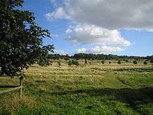
At Bracebridge Heath, it passes the Total Sleaford Road Service Station, just before it passes the Blacksmiths Arms, and meets the end of the A607 at traffic lights at The Bull. Towards Lincoln, it meets the B1131 as London Road, next to The Homestead[37] (former St John's Hospital). It is crossed by the Viking Way at the moment Lincoln Cathedral comes into full view. The road meets the A1434 Newark Road from North Hykeham at traffic lights after passing The Priory Academy LSST and a bridge over the former GNR Grantham-Lincoln railway, where it becomes St Catherine's Road,[38] and passes[39] an Eleanor Cross. At a roundabout at the south end of (what becomes) Lincoln's High Street, it exits to the right along South Park, passing the HQ of Lincolnshire Fire and Rescue Service, and meets the B1188 at traffic lights, where it heads left as Canwick Road.[40]
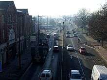
At Pelham Bridge[41] (which was opened by the Queen in 1958), it crosses the railway, with the railway station on the left, the junction with the start of the A57 and Siemens (former Alstom) factory. It crosses the River Witham, before heading up the hill on the north side of the Lincoln Gap, and heading in the direction of the A158 as Lindum Road (for Skegness), where it is crossed by the Viking Way near Lincoln Minster School. As Wragby Road, it passes Lincoln Christ's Hospital School on the left, then meets the B1308[42] near the large Carlton Centre Retail Park. The Lincolnshire Poacher[43] is on the right hand side and there is a right turn for Cherry Willingham and Reepham.
Modern traffic routing has taken the road away from the route of Ermine Street as it passes through Lincoln.
Lindsey
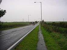
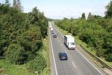
North of Lincoln, the A15 enters West Lindsey, and meets the start of the A158 at a roundabout, then runs concurrently[44] with the A46 to the Riseholme roundabout, where it briefly re-enters the Borough of Lincoln, then follows[45] the Roman road Ermine Street past the Riseholme College of Agriculture on the right, now part of the University of Lincoln, and Lincolnshire Showground[46] to the left.[47] At the end of a 40 miles per hour (64 km/h) section is the Tillbridge Lane roundabout[48] with the A1500, for Gainsborough. From here, it used to be straight, but with RAF Scampton becoming a base for V bombers in the 1950s, the runway had to be extended and the road now has a curved diversion to the east. It passes the Scampton primary school[49] and continues[50] past a right turn to Normanby by Spital, on its most straight section, also the parish boundary of many local villages. At the roundabout with the A631 at Caenby Corner, there is the Total Caenby Corner Garage just south of Spital-in-the-Street. Overtaking is difficult as the road, although straight, is undulating with unmarked dips and slow moving farm traffic. There are two right turns for Bishop Norton and Atterby. There is a right turn for Snitterby and a left turn for Blyborough. At the B1205 staggered crossroads[51] (for Waddingham to the east, and Grayingham to the west), it enters North Lincolnshire.

At the B1206 crossroads, the old route used to go through Hibaldstow and Brigg, with the former road to Redbourne now a cycle route. It passes close to Kirton in Lindsey, home of RAF Kirton in Lindsey much used in the Second World War as a fighter airfield in 12 Group, now home to the Trent Valley Gliding Club. Hibaldstow was a wartime fighter airfield[52] as well, and this is now used as a base for parachuting and parachuting competitions by Target Skysports. The 5-mile (8.0 km) £7 million Brigg and Redbourne bypass[53] was added in December 1989 which follows[54] the old Ermine Street in North Lincolnshire further than previously, with a much flatter, wider and safer road. This section was the upgraded route of an unclassified road. It crosses the Sheffield to Cleethorpes railway line near the deserted village of Gainsthorpe, passes[55] near to Scawby, and joining[56] the M180 at junction 4, near Scunthorpe. It abandons the Roman alignments at a short spur to the A18 at the,Briggate Lodge Roundabout next to the Forest Pines[57] golf club and hotel at Broughton. Ermine Street continues north as the B1207, meeting the Humber near Winteringham.
The route of the A15 now becomes part of the three-laned M180, which was opened on 2 September 1977. The A15 section along Ermine Street was planned to be opened at the same time, but it had to wait twelve years. The buildup of traffic to Grimsby prompted calls for the Brigg bypass for many years, but the Flixborough explosion of 1974 made it more of an emergency. This section goes under the A18, over the River Ancholme, over the old route of the A15 (B1206) and over the South Trans-Pennine railway. At junction 5, the A15 reforms at the dual-grade Barnetby Top Interchange, which is crossed by the Viking Way and has an exit to Elsham. It continues north as a dual carriageway which carries about as little traffic as the M180. The M180 drops to two lanes under this roundabout and continues to Grimsby and Immingham as the A180.
The A15 towards the Humber Bridge, goes directly across the runways of the former RAF Bomber Command airfield at RAF Elsham Wolds (where over 1000 of its aircrew were killed), which is now the Elsham Wolds[58] Industrial Estate. The former route of the A15, pre-1978, is now called B1206,[59] and ends at New Holland, where the A15 formerly connected with the Humber Ferry. The £5.6 million 6-mile (9.7 km) Brigg Bypass to Barton-upon-Humber Bypass (up to where the B1218 crosses)[60] section opened in June 1978.
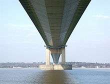
The £2 million 1-mile (1.6 km) Barton-upon-Humber Bypass to Humber Bridge (A1077 interchange)[61] section opened in September 1978, although some maps show this being open before the southern section to the M180. When this whole section[62] opened to the GSJ with the A1077 (for South Ferriby) in 1978, there was no longer any access to the B1218. In the early 1990s, a new interchange[63] was added with the B1206[64] (the former A15), which is crossed[65] by the Viking Way, which follows the road for over a mile. The section[66] across the Humber was opened on 17 July 1981, by the Queen, and was the world's longest single-span bridge until 1997. The tolls[67] are north of the bridge. It crosses[68] the A63 and meets a roundabout with A164 (for Beverley) and A1105, then turns left along a short section[69] of dual-carriageway (former A63) to end at the A63.
See also
References
- ↑ Freestone, Nigel (2013). Ultimate British Roads and Motorways Quiz Book : 200 Questions on Road and Motorway History. Andrews UK. p. 3. ISBN 9781909949805.
- ↑ Hucker, Richard Adrian. "How Did the Romans Achieve Straight Roads?" (PDF). Fig.net. p. 1. Retrieved 14 June 2016.
- ↑ "Cycle Route". OS grid TL1690. Geograph project. Retrieved 11 May 2013.
- ↑ "Brick Patterns, Norman Cross". OS grid TL1590. Geograph project. Retrieved 11 May 2013.
- ↑ "Norman Cross Hotel". OS grid TL1590. Geograph project. Retrieved 11 May 2013.
- ↑ "London Road Yaxley". OS grid TL1792. Geograph project. Retrieved 11 May 2013.
- ↑ "London Road, Peterborough". OS grid TL1997. Geograph project. 23 November 2005. Retrieved 11 May 2013.
- ↑ "Covered footbridge across Bourges Boulevard". OS grid TL1898. Geograph project. Retrieved 11 May 2013.
- ↑ "Pedestrian crossing". OS grid TF1504. Geograph project. Retrieved 11 May 2013.
- ↑ "Eye roundabout, Peterborough". OS grid TF2101. Geograph project. Retrieved 11 May 2013.
- ↑ "15 Meets 47". OS grid TF2002. Geograph project. Retrieved 11 May 2013.
- ↑ "Glinton Bypass". OS grid TF1405. Geograph project. Retrieved 11 May 2013.
- ↑ "The B1524, Lincoln Road". OS grid TF1408. Geograph project. Retrieved 11 May 2013.
- ↑ "becoming". Geograph project. Retrieved 11 May 2013.
- ↑ "Garden Centre Peterborough | Waterside Garden Centre". BeGardenHappy. Retrieved 11 May 2013.
- ↑ "About us". Thehorseshoethurlby.co.uk. Retrieved 11 May 2013.
- ↑ "Baldock's Mill". Geograph project. Retrieved 3 December 2013.
- ↑ "Bourne Eau and memorial gardens". Geograph project. Retrieved 3 December 2013.
- ↑ Archived 11 July 2007 at the Wayback Machine.
- ↑ "Bourne town centre". Geograph Project. Retrieved 3 December 2013.
- ↑ "The Burghley Centre, Bourne". Rex Needle. Retrieved 11 May 2013.
- ↑ "The Lord Nelson, Morton". Pub-explorer.com. 14 April 2003. Retrieved 11 May 2013.
- ↑ "Looking towards Bourne on the A15". OS grid TF0926. Geograph project. Retrieved 1 May 2013.
- ↑ "Robin Hood and Little John". OS grid TF0830. Geograph project. Retrieved 11 May 2013.
- ↑ "A15, Folkingham". Geograph project. Retrieved 3 December 2013.
- ↑ "Osbournby Roundabout". OS grid TF0736. Geograph project. 10 March 2007. Retrieved 11 May 2013.
- ↑ "Osbournby Primary School". Osbournby.lincs.sch.uk. Retrieved 11 May 2013.
- ↑ "Fine Pub Food in Sleaford, Lincolnshire". The Tally Ho Inn. Retrieved 11 May 2013.
- ↑ "The Tally-Ho Inn". Geograph project. Retrieved 3 December 2013.
- ↑ "Silk Willoughby - must be better than this?". OS grid TF0442. Geograph project. 10 March 2013. Retrieved 11 May 2013.
- ↑ "Road Bridge Over Railway". OS grid TF0545. Geograph project. 15 February 2006. Retrieved 11 May 2013.
- ↑ "for". Geograph project. Retrieved 11 May 2013.
- ↑ "The Kitchen". OS grid TF0160. Geograph project. 9 July 2007. Retrieved 11 May 2013.
- ↑ Untitled Document Archived 20 March 2012 at the Wayback Machine.
- ↑ "A15 passes Waddington airfield". OS grid SK9964. Geograph project. 1 May 2007. Retrieved 11 May 2013.
- ↑ "On guard". OS grid SK9965. Geograph project. Retrieved 11 May 2013.
- ↑ "on PubExplorer". Pub-explorer.com. Retrieved 11 May 2013.
- ↑ "St.Catherines". OS grid SK9769. Geograph project. Retrieved 11 May 2013.
- ↑ "Site of the Eleanor Cross". OS grid SK9769. Geograph project. Retrieved 11 May 2013.
- ↑ "Canwick Road approaching Lincoln City Centre from the south". OS grid SK9770. Geograph project. Retrieved 11 May 2013.
- ↑ 50 years of Pelham Bridge (26 June 2008). "Lincolnshire - Places - 50 years of Pelham Bridge". BBC. Retrieved 11 May 2013.
- ↑ "Outer Circle Road, Lincoln". OS grid SK9972. Geograph project. 13 September 2005. Retrieved 11 May 2013.
- ↑ "Lincolnshire Poacher - Lincoln". Lincolnshirepoacherpub.co.uk. 28 April 2013. Retrieved 11 May 2013.
- ↑ "A46 Lincoln Ring Road". OS grid SK9874. Geograph project. 9 November 2006. Retrieved 11 May 2013.
- ↑ "Ermine Street". OS grid SK9776. Geograph project. Retrieved 11 May 2013.
- ↑ "Lincolnshire Events Centre | Lincolnshire Showground | Events Centre". Lincolnshire Showground. 18 January 2013. Retrieved 11 May 2013.
- ↑ "Entrance to Lincolnshire Showground from the A15". OS grid SK9777. Geograph project. 10 December 2005. Retrieved 11 May 2013.
- ↑ "Commercial Buildings at the A1500 A15 junction". OS grid SK9778. Geograph project. 10 December 2005. Retrieved 11 May 2013.
- ↑ "Home". Pollyplatt.lincs.sch.uk. Retrieved 11 May 2013.
- ↑ "Ermine Street". OS grid SK9685. Geograph project. 28 April 2007. Retrieved 11 May 2013.
- ↑ "B1205 junction with the A15". OS grid SK9696. Geograph project. 26 March 2006. Retrieved 11 May 2013.
- ↑ "The Wartime Memories Project - RAF Hibaldstow". Wartimememories.co.uk. Retrieved 11 May 2013.
- ↑ "A15 north towards the M180". OS grid SK9698. Geograph project. Retrieved 11 May 2013.
- ↑ "Lay-by on the A15 west of Hibaldstow". OS grid SE9503. Geograph project. Retrieved 11 May 2013.
- ↑ "A15 near Scawby". OS grid SE9505. Geograph project. 6 September 2006. Retrieved 11 May 2013.
- ↑ "M180 west towards junction 4". OS grid SE9606. Geograph project. Retrieved 11 May 2013.
- ↑ "Hotels in North Lincolnshire - Forest Pines Hotel & Golf Resort". QHotels. Retrieved 11 May 2013.
- ↑ "Elsham Wolds - Old Hangar". OS grid TA0413. Geograph project. 30 July 2006. Retrieved 11 May 2013.
- ↑ "The old Barton to Brigg Turnpike road". OS grid TA0314. Geograph project. 4 October 2005. Retrieved 11 May 2013.
- ↑ "A15". OS grid TA0219. Geograph project. 14 July 2007. Retrieved 11 May 2013.
- ↑ "A15 exit to Barton-Upon-Humber". OS grid TA0220. Geograph project. 19 August 2005. Retrieved 11 May 2013.
- ↑ "A15". OS grid TA0218. Geograph project. Retrieved 11 May 2013.
- ↑ "A15/B1206 turn-off". OS grid TA0316. Geograph project. Retrieved 11 May 2013.
- ↑ "The Road to Barton". OS grid TA0315. Geograph project. 8 April 2007. Retrieved 11 May 2013.
- ↑ "Crossing the A15". OS grid TA0216. Geograph project. Retrieved 11 May 2013.
- ↑ "Humber Bridge from South". OS grid TA0222. Geograph project. Retrieved 11 May 2013.
- ↑ "Humber Bridge toll plaza". OS grid TA0225. Geograph project. Retrieved 11 May 2013.
- ↑ "Rail and road". OS grid TA0225. Geograph project. 16 April 2007. Retrieved 11 May 2013.
- ↑ "East or west?". OS grid TA0126. Geograph project. 1 September 2007. Retrieved 11 May 2013.
External links
-
 Media related to A15 road (England) at Wikimedia Commons
 - The Society for All British Road Enthusiasts' article on A15

