A272 road
| |
|---|---|
|
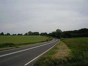
The A272 between Petersfield and Winchester | |
| Route information | |
| Length: | 85 mi (137 km) |
| Major junctions | |
| East end: |
Five Ashes (near Heathfield) 50°59′38″N 0°12′48″E / 50.9939°N 0.2133°E |
|
[[Image:Motorway Left.svg|[ |x30px|link=]] | |
| West end: |
South Wonston (between Winchester and Andover) 51°08′28″N 1°22′58″W / 51.1410°N 1.3828°W |
| Location | |
| Primary destinations: |
Winchester Petersfield Uckfield |
| Road network | |

The A272 is a road in southeast England. It follows an approximate East-West route from near Heathfield, East Sussex to the city of Winchester, Hampshire.
Route
The eastern end of the A272 starts at a junction with the A267, 1.5 miles (2.4 km) north-west of the village of Cross In Hand, East Sussex. It heads west, crossing the A26 and A22 north of Uckfield, and continues through Newick before going over the border into West Sussex at a point east of Scaynes Hill. It then bypasses the town of Haywards Heath and continues west, crossing the main London-Brighton A23 road at Bolney.
The route continues, crossing the A24 and passing through a number of villages and small towns in West Sussex, such as Billingshurst, Petworth and Midhurst. It then crosses the county boundary into Hampshire and reaches Petersfield. The final section passes the National Trust property of Hinton Ampner and rises high on to the Hampshire downs, passing Cheesefoot Head, before descending to merge with the A31 at Chilcomb to the east of Winchester.
In former years, the A272 continued north-west from Winchester to Stockbridge, but this section has now been redesignated as the B3049. Today, after 1.3 miles (2.1 km) it re-emerges from the A31 to run north to the Winnall Roundabout, Junction 9 of the M3. Here it merges with the A34, passing east and north of Winchester (with limited access to the A33 northbound), before re-emerging near Littleton. It then runs NW along the Andover Road (formerly B3420), terminating at the A30, an overall length of 85 miles (137 km).[1] To the north the B3420 continues across the River Test to Wherwell and Andover.
Features
The A272's route is predominantly rural, despite being only 40 miles (64 km) from the centre of London at its nearest point. Most of the time it passes through countryside, villages and small towns, and the only built-up area of any size that it traverses is Haywards Heath and its surrounding villages. Also, it has virtually no dual carriageway sections (just three very short sections between Petworth and Midhurst), and therefore gives the driver an experience which is reminiscent of English country roads as they were 50 or more years ago.
While it has been said that the A272 follows part of the route that was taken by pilgrims travelling between the cathedral cities of Winchester and Canterbury it is unlikely because, for most of its length, it passes through the low weald of Sussex. Prior to the development of modern roads, this was difficult for travellers, because of the extensive forest and tracts of low-lying marshy ground. The more likely route was the Pilgrims' Way, which followed the chalk escarpment of the North Downs.
In popular culture
The road is the subject of a book by the Dutch author, Pieter Boogaart, A272 - An Ode to a Road (Pallas Athene, 2000).[2] It was also mentioned by Michael Palin in an early Monty Python's Flying Circus sketch about Pablo Picasso painting whilst riding a bicycle: "Well this is a truly remarkable occasion as it's the first time that a modern artist of such stature... has taken the A272."
See also
References
- ↑ "Directions to A272". Google. Retrieved 29 March 2013.
- ↑ Boogaart, P (2000). A272: An Ode to a Road. Pallas Athene. ISBN 1-873429-29-0.
External links
| Wikimedia Commons has media related to A272 road (England). |
A roads in Zone 2 of the Great Britain road numbering scheme | ||
|---|---|---|
Coordinates: 50°59′17″N 0°37′56″W / 50.9881°N 0.6321°W