A92 road
| |
|---|---|
 | |
| Route information | |
| Length: | 89.1 mi[1] (143.4 km) |
| Major junctions | |
| South end: |
[[Image:Motorway Left.svg|[ |x30px|link=]] |
|
| |
| Northeast end: |
|
| Location | |
| Primary destinations: | Edinburgh, Dunfermline, Kirkcaldy, Tay Bridge, Dundee, Arbroath, Montrose, Stonehaven |
| Road network | |

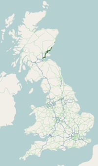
The A92 is a major road in Fife and Angus, Scotland. It runs from Dunfermline to Stonehaven.
History
The A92's original route in southern Fife is now classed as the A921, which connected with the M90 junction 1 via Burnistland, Kirkcaldy and linked into the Thornton bypass.
Plans were drawn up during the 1960s for the new East Fife regional road which would have entailed a new dual carriageway road starting at the M90 Masterton (Junction 2), which would have mirrored what is now the A921 and B9157 to Mossgreen area, before heading North eastward to Chapel Level connecting up with the Thornton By pass. The plans were held back until the early 1970s, but were held back further due to the Oil crisis. During the 1970s the Scottish Development Department commissioned a new traffic study which concluded that the A92 should follow the more northern route to provide a better link for Cowdenbeath and Lochgelly[2] before connecting directly onto the Thornton Bypass,[3] which was completed by early 1983.
The new section between Crossgates and Glenrothes began construction in 1980, being built in four phrase:
- Thonrton By pass: Opened on 16 August 1983[4]
- Halbeath - Cowdenbeath: Opened in September 1985
- Cowdenbeath - Lochgelly: Opened on 13 August 1987
- Lochgelly - Thornton: the final phrase which opened on 16 July 1990[5]
In early April 1998 the A92 was extended beyond the Crossgates junction to provide direct access with the M90 southbound, due to congestion around the Halbeath interchange. The new section was built three months ahead of schedule costing £8.4m.[6]
Up until the late 1990s, the A92 continued north from Stonehaven, through Aberdeen and terminated at Fraserburgh. This section has now been renumbered A90 and A952.
The section of the A92 between Dundee and Aberdeen was formerly part of the Euroroute system, of route E120 which ran in a circular route between Inverness, Aberdeen, Dundee and Perth.
Route
Starting at its junction with the M90 motorway near Dunfermline, it runs north east past Cowdenbeath, Lochgelly, Kirkcaldy, Glenrothes, Ladybank and Newport-on-Tay. The road is a dual carriageway from the M90 to Glenrothes town centre, changing to a single carriageway as it passes through the northern side of the town, before switching back to dual carriageway north of Glenrothes (until it meets the A912 towards Perth and the A914 towards St Andrews), it reverts to a single carriageway until a few miles short of the Tay Road Bridge at Dundee. The section through Fife is often described as the East Fife Regional Road.
Across the Tay Road Bridge, the A92 continues along the east coast past Monifieth, Carnoustie, Muirdrum, Arbroath, Montrose, Inverbervie and the Fowlsheugh Nature Reserve before terminating at Stonehaven where it merges with the A90 15 miles south of Aberdeen, this section acting mainly as a coastal tourist route for traffic bound for the Granite City. The 16-mile section of the road from Dundee to Arbroath was upgraded to dual carriageway standard in 2005 and significantly reduced the journey time between the two towns. There was a lot of criticism locally of the 40 mph speed limit on the dual carriageway stretch within the Dundee City boundary. Between Arbroath and Stonehaven the road is a single carriaegway apart from two very short sections of dual carriageway (near Gourdon and at the terminal junction with the A90).
Archaeological
The A92 road traverses lands on which prehistorical archaeological sites are present. Examples of these features include Gourdon Hill[7] and the Stone of Morphie,[8] both situated slightly to the west of the A92 alignment.
References
- ↑ "Driving directions to A92". Google Maps. Google. Retrieved 21 September 2013.
- ↑ http://www.ciht.org.uk/motorway/m90inveperth.htm
- ↑ http://hansard.millbanksystems.com/written_answers/1974/jun/19/thornton-bypass-fife
- ↑ "The Big Link up, P1. Glenrothes Gazette. 18 August 1983
- ↑ "Archived copy". Archived from the original on 23 September 2013. Retrieved 2013-05-28.
- ↑ Dunfermline press, 3 April 1998, " New interchange will ease commuters chase" by Kevin McRobbert
- ↑ RCAHMS archaeological database: Gourdon
- ↑ C.Michael Hogan, Stone of Morphie, 2007, The Megalithic Portal, ed. A. Burnham, (site originally nominated by contributor cosmic)
Links
- http://www.ciht.org.uk/motorway/m90inveperth.htm
- http://www.sabre-roads.org.uk/wiki/index.php?title=A92
- http://www.sabre-roads.org.uk/wiki/index.php?title=East_Fife_Regional_Road
A roads in Zone 9 of the Great Britain road numbering scheme | ||
|---|---|---|
Coordinates: 56°15′43″N 3°08′35″W / 56.26194°N 3.14306°W