Aghavoher
| Aghavoher | |
|---|---|
| Irish transcription(s) | |
| • Derivation: | Achadh an Mhothair |
| • Meaning: | "field of the trees or mound" |
| Country | Ireland |
| County | County Cavan |
| Barony | Loughtee Lower |
| Civil parish | Tomregan |
| Area | |
| • Total | 92 ha (228 acres) |
Aghavoher (from Irish: Achadh an Mhothair, meaning "field of the trees or mound") is a townland in the civil parish of Tomregan, County Cavan, Ireland. It lies in the former barony of Loughtee Lower.[1]
Geography
Aghavoher is bounded on the north by Cranaghan townland, on the west by Clifton, Mullynagolman and Carrigan townlands, on the south by Breandrum townland and on the east by Greaghrahan and Carn townlands. Its chief geographical features are Aghavoher Lough and the Rag River on its northern boundary and a small hill which rises to 306 feet above sea level. Aghavoher is traversed by the Kildallan road and Carrigan lane.
The townland covers 228 statute acres,[2] including eleven acres of water.
History
The earliest surviving spelling of the townland name is in a printed list of Cavan townlands dated 1790 where it is spelled "Aughiogher". Centuries before that the townland formed part of the Black Pig's Dyke in pre-Christian times.
Aghavoher formed part of the termon lands belonging to Tomregan Roman Catholic Church which were granted to the Church of Ireland Bishop of Kilmore in 1610 as part of the Plantation of Ulster. By a lease dated 6 April 1612 the said bishop granted the lands to Sir Oliver Lambart of Kilbeggan, County Westmeath and Sir Garret Moore, 1st Viscount Moore of Mellifont, County Louth. On 17 July 1639 the bishop re-granted the lands to Charles Lambart, 1st Earl of Cavan.
The Tithe Applotment Books for 1827 list the following tithepayers in the townland- Profet, McKiernan, Stevens, Lee, Murrey, Berry, Patterson.[3]
A deed dated 23 February 1835 now in the Cavan Archives Service (ref P017/0043) is described as-
Deed of indemnity made between Mary Anne Patterson, Sandybrook, County Cavan, widow, devisee and an executor named in will of Alexander Patterson, late of Sandybrook, esquire, of the first part, William Rogers, junior, Cornacrum, County Cavan, gentleman, of the second part, and Joseph Denham, Killeshandra, County Cavan, gentleman, trustee, of the third part. Patterson grants to Denham the lands of Aghavoher (Aughavoher) known by the name Sandybrook, barony of Lower Loughtee, County Cavan, by virtue of lease now held by. Lands granted in order to indemnify Rogers against the payment of several legacies and annuities outlined in the will of Alexander Patterson, dated 28 February 1832.
The Ordnance Survey Name Books for 1836 give the following description of the townland- "Achadh a mothar, 'field of the cluster'. It lies in the South-East extremity of the parish. It is bounded on the North-West by Carigan and Mullynagolman. On the West by Clifden. On the North by Cranaghan. On the East by Drumlane and on the South by Kildallan. The proprietor J.C. Jones Esq and the Protestant Bishop of Kilmore. The land agent is Mr. Knipe of Belturbet. The soil is of good quality and produces wheat, oats, flax and potatoes. The houses are built of stone. Tenants have it in lots which are held by leases of years. Inhabitants in good circumstances. Held in freehold. Rent per acre is 5s/6d to the bishop and 5s to Mr. Jones. Contains Sandybrook House which is the residence of Mrs Paterson. A neat house."
Griffith's Valuation of 1857 lists the landlords of the townland as Jones and Moore and the tenants as Berry, Winslow and Kellett.[4]
In the 1901 census of Ireland, there are six families listed in the townland.[5]
In the 1911 census of Ireland, there are five families listed in the townland.[6]
Antiquities
The chief structures of historical interest in the townland are a Bronze-Age ring-barrow on the border with Clifton;[7] a medieval crannóg in Aghavoher Lough;[8]Sandville House.[9] and Sandybrook House.
References
- ↑ "Placenames Database of Ireland". Retrieved 29 February 2012.
- ↑ "IreAtlas". Retrieved 29 February 2012.
- ↑ Tithe Applotment Books 1827
- ↑ Griffith’s Valuation 1857 - Aghavoher
- ↑ Census of Ireland 1901
- ↑ Census of Ireland 1911 - Aghavoher
- ↑ Site number 94, page 20, Aghavoher townland, in “Archaeological Inventory of County Cavan”, Patrick O’Donovan, 1995
- ↑ Site number 1467, page 175, Aghavoher townland, in “Archaeological Inventory of County Cavan”, Patrick O’Donovan, 1995
- ↑
External links
Places in County Cavan | ||
|---|---|---|
| Towns | 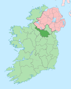 | |
| Villages |
| |
| Townlands | ||
| Landforms | ||
| ||