Ajnoha
| Ajnoha | |
|---|---|
| village | |
 Ajnoha  Ajnoha Location in Punjab, India | |
| Coordinates: 31°19′30″N 75°53′52″E / 31.325046°N 75.8976746°ECoordinates: 31°19′30″N 75°53′52″E / 31.325046°N 75.8976746°E | |
| Country |
|
| State | Punjab |
| District | Hoshiarpur |
| Area | |
| • Total | 3.3 km2 (1.3 sq mi) |
| Elevation | 236 m (774 ft) |
| Population (2001) | |
| • Total | 2,530 |
| • Density | 770/km2 (2,000/sq mi) |
| Languages | |
| • Official | Punjabi |
| Time zone | IST (UTC+5:30) |
| Pin code | 144404 |
| Vehicle registration | PB-07- |
Ajnoha is a village in the Hoshiarpur district of Punjab, India.[1]
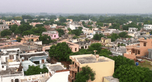
Aerial view of Ajnoha
Geography
Ajnoha is located in the fertile plains of Doaba, Punjab. It is bordered by Bist Doab canal on the East, Nadalon village on the South, and a brook (Choe) on the North.
Demographics
The village of Ajnoha has a population of 2,530 of which 1,287 are males while 1,243 are females as per Population Census 2011.[2]
Literacy rate
The village of Ajnoha has a higher literacy rate compared to Punjab. In 2011, the literacy rate of Ajnoha was 84.49% compared to 75.84% of Punjab. In Ajnoha, the Male literacy rate stands at 89.55% while Female literacy rate is 79.44%.[2]
Main religious places in Ajnoha
- Gurudwara Sahib Akalian
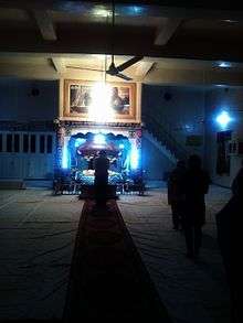
A view of Gurudwara Sahib Akalian, Ajnoha
- Gurudwara Shri Ravidaas ji
- Dargah Peer Baba Dheri Shah ji
- Dhan Dhan Baba Sukhdev ji
- Dhan Dhan Baba Arjan ji
- Gurudwara Akali Baba Phoola Singh ji
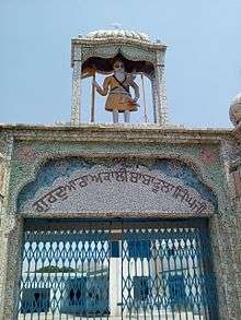
Gurudwara Akali Baba Phoola Singh ji, Ajnoha.
- Shri Ravidaas Gurdwara
- Shiv Mandir
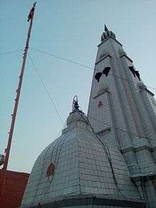
Prachin Shiv Mandir, Ajnoha.
- Dera Shri Shri Natha Gir ji Mahraaj
References
- ↑ "www.ajnoha.info: website of village ajnoha". theajnohatimes.tripod.com. Retrieved 2016-04-18.
- 1 2 "Ajnoha population". Census 2011. Retrieved 29 April 2016.
This article is issued from Wikipedia - version of the 8/25/2016. The text is available under the Creative Commons Attribution/Share Alike but additional terms may apply for the media files.