Alamata
| Alamata (ኣላማጣ) | |
|---|---|
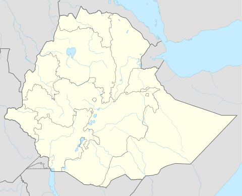 Alamata (ኣላማጣ) Location within Ethiopia | |
| Coordinates: 12°25′N 39°33′E / 12.417°N 39.550°ECoordinates: 12°25′N 39°33′E / 12.417°N 39.550°E | |
| Country | Ethiopia |
| Region | Tigray |
| Zone | Debubawi (Southern) |
| Elevation | 1,520 m (4,990 ft) |
| Population (2007) | |
| • Total | 33,214 |
| Time zone | EAT (UTC+3) |
Alamata (Ge'ez: ኣላማጣ) is a town and separate woreda ('Alamata Town') in northern Ethiopia. Located in the Debubawi (Southern) zone of the Tigray region (or kilil), it has a latitude and longitude of 12°25′N 39°33′E / 12.417°N 39.550°E and an elevation of 1520 meters above sea level and is located along Ethiopian Highway 2. It is surrounded by Alamata woreda.
History
On 14 December 1895, Emperor Menilek's passed through Alamata on their way northwards against the Italians. Arbegnoch under British leadership, liberated the town from Italian control during the Second World War on 5 May 1941; it was at the southern edge of the Woyane rebellion of 1943.[1] On 14 December 1895, Emperor Menilek's passed through Alamata on their way northwards against the Italians. Arbegnoch under British leadership, liberated the town from Italian control during the Second World War on 5 May 1941; it was at the southern edge of the Woyane rebellion of 1943.
The first reports of crop failure in Wollo, were made in October 1971 by the chief municipal officer of Alamata; this report was handled very indifferently by his superiors who did not respond until July 1972, when they asked for a revised report.
Alamata was garrisoned by the Derg during the Ethiopian Civil War. The Tigrayan People's Liberation Front captured the town in 1988.
Demographics
Based on the 2007 national census conducted by the Central Statistical Agency of Ethiopia (CSA), this town has a total population of 33,214, of whom 16,140 are men and 17,074 women. 82.35% of the population said they were Orthodox Christians, and 16.96% were Muslim.[2]
The 1994 census reported this town had a total population of 26,179 of whom 12,094 were males and 14,085 were females.
Location
Alamata wereda is located in the southern zone of Tigray, bordered by Raya Azebo in the North, Ofla in the west, the Amahara National Regional State in the south and the Afar National Regional State in the East at 12°15'N latitude and 39°35'E longitude. It is situated 600km north of Addis AbAba and about 180km south of the Tigray Regional capital city, Mekelle.[3] It has ten tabias, namely: Tumuga, Selen Wuha, Limaat,Selam Bekalsi, Kulu Gize lemlem, Gerjale, Ta`o, La`elay Dayu, Tsetsera and Merewa.
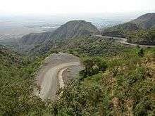
Topography
Topographically, Alamata is divided into western highland and eastern lowland. The western part (Tsetsera and Merewa) is categorized under the northern highlands of Ethiopia, having an altitude range of 2000 to 3000 meters above sea level (m.a.s.l). It is characterized by steep slopes, gorges and undulating terrain having scattered flat lands used for grazing livestock and farming. It covers 25% of the woreda. The topography of the area dominated by steep slopes has induced erosion.The eastern lowland with its eight tabias is generally plain in topography with an altitude ranging from 1450 to 1750 m.a.s.l. The plain landscape of this area makes the area suitable for agriculture and it covers 75% of the woreda.[4]
Land use and farming system
A Mixed farming system with the predominate of crop production is practiced in the district. Cultivable land, pasture and forest occupy about 67.8%, 8.5% and 8.2% of the total land area, respectively. The remaining area (15.5%) is non-usable, water body, settlement and other land use types. Of the total cultivated land (14,535 ha), annual crops occupy 97.9%. Permanent crops, grazing land, wood land, fallow land and other lands occupy 0.08%, 0.03%, 0.54%, 0.30% and 1.1% of the cultivated land, respectively. Permanent crops include fruits and stimulant plants like chat. The average size of land holding for the district is 0.88 hectare. The major food crops grown in the area are cereals, occupying 93.6% of the total cultivated area of temporary crops in the 2001/02 cropping season, followed by pulses covering 5.9%, oilseeds covering 0.22%, vegetables occupying 0.21% and root crops and other stimulants covering only 0.07% of the cultivated area of temporary crops. Sorghum, teff and maize are the major cereal crops 20 grown in the area. Moisture stress, weeds and invasive species (Parthynium, Striga and Prosopis juliflora), unavailability of improved agricultural technologies, crop pests and diseases, post-harvest losses, salinity and water-logging problems, poor water harvesting and irrigation agronomy practices, deforestation and soil erosion in the foot hills are the major production constraints in the area.[5]
Notes
- ↑ "Local History in Ethiopia" (pdf) The Nordic Africa Institute website (accessed 6 September 2007)
- ↑ Census 2007 Tables: Tigray Region, Tables 2.1, 3.1, 3.2, 3.4.
- ↑ Mebrahtu, Tirhas
- ↑ Mebrahtu, Tirhas
- ↑ TARI, 2004
Woredas of the Debubawi Zone | ||
|---|---|---|
 | ||