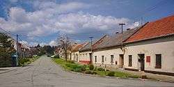
Alojzov
| Alojzov | |||
|---|---|---|---|
| Municipality | |||
 | |||
| |||
 Alojzov | |||
| Coordinates: 49°25′24″N 17°2′29″E / 49.42333°N 17.04139°ECoordinates: 49°25′24″N 17°2′29″E / 49.42333°N 17.04139°E | |||
| Country |
| ||
| Region | Olomouc | ||
| District | Prostějov | ||
| Area | |||
| • Total | 4.64 km2 (1.79 sq mi) | ||
| Elevation | 333 m (1,093 ft) | ||
| Population | |||
| • Total | 232 | ||
| • Density | 50/km2 (130/sq mi) | ||
| Postal code | 798 04 | ||
| Website | http://www.alojzov.cz | ||


Alojzov is a village and municipality (obec) in Prostějov District in the Olomouc Region of the Czech Republic.
The municipality covers an area of 4.64 square kilometres (1.79 sq mi), and has a population of 232.
Alojzov lies approximately 8 kilometres (5 mi) south-west of Prostějov, 25 km (16 mi) south-west of Olomouc, and 203 km (126 mi) east of Prague.
References
Notes
External links
- Village website (Czech)
| Wikimedia Commons has media related to Alojzov. |
This article is issued from Wikipedia - version of the 7/21/2016. The text is available under the Creative Commons Attribution/Share Alike but additional terms may apply for the media files.