Amir Shahwala
| Amir Shahwala | |
|---|---|
| village | |
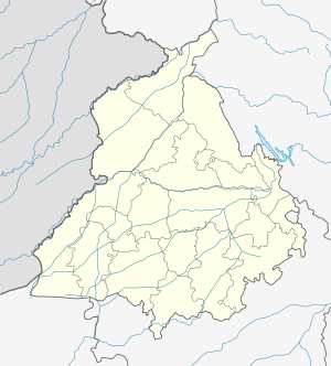 Amir Shahwala  Amir Shahwala Location in Punjab, India | |
| Coordinates: 31°05′07″N 75°04′33″E / 31.0853101°N 75.0757157°ECoordinates: 31°05′07″N 75°04′33″E / 31.0853101°N 75.0757157°E | |
| Country | India |
| State | Punjab |
| District | Firozpur |
| Tehsil | Zira |
| Elevation | 210 m (690 ft) |
| Population (2011) | |
| • Total | 680 |
| Time zone | IST (UTC+5:30) |
| 2011 census code | 34247 |
Amir Shahwala is a village in the Firozpur district of Punjab, India. It is located in the Zira tehsil.[1]
Demographics
According to the 2011 census of India, Amir Shahwala has 110 households. The effective literacy rate (i.e. the literacy rate of population excluding children aged 6 and below) is 59.31%.[2]
| Total | Male | Female | |
|---|---|---|---|
| Population | 680 | 351 | 329 |
| Children aged below 6 years | 100 | 56 | 44 |
| Scheduled caste | 450 | 226 | 224 |
| Scheduled tribe | 0 | 0 | 0 |
| Literates | 344 | 205 | 139 |
| Workers (all) | 222 | 194 | 28 |
| Main workers (total) | 222 | 194 | 28 |
| Main workers: Cultivators | 65 | 64 | 1 |
| Main workers: Agricultural labourers | 94 | 73 | 21 |
| Main workers: Household industry workers | 1 | 1 | 0 |
| Main workers: Other | 62 | 56 | 6 |
| Marginal workers (total) | 0 | 0 | 0 |
| Marginal workers: Cultivators | 0 | 0 | 0 |
| Marginal workers: Agricultural labourers | 0 | 0 | 0 |
| Marginal workers: Household industry workers | 0 | 0 | 0 |
| Marginal workers: Others | 0 | 0 | 0 |
| Non-workers | 458 | 157 | 301 |
References
- ↑ "Punjab village directory" (PDF). Government of India. Retrieved 2015-10-08.
- 1 2 "District Census Handbook – Firozpur (incl. Fazilka)". 2011 Census of India. Directorate of Census Operations, Punjab. Retrieved 2015-10-08.
This article is issued from Wikipedia - version of the 8/25/2016. The text is available under the Creative Commons Attribution/Share Alike but additional terms may apply for the media files.