Zira, Punjab
| Zira ਜ਼ੀਰਾ | |
|---|---|
| Town | |
|
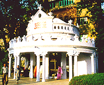
Jain Swetamber Temple, Zira | |
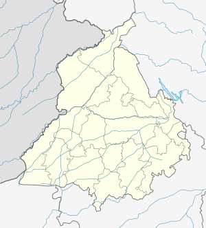 Zira  Zira Location in Punjab, India | |
| Coordinates: 30°58′N 74°59′E / 30.97°N 74.99°ECoordinates: 30°58′N 74°59′E / 30.97°N 74.99°E | |
| Country |
|
| State | Punjab |
| District | Ferozepur |
| Government | |
| • Body | Nagar Palika |
| • Member of the Legislative Assembly | Hari Singh Zira (SAD) |
| Population (2011)[1] | |
| • Total | 36,732 |
| Time zone | IST (UTC+5:30) |
| PIN | 142047 |
| Telephone code | 01682 |
| Vehicle registration | PB-47 |
Zira (Punjabi: ਜ਼ੀਰਾ) is a town and a municipal council in Ferozepur district in the Indian state of Punjab.
History
The neighbourhood of Zira, had been for many years a wasteland, when in 1508 Ahmad Shah came from Gugera and founded Zira Khas. He was driven out by Sher Shah Suri, during whose rule nearly all the villages of this ilaqa were located. Mohar Singh was, in turn driven out by Diwan Mohkam Chand, Ranjit Singh’s General, and the ilaqa was added to the Lahore Demense. It was afterwards divided into two portions, of which the eastern portion, which preserved the name, Zira, was made over to Sarbuland Khan, a servant of the Lahore Government, and the western portion, to which the name, ilaqa Ambarhar, was given was made an appanage of Kanwar Sher Singh, son of the Punjab sovereign. At a later date, Sher Singh obtained the possession of the whole ilaqa and abolished the subdivision of Ambarhar. [2]
It is unclear when, exactly, the municipality was founded – one source indicates The Municipality Committee, Zira, was constituted in 1876[3] while another says 1867.[4]
Zira was one of the two tehsils of Punjab, (the other one being Ferozepur), that was part of a controversy during the partition of India. Sir Cyril Radcliffe created the boundary between India and Pakistan just days before the partition. A draft of the Award was supposedly sent to Evan Jenkins, the provincial governor of Punjab by George Abell, Lord Mountbatten of Burma's private secretary, with a preliminary description of the Punjab boundary. This draft showed the Ferozepur and Zira tehsils being allotted to Pakistan. During partition Zira city had a Muslim majority by 51% Sikhs making up 35% and Hindus 14%. When violence erupted in most Ferozepur Zira area was very quiet because most of the residents treated each other like brothers. Many Sikh residents were really close to there Muslim friends and did not want them to leave, but due to so much problems in the Ferozepur area they had no choice to leave.[5]
The final version of the boundary however awarded the areas to India. This led Mohammed Ali Jinnah, the founder of Pakistan, to proclaim that the Award of the Boundary Commission was unjust, incomprehensible and perverse. He, however, agreed to abide by it.[6] The dispute was settled in 1960 as part of an agreement between the governments of India and Pakistan.[7]
In 1947, at the time of partition, almost all the Muslim community who were living in "Zira" migrated to Pakistan. They settled in "Khanewal" district of Western Punjab. They engaged in farming, business and government services. Most of them named themselves as "Zirvi" (which is a sign of love to their "dharti maa"). These people always praised the good behaviour of Sikhs and Hindus at the time of partition. They remember sweet memories of Zira with tears. It reflects that how a calm and prosperous town was that prior to partition where the people lived with harmony.[8]
Zira Bomb Case, 1930 – The high-handedness of the British invaders in suppressing the rising tide of freedom movement in India with the worst type of governmental barbarity produced its reaction in the growth and spread of revolutionary activity to avenge the wrongs done to the people. One such incident in the Ferozepur District was the Zira Bomb Case of October 1930.[9] The Zira Bar Association was formed in the same year.[10]
Population
As of 2011 India census,[11] Zira had a population of 36,732. Males constitute 52% of the population and females 48%. Zira has an average literacy rate of 63%, higher than the national average of 59.5%: male literacy is 66%, and female literacy is 59%. In Zira, 13% of the population is under 6 years of age. Zira's population was 2,702 in 1853.[12]
Education
Here are some prominent schools and colleges in Zira
- Bhai gurdas mal school for girls
- Jain School
- Ambrosial Public School
- Government College Zira
- DPD College
- Doon Valley Cambridge School
- Paradise Public Senior Secondary School
- Jawahar Navodaya Vidyalaya
- Jiwan Mall Government Senior Secondary School
References
- ↑ "Census of India: Search Details".
- ↑ Arora Digital Studio, Zira Archived 7 July 2011 at the Wayback Machine.
- ↑ "Local Self-Government". Retrieved 24 July 2006.
- ↑ "Imperial Gazetteer2 of India, Volume 24, page 437 – Imperial Gazetteer of India – Digital South Asia Library". Retrieved 24 July 2006.
- ↑ "Prof Datta on Viceroy's role". Retrieved 24 July 2006.
- ↑ "Pakistan government website". Archived from the original on 27 January 2006. Retrieved 24 July 2006.
- ↑ "Ministry of External Affairs, India website". Archived from the original on 7 May 2005. Retrieved 24 July 2006.
- ↑ Muhammad Din Chaudhary, Green Town, Khanewal, Pakistan
- ↑ "Fazilka". Retrieved 19 August 2012.
- ↑ "Education and Recreational and Medical Facilities". Retrieved 19 August 2012.
- ↑ "Census of India 2001: Data from the 2001 Census, including cities, villages and towns (Provisional)". Census Commission of India. Archived from the original on 16 June 2004. Retrieved 1 November 2008.
- ↑ "Women's Organizations". Retrieved 19 August 2012.
ARYA NIWAS ZIRA(PB)