Anahola, Hawaii
| Anahola, Hawaii | |
|---|---|
| Census-designated place | |
 Location in Kauai County and the state of Hawaii | |
| Coordinates: 22°8′42″N 159°18′47″W / 22.14500°N 159.31306°WCoordinates: 22°8′42″N 159°18′47″W / 22.14500°N 159.31306°W | |
| Country | United States |
| State | Hawaii |
| County | Kauai |
| Area | |
| • Total | 3.9 sq mi (10.2 km2) |
| • Land | 3.8 sq mi (9.7 km2) |
| • Water | 0.2 sq mi (0.5 km2) |
| Elevation | 30 ft (9 m) |
| Population (2010) | |
| • Total | 2,223 |
| • Density | 514.8/sq mi (198.8/km2) |
| Time zone | Hawaii-Aleutian (UTC-10) |
| ZIP code | 96703 |
| Area code(s) | 808 |
| FIPS code | 15-02200 |
| GNIS feature ID | 0358587 |
Anahola (literally "deadly winds" in Hawaiian) is a census-designated place (CDP) in Kauaʻi County, Hawaiʻi, United States. The population was 2,223 at the 2010 census.
History
During the reign of King Kamehameha I, the islands of Kauaʻi was one of the last Hawaiian islands to join Kamehameha's Kingdom of Hawaiʻi. The ruler, Kaumualii, resisted Kamehameha for years, surviving two attempts to invade Kaua'i.
Anahola is also the place of an ancient surfing area, Ka-nahā-wale, which literally translates to "easily broken".[1]
Geography
Anahola is located at 22°8′42″N 159°18′47″W / 22.14500°N 159.31306°W (22.145049, -159.312969).[2]
According to the United States Census Bureau, the CDP has a total area of 3.9 square miles (10 km2), of which, 3.8 square miles (9.8 km2) of it is land and 0.2 square miles (0.52 km2) of it (4.57%) is water.
The community is located on Hawaii Route 56 at the northeast coast of the island of Kauai. Anahola is adjacent to Anahola Bay, a bay of the Pacific Ocean.
Demographics
As of the census[3] of 2000, there were 1,932 people, 549 households, and 422 families residing in the CDP. The population density was 514.8 people per square mile (198.9/km²). There were 606 housing units at an average density of 161.5 per square mile (62.4/km²). The racial makeup of the CDP was 13.7% White, 0.4% African American, 0.5% Native American, 7.1% Asian, 47.7% Pacific Islander, 1.4% from other races, and 29.2% from two or more races. Hispanic or Latino of any race were 8.1% of the population.
There were 549 households out of which 36.4% had children under the age of 18 living with them, 53.2% were married couples living together, 17.5% had a female householder with no husband present, and 23.0% were non-families. 14.6% of all households were made up of individuals and 3.5% had someone living alone who was 65 years of age or older. The average household size was 3.52 and the average family size was 3.98.
In the CDP the population was spread out with 31.7% under the age of 18, 9.5% from 18 to 24, 27.8% from 25 to 44, 22.8% from 45 to 64, and 8.2% who were 65 years of age or older. The median age was 32 years. For every 100 females there were 101.0 males. For every 100 females age 18 and over, there were 95.6 males.
The median income for a household in the CDP was $41,771, and the median income for a family was $41,302. Males had a median income of $25,875 versus $27,000 for females. The per capita income for the CDP was $13,829. About 12.4% of families and 14.2% of the population were below the poverty line, including 21.5% of those under age 18 and 4.9% of those age 65 or over.
References
- ↑ Pukui, Mary Kawena. Place Names of Hawaii. University of Hawaii Press. ISBN 0-8248-0524-0.
- ↑ "US Gazetteer files: 2010, 2000, and 1990". United States Census Bureau. 2011-02-12. Retrieved 2011-04-23.
- ↑ "American FactFinder". United States Census Bureau. Archived from the original on 2013-09-11. Retrieved 2008-01-31.
External links
Islands, municipalities, and communities of Kauai County, Hawaii, United States | ||
|---|---|---|
| CDPs | 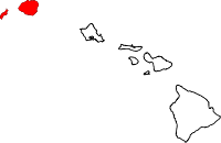 | |
| Unincorporated communities | ||