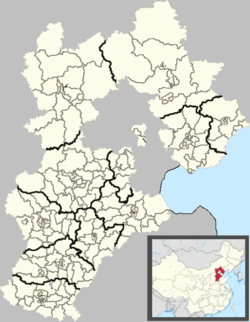
Anci District
| Anci 安次区 | |
|---|---|
| District | |
 Anci Location in Hebei | |
| Coordinates: 39°31′14″N 116°42′11″E / 39.52056°N 116.70306°E | |
| Country | People's Republic of China |
| Province | Hebei |
| Prefecture-level city | Langfang |
| Area | |
| • Total | 595 km2 (230 sq mi) |
| Elevation | 17 m (57 ft) |
| Population | |
| • Total | 350,000 |
| • Density | 590/km2 (1,500/sq mi) |
| Time zone | China Standard (UTC+8) |
| Postal code | 065000 |
| Area code(s) | 0316 |
| Website |
anci |
Anci (Chinese: 安次; pinyin: Āncì) is a district of Langfang, Hebei, People's Republic of China.
Administrative divisions
Subdistricts:[1]
- South Yinhe Road Subdistrict (银河南路街道), West Guangming Street Subdistrict (光明西道街道), Yonghua Street Subdistrict (永华道街道)
Towns:
- Luodai (落垡镇), Matou (码头镇), Geyucheng (葛渔城镇), Donggugang (东沽港镇)
Townships:
- Yangshuiwu Township (杨税务乡), Qiuzhuang Township (仇庄乡), Diaohetou Township (调河头乡), Beishijiawu Township (北史家务乡)
References
External links
This article is issued from Wikipedia - version of the 10/18/2016. The text is available under the Creative Commons Attribution/Share Alike but additional terms may apply for the media files.