Caofeidian District
| Caofeidian 曹妃甸区 | |
|---|---|
| District | |
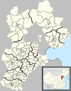 Caofeidian Location in Hebei | |
| Coordinates: 39°16′19″N 118°26′52″E / 39.27194°N 118.44778°ECoordinates: 39°16′19″N 118°26′52″E / 39.27194°N 118.44778°E | |
| Country | People's Republic of China |
| Province | Hebei |
| Prefecture-level city | Tangshan |
| Township-level divisions | 3 towns |
| Seat | Tanghai Town (唐海镇) |
| Area | |
| • Total | 725 km2 (280 sq mi) |
| Elevation | 4 m (13 ft) |
| Population (2003) | |
| • Total | 140,000 |
| • Density | 190/km2 (500/sq mi) |
| Time zone | China Standard (UTC+8) |
| Postal code | 063200 |
| Area code(s) | 0315 |
| Website |
caohuidian |
Caofeidian District[1] (simplified Chinese: 曹妃甸区; traditional Chinese: 曹妃甸區; pinyin: Cáofēidiān Qū), formerly Tanghai County (simplified Chinese: 唐海县; traditional Chinese: 唐海縣; pinyin: Tánghǎi Xiàn), is a district of Tangshan, Hebei, People's Republic of China, along the coast of the Bohai Sea. As of 2003, it had a population of 140,000 residing in an area of 725 km2 (280 sq mi). The district's administration is highly unusual in that apart from its seat, Tanghai (唐海镇) and two other towns Binhai (滨海镇) and Liuzan (柳赞镇) the rest of its administrative units are informal, mostly being farms.[2]
References
- ↑ "撤销唐海县,设立唐山市曹妃甸区". 行政区划网. 2012-07-29. Retrieved 2012-08-02.
- ↑ 2011年统计用区划代码和城乡划分代码:饶阳县 (in Chinese). National Bureau of Statistics of the People's Republic of China. Retrieved 2012-07-21.
This article is issued from Wikipedia - version of the 11/14/2016. The text is available under the Creative Commons Attribution/Share Alike but additional terms may apply for the media files.