Arçais
For the Italian philosopher, see Paolo Flores d'Arcais.
| Arçais | |
|---|---|
|
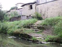
The church in Arçais | |
 Arçais | |
|
Location within Nouvelle-Aquitaine region  Arçais | |
| Coordinates: 46°17′49″N 0°41′23″W / 46.2969°N 0.6897°WCoordinates: 46°17′49″N 0°41′23″W / 46.2969°N 0.6897°W | |
| Country | France |
| Region | Nouvelle-Aquitaine |
| Department | Deux-Sèvres |
| Arrondissement | Niort |
| Canton | Frontenay-Rohan-Rohan |
| Government | |
| • Mayor (2001–2008) | Michel PANIER |
| Area1 | 15.12 km2 (5.84 sq mi) |
| Population (2006)2 | 654 |
| • Density | 43/km2 (110/sq mi) |
| Time zone | CET (UTC+1) |
| • Summer (DST) | CEST (UTC+2) |
| INSEE/Postal code | 79010 / 79210 |
| Elevation |
1–36 m (3.3–118.1 ft) (avg. 13 m or 43 ft) |
|
1 French Land Register data, which excludes lakes, ponds, glaciers > 1 km² (0.386 sq mi or 247 acres) and river estuaries. 2 Population without double counting: residents of multiple communes (e.g., students and military personnel) only counted once. | |

Arçais is a commune in the Deux-Sèvres department in the Nouvelle-Aquitaine region in western France. It is the only village in the centre of the Marais Mouillé, the so-called "wet marsh" which forms the eastern half of the Marais Poitevin (the Poitou Marshes), near the city of Niort. It is a popular centre for tourism, with several embarcadères which hire out punts and other boats for use on the network of canals that surrounds the village. There are also several shops, bars and other facilities, including bike hire.
See also
References
External links
| Wikimedia Commons has media related to Arçais. |
- The interregional park Marais Poitevin
- Poitou-Charentes Vacances: regional tourism website, with links to boat and bike companies in Arcais
This article is issued from Wikipedia - version of the 11/11/2016. The text is available under the Creative Commons Attribution/Share Alike but additional terms may apply for the media files.