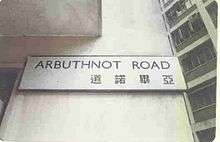
Arbuthnot Road
| Arbuthnot Road | |||||||||||
 | |||||||||||
| Traditional Chinese | 亞畢諾道 | ||||||||||
|---|---|---|---|---|---|---|---|---|---|---|---|
| Simplified Chinese | 亚毕诺道 | ||||||||||
| |||||||||||

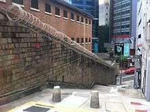
Arbuthnot Road is a road in Central, Hong Kong. The road begins at the Former Central Magistracy, a declared monument of Hong Kong.[1] The road ends at the Hong Kong Zoological and Botanical Gardens.
History
Most of the roads built and declared at the outset in Colonial Hong Kong in 1841 were close to the waterfront. The Magistracy was not established until 1847 and the land on which it was built was previously largely unoccupied. Arbuthnot Road is rather inclined, and runs between Hollywood Road and Caine Road, the latter of which was not named until 1859. It is likely that it was not named or created until the 1850s or later; it was named after George Arbuthnot.[2]
Notable buildings
- No. 1: Hong Kong Police Club, former Central Magistracy
- No. 2: Cafe O, Ovolo Hotels
- No.s 3-5a: Universal Trade Centre including the Orthodox Metropolitanate of Hong Kong and South-East Asia[3] and the St Luke Cathedral of Hong Kong
- No.s 4-8: Philia Lounge
- No.s 4-8: G/F La Kasbah (North African Food), 1/F Wild Grass (Western Restaurant)
- No.s 4-8: SK serviced apartments
- No. 10: Chez Moi (French restaurant)
Transport
- MTR Central Station, Exit "D1"
- Public bus, route no. 12M, 13, 23A and 40M
- Green light bus, route no. 10A & 10B
Car park, 2 car parks are located on Arbuthnot Road:
- The Centrium, 10-12 Arbuthnot Road
- Universal Trade Centre, 3 Arbuthnot Road
See also
References
- ↑ Discover HongKong - Heritage - Declared Monuments Archived August 23, 2006, at the Wayback Machine.
- ↑ Frank H. H. King (January 1988). The History of the Hongkong and Shanghai Banking Corporation: Volume 1, The Hongkong Bank in Late Imperial China 1864-1902: On an Even Keel. Cambridge University Press. p. 107. ISBN 0-521-32706-7.
- ↑ Official website, Orthodox Metropolitanate of Hong Kong and South-East Asia
External links
| Wikimedia Commons has media related to Arbuthnot Road. |
Coordinates: 22°16′46″N 114°09′17″E / 22.279502°N 114.154663°E